Piedmont Charcoal Kilns
Wyoming State Historic Site
(location)I was making my way along county roads of uncertain quality. Most of them seemed to be oiled and not at all dusty, but one bit was one lane covered in big, dusty gravel. All of it was smooth. As the roads were improving again, I saw them, like rock beehives. Charcoal kilns. One of those signs in Leadville along the Mineral Belt was about the creation of charcoal. They would stake out a circle sometimes 100 feet wide, pile it high with wood, light it up, and bury it with dirt to make charcoal for the smelters. Eventually they started getting charcoal from places with kilns like these which were built where there were more trees. That's what it said. You look around Leadville, there's quite a number of trees. You look around here, there's nearly none. It's all range land now with this row of well preserved kilns in the middle of the sage covered hills.
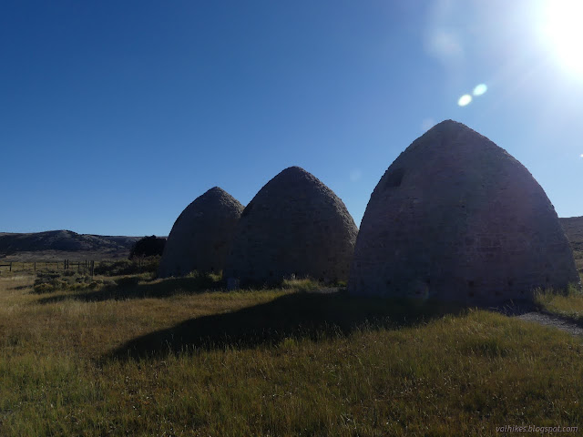
Of course I had to stop. There's a pair of signs to tell us all a little about these and a QR code to get more information if you've got any signal. I didn't. This spot is too far from I-80. They were built in 1869 to supply iron smelting in Utah and took advantage of the trees in the mountains to the south. They went out of business when the railroad moved the rails in the early 1900s.


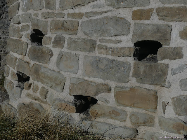
I remembered the smell of the ones on Wildrose in Death Valley and stepped inside. Those were used for only three years and the blackened residue was thick and there was a distinct smell. (It's possible that illegal camping and campfires might renew the smell in those some.) I wondered what these, which had decades of use, might be like. They must have had to chip away at the insides from time to time and the rocks, limestone and sandstone, are likely porous enough that the smell could never completely go.

I stepped into each by turn and each had a distinct smell from all the others. Well, I suppose I didn't try to smell the ruined one. Missed out there.


I looked around again at the hills covered in sages and such. The Piedmont Cemetery is on the hill nearby. I couldn't see where the accepted entry to visit it might be.

(location)
I reached a highway again at Hilliard. It was another location where there were many charcoal kilns, but nothing is left of these. This town died about the same time as Piedmont but because the railroads switched from charcoal to coal and closed the station. There is a turnout with more signs to tell about history and scenery and recreation. I missed out on going to see the tunnels that were built when the railroad bypassed Piedmont. These are now also abandoned. The railroad now follows I-80. However, the scenery was on display.

*Wasatch 2022 photo album*
©2022 Valerie Norton
Written 27 Nov 2022
Liked this? Interesting? Click the three bars at the top left for the menu to read more or subscribe!


Comments