Kings: Henrys Basin and Big Meadows
Uinta-Wasatch-Cache National Forest
(brown line, map link)
DAY 1 | DAY 2 | DAY 3 | DAY 4
It was a windy morning and I didn't much like my kitchen spot's wind blocking, so I packed up and left before eating.

I bumped into eight people scattered over three groups making their way to the peak in the short distance to the junction of Henry's Fork Trail with Henry's Basin Trail. This day wouldn't have any cloud troubles no matter how early they got up. Or late, for that matter.
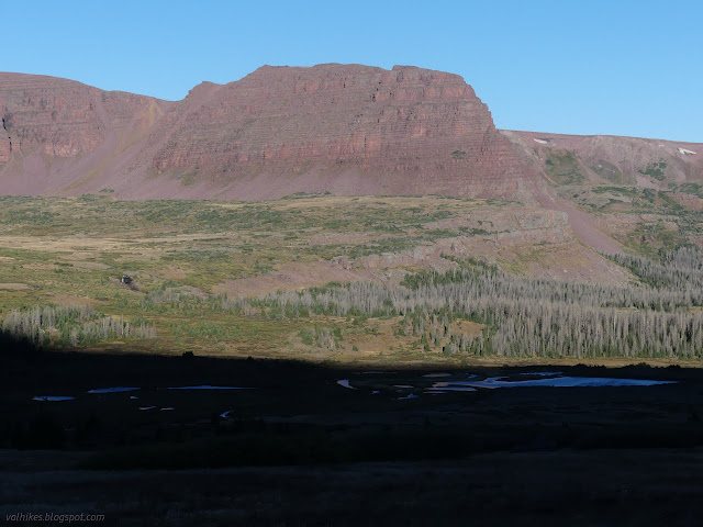
At the sign for Henry's Basin, I turned and left the crowd behind. There is a rock ledge halfway to Henrys Fork Lake that made a pretty reasonable windbreak for cooking breakfast. The area was another established camp site beside a marsh area on the map that looked rather lake-like to me.


Fueled up for the next few hours, I continued along the trail seeing absolutely no one. It had a few trees down, but clearly gets a lot of use by people and horses.
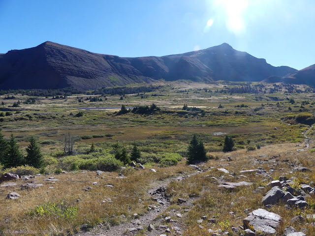


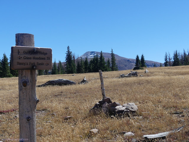
The signed junction was time to leave Henry's Fork and Basin. It looks like many people take this little loop for a little extra to see. Many go my way, too. It's the Highline! "A" (North Slope) that is.

Trail gets rather faint when it hits the high meadow, but there's huge cairns to follow instead. Some complete this loop by keeping to Highline and retracing the few miles back on East Fork Smith Fork. There's two other options that lead to a slightly bigger loop, and they're signed to make finding them easy. I'd somehow got stuck in the thought rut that Dahlgreen Ridge would be part of looping back to Henry's Fork, except it doesn't quite have a connection available, so got discarded. Instead, I went down the hill on Big Meadows even thought I suspected views would be better from Dahlgreen Ridge. Maybe I'd have got to see Alligator Lake were it not for the thought rut.


The trail is a challenge to follow. At first it's just finding it. Generally it just requires getting around the next tree to see it again, so it's just a little guesswork. This is the only area I saw blazes. Once in trees, there was some ease because there were places with significant work, all very aged. Then it was hard because the stacks of trees were so extensive that finding a way around was difficult. But there were the blazes to help in finding it. Some of the blazes looked more recent than the cuts on the cleared trees. A few were traditional two cut blazes, but there were a lot of single and triple cuts too.

And with all these clues, I still lost the trail. Add to that two lines on the maps (Forest Service and OpenStreetMap) that both showed signs of being approximate and didn't agree so it wasn't always clear where I should be looking for trail when I did lose it. I kept it up because as hard as it was to walk the trail, it was even harder to go my own way. The forest is, as I said, full of fallen trees. The meadows are tempting, but tend to be bogs no mater how browned they are looking. They don't offer an easier walk.


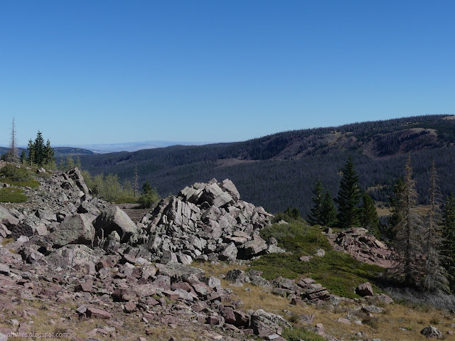
I found trail again shortly after leaving the wilderness and backtracked to find an actual wilderness sign. Trail was pretty easy to follow and walk once out of the wilderness, at least as far as Sargent Lake Trail.


I met a hunter coming up the trail. He said that Dahlgreen is fine while it is along the ridge, but the other half of it is even harder than Big Meadows to find and travel. I didn't have much left to hike and plenty of time to hike it, so went looking for a benchmark before trying to follow Sargent Lake Trail back.

I got on an old road while trying to follow trail back from the benchmark to the junction, so had to find myself again. It's all quite ridiculous. Then down to Sargent Lake. It was easy until I hit the meadow and the cows and there was no clue where the trail should be. I wanted to visit the lake, so just wandered my own way. I hit forest and downed trees on the way but I managed to get there.

I found the trail out from the lake and managed to find where it got back into the forest. It tried to push me off toward the China Meadows Trailhead and I had to backtrack to get on the trail back to my parking. It was all clearly well used, but apparently takes more to keep a trail obvious across certain meadows. It was nice to already know some of the trail at the end. Those last 5 miles were hard.

I got back to my car and then back to my trailer. (In another state! It feels weird to have been parked in two states.) Everything in order. I guess that last bit of trail means everything was in my sort of order for the trip, too. Always got to find the unmaintained bit. They should do a better job maintaining the trails I want to hike. Still a great trip.
*Wasatch 2022 photo album*
©2022 Valerie Norton
Written 26 Nov 2022
Liked this? Interesting? Click the three bars at the top left for the menu to read more or subscribe!


Comments