Posts

Showing posts from June, 2011

sketch

Image
Just one sketch for the month. Our various protections from the rain that was preparing to come down all night .

Shenandoah: Beecher Ridge

Image
Shenandoah National Park < day 1 There was torrential rain through the night from not long after we went into the tent to not long before we came out of it in the morning. We'd not been careful enough with the ground cloth and some water had come onto it. My bag was wet, although still too warm for the night. Wet was creeping into everything, but had soaked nothing, so we were doing quite well. Well, almost everything. The new dry bag as bear bag was very successful and food very dry. Also bright orange and easy to spot, not that we've ever lost a bear bag. We put together breakfast letting the instant oatmeal soak for 5 or 10 minutes before gobbling it up. Worked a charm and wasn't so cold out that we missed the heat. Oatmeal's never hot anyway, when having it out in the woods. We packed everything back up. Now the place where the tent was was the one dry spot instead of the one soaked spot. Our campsite for the night, post tenting and delu

Shenandoah: Overall Run

Image
Shenandoah National Park Locate the trailhead. I found myself in Maine and stopped by my sister's place on the way home. Once she realized I'd be there in time for a weekend outing, she decided I could help her retry backpacking. She wanted to see what Shenandoah had to offer to the weekend backpacker, so looked over the suggested hikes they have put together. The only ones that seem a reasonable 2 day length, at least in the beginner section, were listed as "strenuous". We went for one saying it had the highest waterfall in the park along it. It did turn out to have plenty of down for the first day and up the following day. We started off from the road onto the Appalachian Trail, so that's a quarter mile of the AT down. We came to a sign post and started down the long hill past waterfalls and cascades and eventually to look for a camping spot. It is a lush and green place on the east, as the sister loves to mention. These seemed to tur

Arroyo Seco

Image
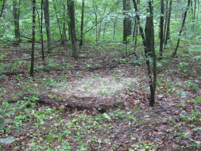
Pasadena Front Country Locate the trailhead. Arroyo Seco is open again and the hikethegeek types planned a trip up it, so I joined up with them to see how it is now. The group was quite large, including a few dogs. It took a while for them all to gather and once gathered, they filled the road. Quite a force to be reckoned with. They also weren't moving very fast. We got to the stream and the water was clear again. Hooray! Once entering the forest, just after the Forest Service buildings as we really enter the canyon, the stream no longer comes all the way to the cliff. Instead it has been pushed back to allow a road worth of gravel for walking on. Some of the group wasn't happy with not getting into the stream and went down to it anyway. Everyone else followed, but I stayed high, I'd walked down there last time and it was enough for me. The bottom of the canyon is still very clear of any growth, but there have been efforts to restore the crossings, at l

follow by email