Posts

Showing posts from July, 2014

sketches

Image
Somehow all my sketches seem to have been on backpacking trips this month. Sitting at the edge of the creek at the end of the day after going up Cloudripper . Sitting at the edge of a meadow stinking with cow but quite lovely on the way up Capitol Creek . The morning sun on the Devil's Rockpile over Geneva Lake . At Snowmass lake taking in the 14er Snowmass Mountain that sits way back behind it.

Paria Canyon (White House)

Image
Grand Staircase-Escalante National Monument Locate the trailhead. It is a moody morning sky over the desert although the radio is only claiming a 20% chance of rain, and that for the afternoon. It is hard to resist the temptation to explore just a little bit in the area, even if it is down a canyon known for getting better and better as one travels down it. I have enough water tucked away in the car for a few miles of desert hiking. From this trailhead, there is a day use fee of $6 per person and dog. The trail, such as it is, simply follows the river bed down. Before getting down into the canyon, another sign reminds travelers that flash floods are extremely dangerous in the area. Eroded cliffs on the other side of the highway from a BLM information sign at the start of the road into White House.

Capitol-Snowmass: West Snowmass Creek

Image
White River National Forest Locate the trailhead. DAY 1  |  DAY 2  |  DAY 3  |  DAY 4 It rained off and on during the night and at one time I woke to a jackrabbit testing my bivy for edibility. Yesterday's short day made sense yesterday, but seemed less sensible in the evening, and not just because of the rubber eating jackrabbit. Besides the teeth marks in my hiking stick handle, he has done no damage. It is just that I do not see where to camp tonight and it would only be a slightly long day to finish if I had walked a little further yesterday. I decide to hike out anyway and get up with the breaking light. There is a pause in the rain with more threatening, so it seems like a very good time to pack up and try to get my bivy dry. My little roof is sufficiently under a tree that it is already dry after the light rain. A pile of sticks in the middle of the water makes me think there may be beaver in the area. A broken dam leaves another suspicious pile of

Capitol-Snowmass: Snowmass Lake

Image
White River National Forest Locate the trailhead. DAY 1  |  DAY 2  |  DAY 3  |  DAY 4 Another dry night and the bench for sunset watching is now a bench for the sunrise. The same mountains are fringed with light from the new sun as glowed red the evening before. I have decided to have a short day after two 12 mile days, so there is time to paint in the morning. A couple people come up from the other sites for the water that runs past mine. They think it is a spring, but I am suspicious it is just an underground outlet for Snowfield Lake above. I watched a couple waterfalls tumble a few tens of feet and disappear into the rocks without even a splash in the Avalanche drainage yesterday. The water reappears eventually below, but it is not a spring. It is a little late by the time I get started and promptly lose the trail at the creek crossing. Geneva Lake in mid-morning, still with a few fish jumping, from the spur to site 4. Willows above the lake extend to

Capitol-Snowmass: Avalanche Creek

Image
White River National Forest (map link) DAY 1  |  DAY 2  |  DAY 3  |  DAY 4 The clear night skies stayed that way overnight even though I did not trust them to. Having breakfast and almost packed up, my neighbor comes over to make sure I have everything I need again. He was planning to follow my route for a while, then take a trail to the west and cut back over an unmaintained trail that is rumored to remain passable over Avalanche Pass before joining with the current trail again. He has had second thoughts about the unmaintained trail and will instead continue down this trail and climb back up Hell Roaring to a trailhead a little more than a mile down the road from Capitol Ditch and Creek. There are many loops possible in this area. It is probably odd to feel a sense of loss because so much of trail maintenance is the feet passing over it and now this trail will get one less set, but I do feel it. When breakfast is done, the last of the gear packed up, and the half m

Capitol-Snowmass: Capitol Creek

Image
White River National Forest (map link) DAY 1  |  DAY 2  |  DAY 3  |  DAY 4 I wanted a backpacking trip for while I was in Colorado, so I asked the internet and came up with this page of "backpacking" hikes . With one loop not quite 8 miles long, it does run a bit short, but the longest loop (second down) looked interesting and would be convent to my location, so I bought the map. Since the last "40 mile, 5 day" loop was so far off, I had to measure it out for myself. My estimate was 43 miles and I expect that to be an underestimate, but it is still well within a 5 day trip. I packed as if for the Sierras, since they are big mountains at the same latitude. Also, being in Breckenridge for nearly a week beforehand should give me a good feel for the likely weather. It could be arrogant, but it seemed reasonable. Rain gear a must since big mountains will make their own weather and are prone to throwing down the drops. With that, planning complete. I

Lookout Mountain

Image
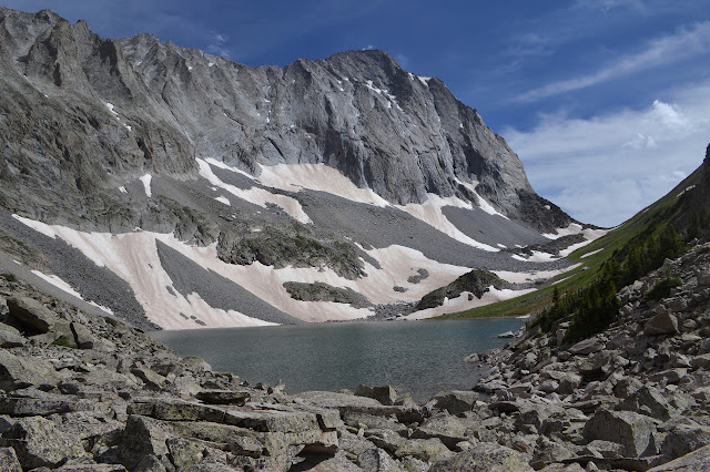
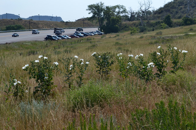
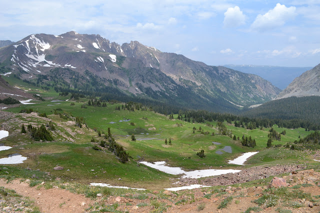
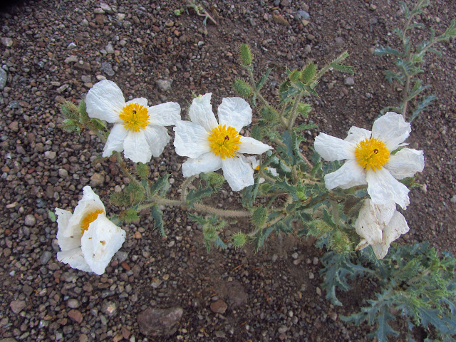
Jeffco Open Space Map link. I am told it was not the case a couple days ago, but today is hot in Golden, Colorado. We will hike up from the highway to the top of Lookout Mountain where Buffalo Bill is buried to reassure ourselves that he is, indeed, dead. The hike is a popular one that starts at the edge of highway 6 and climbs through a semi-familiar landscape of sages and, higher up, pines. Garth, who has been hiking barefoot some recently, points out the three cacti that can make that miserable. One is the prickly pear that is so common everywhere, including at home. Some of the familiar is not so much so upon closer inspection. These hillsides seem to be covered in Matilija poppies, but it is more likely that they are crested prickly poppy (Argemone polyanthemos), which also has the big, crinkled, white petals. A selection of prickly poppy on the hillside just along one of the parking areas on the side of the highway. The trail climbs along Chimney Gulch. The bo

Buffalo Mountain loop

Image
White River National Forest Map link. I want to be in the Denver area in the evening, but until then, I can enjoy most of the day hiking. Two trailheads leave off from the road near each other to circle around the 12,777 foot peak of Buffalo Mountain via an 11,900 foot pass at the far end. Taking the loop clockwise allows the option of heading up to the top of the peak at the end if there is time. The total length is just under 12 miles, if I believe the map mileages that are often a little short. (Actual length: 14 miles.) The spur up the mountain is 2.1 miles. Arriving at the parking, the two trailheads turn out to be on either side of it. There is even a stop for the Summit Stage, the free bus service that Summit County runs. The start of Lily Pad Trail. The Summit Stage provides opportunities for one way hikes as it stops by many trailheads. The trail starts off on a wide roads next to some houses, but soon comes to some utility infrastructure and shrinks to t

Quandary Peak

Image
White River National Forest Locate the trailhead. With the morning free to "look around" and having noticed that there is a 14k mountain a few miles from where I am staying in Breckenridge, I had to check it out. There are a number of routes, but the most common is a trail just 3.3 miles in length that starts at 11,000 feet. There was a moment where I realized that although I have been up a 14er twice, it was in the first half of my life. Williamson (14k) became Cloudripper (13k) when the permit did not work out. It is well past time for another. The car seemed to have a bad time of it over the 10,666 foot pass, but seems to have acclimated a bit just like me. Or it might be the lower gears used when not driving the interstate. At 6:30AM, there are more than half a dozen cars already parked at the trailhead on the county road (851), but still good parking out of the way of traffic remains. There is also a big lot just off the highway on 850 that does not add mor

Alma Christensen Interpretive Trail

Image
Fremont Indian State Park Fishlake National Forest Map link. I picked a random spot along the road to go geocaching to stretch my legs and break up driving to Colorado, which turned out to be a nice little stretch of old highway now bypassed by Interstate 70 in Utah. The first cache was placed next to a pair of right-of-way markers for the road, which was fun to find. Another had me parking near another benchmark and climbing up a short way along an old road. Coming down again, I noticed them scattered over the hillside thick with the fragrance of sage and blooming with all their might: Matilija poppies. Along a bit of old Utah state road there are Matilija poppies growing. After the rather surprising flowers, I found a nice trail I wanted to go down, but had no idea how far would go, and then some road construction. The pilot car for it decided it needed to lead everyone past my turn and then past a couple little trails and I decided to go for one since I was still

Cloudripper: Green Lake

Image
Inyo National Forest Map link. DAY 1  |  DAY 2  |  DAY 3 The night cleared up from time to time, but the morning is changing quickly, clouding over and clearing up. There are a few more drops, but it is hard to notice them. There is nothing left but the short hike out and the long drive home, so we are reluctant to get up. On the other hand, the weather is threatening, so there is motivation to get packed up. The weather may be churning above, but below it is still on Green Lake in the morning. Eventually the weather looks threatening enough to motivate movement. We say goodbye to the purple pine cones and start down. Walking out past the sturdy pines that populate the timber line. The male pine cones are a bit purple at a distance. Looking down on Brown Lake and getting a little behind those who are crossing the marshy section below toward the lake.

Cloudripper: Cloudripper Peak

Image
Inyo National Forest Map link. DAY 1  |  DAY 2  |  DAY 3 The downright pleasant night at Thunder and Lightning Lake turns into an even more pleasant morning as the sun crests over, from our perspective, low hills. We are slow to get up because while we have decided how we will go after the mountain again, we have not decided if. We got close to it and saw it and saw views like what it should have, maybe there is something else interesting around. But really, what else are we going to do? It is just too nice a day not to and we are so close. Once settled, it is not long before we are packed up and starting up the inlet area of the lake to reach the flat above. It looks like there are a couple tough spots, but we do not find them as we climb. Bernard, Linda, Menzo, and Bhagwan climbing up and out of Thunder and Lightning Lake near the inlet. Bhagwan still leads us heading up to the flat above the lake. The climb was a lot easier than expected. The night above

Cloudripper: Thunder and Lightning Lake

Image
Inyo National Forest Map link. DAY 1  |  DAY 2  |  DAY 3 We set off to Bishop on a quest to bag Cloudripper, the tallest peak in the Inconsolable Range, a small subrange of the Sierra Nevada Mountains. This can actually be done as a day hike, but we have three days to make the peak, and then, well, whatever. I heard that and started looking around and thinking, oh we can hit The Hunchback (or Coyote Ridge) and Vagabond (not actually named on the USGS maps) on the way up, and then there is supposed to be a fairly easy way down int Seven Lakes for the night. Then we might be able to follow the trail over Jigsaw Pass and maybe hit Mt. Agassiz or something and head back north along the trail to Bishop Pass for some camping by a lake. The last day could see little Chocolate Peak and maybe Mt. Hurd. Lots of mountains, it would be an epic journey of only three days! The rest were a bit more focused. After sorting out one member accidentally bringing the wrong boots (an older

follow by email