Posts

Showing posts from November, 2018

Beith Creek Loop

Image
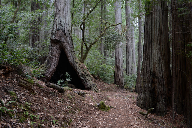
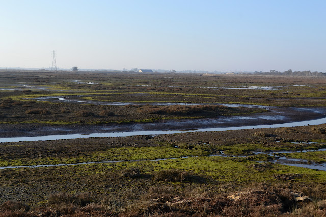
Arcata Community Forest Click for map. Out for a quick loop hike while there is clear air and patches of sun. Oh, and the threat of rain. In fact, it is actually sprinkling a little as I start, but I have my rain coat and the trees will probably put an end to most the thin drops. Sure, they'll replace them with big drips, but it takes a lot of thin drops to make a big drip. Not so deep in the dark forest looking out on the neighborhood horses. The eyes adjust and it is not too dark to follow the path through the redwoods even covered with redwood leavings. I know there are some spots up high to look out to Humboldt Bay, so power up the road to the top so that the weather has the least amount of time to fill in the air with rain or mist. Of course, the weather doesn't need more than a few minutes and it takes me longer to get to the top. On big stump cut off bluntly. This is a second growth forest, so the trees are tight and much smaller.

Grasshopper Mountain and Johnson Camp Loop

Image
Humboldt Redwoods State Park Click for map. I was wanting to do some redwoods "properly" meaning, well, wander beneath them for a while trying to look up far enough to see the top. Probably. I'm not really sure. But redwoods. Properly. I noticed I could find some and get a peak as well and went for it. I also noted that it is a bit of a long hike and I would want to use all the light of this short day and started off very early. The route up the mountain starts with a fire road signed as "lookout". The main parking at the bottom of the road is all signed no parking from sunset to 8 AM making it illegal for another 1.5 hours and I don't want the pressure of getting down before sunset (after all, there is still some light available after sunset) so continued on to something unsigned next to the gate. It is still quite dark as I park and a little lighter once my shoes are on, but still too dark for the camera to autofocus on the gate for a picture of t

Beside Humboldt Bay

Image
wildlife sanctuary area Click for map. I wandered down to the marsh again in the morning to see it in another light, although went to a little different spot just south of the main marsh area. My entry to the trail is a little opportunistic, but obviously well used. The trail is the new bike path and paved, but so it goes. Unfortunately, the different light is actually a heavily filtered one. It is a bit foggy this morning. The marsh and the distant imagining of trees in the fog. The faint vertical lines a little closer are people out on the marsh. A bit of the land has been ground up with some machine, but not for very long. Further along it is all signed "wildlife sanctuary". Not a lot of wildlife is visible, but there is something in the distance that looks like a plastic bag on a stick. Or an egret. Actually, they are definitely egrets as the walk a little sometimes. Mostly, they seem to be standing about waiting for something. Across the churned up gr

Arcata Marsh

Image
wildlife sanctuary area Click for map. I'd kept meaning to visit the marsh area between wandering dunes and beaches and big trees, but never quite made it. Admittedly, there are tidal flats and brackish pools in other areas, so I did get a little bit of the marsh but with a fair bit fewer people hanging around. Here, I've barely entered before a large and apparently organized group passes by. I do wonder where they parked because I only found an area with three spots. There is a little bit of education out here too. Signs tell about the area. The first one I find tells about river otters that can be found around here, but are rare to see and a little hard to spot. It gives a few tips for finding them. Heading into the well used trails. They are not the slightest bit marshy. Pools sit beside the paths with what might be the evidence of river otter, according to the sign. A railroad used to pass through here carrying away the redwoods. A short wander down one

Clam Beach - Strawberry Creek to Little River

Image
Clam Beach County Park Little River State Beach Moonstone County Park Click for map. Back in Arcata, the obvious hikes are up under big trees or out in the dunes. Little River is a pretty little spot when zooming past it on the freeway, so I decided to go for some beach and/or dunes hiking to finish up there from Clam Beach. Perhaps now that I have learned to stop fighting the gentle downhills so much, I might be able to get across the really flat stuff without much pain too. Anyway, it is just 2 miles or so and I have managed that much flat before. There are a few lots for Clam Beach. The first one is at the corner just short of the campground and has a sign that is easy to miss. The lot is unpaved and seems to have been the staging ground for an old road on the dunes once. The regulations and warning of tickets if one should get locked in seem to have survived much longer than the road. A very well established trail of gravel passes by another sign warning me to ta

Arcata Ridge Trail quick look

Image
Arcata Community Forest In the neighborhood again, so I thought I'd check on if the Arcata Ridge Trail is complete yet. The current map shows that the city owns the land, but no trail has been constructed. That was last updated in June, so there could be something more now. Anyway, it'll be partly built before it is fully built and they probably won't be updating the map for that. I have hiked the area before. (This is only the part marked with a black line in the previous hike.) The track for this hike is here , if you would like a map for this short hike. Since it is a short hike, I decided to see how Timmy would do on it and brought him. Walking under the big redwood trees. Timmy is learning this new walking trails trick at the age of 19. He has gotten to be a lot less timid over the years, but meeting people on trail is still not something he handles well. Luckily, he is easy to hold and he can handle bicycles and runners when he is in my arms. Most of the rou

follow by email