Posts

Showing posts from January, 2018

scetches

Image
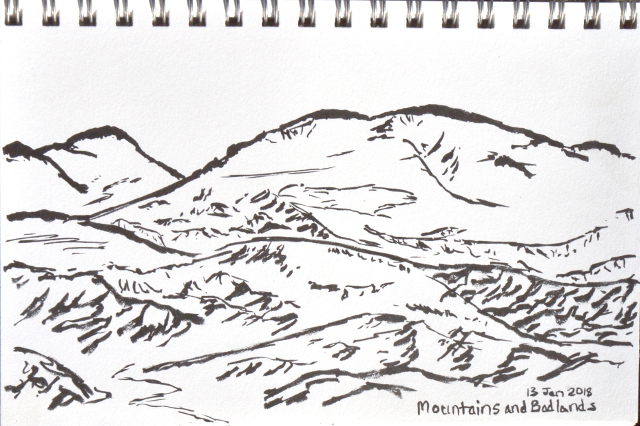
After a while, a few sketches. Badlands to the east viewed from the top of Fox Mountain . Grassy fields to the west of Fox Mountain . End of the trail on the edge of Lake Casitas .

Butterfly Peak and Rock Point

Image
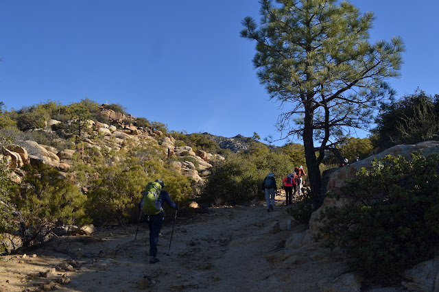
San Bernardino National Forest Click for map. The day starts early with the blue moon in total eclipse, which is pretty cool even if it is only an accident of the calendar. The blue moon, still partly in eclipse, setting as the sun rises. Today, the plan is to join a scheduled Hundred Peaks Section hike and climb a couple peaks on their list. Everyone is welcome to come on a hike if they are capable of completing it, you just have to email the hike leader. The trail we are starting at seems to be a little more exclusive. I expect someone asked permission at some point and this group is a rather good guest, not known for carving on or cutting fences and more likely to pick up trash than to drop it. They gather and we all sign the standard waiver and then we are off. The trail start is marked at the start of a track between fence and road. The trail follows paved road for a short way, then turns away from the Pathfinder Ranch entrance and onto a dirt road behind a...

Lookout and Table Mountains strolling the PCT

Image
San Bernardino National Forest 30th of January, 2018 Click for map. I headed for Riverside with a list of plans, stopping by the Trabuco Ranger Station for a map and a couple backpacking permits to help pull them off, then off to the junction of SR-74 and the Pacific Crest Trail in time for the nice afternoon hike which was number one on my list. Just south of here is a peak identified as "Lookout Mountain #1" on the Hundred Peaks Section list and a few miles south of that is a bump just slightly off the PCT marked as "Table Mountain high point" on peakbagger , which are my excuse to hike a few miles along the PCT. Parking is well signed and north of the highway. I have a track in the GPS to show a couple routes to the top of Lookout but cannot seem to find them once it loads up. (This is due to it coming up as a route instead of a track and that both saved routes and tracks only show up when the device is told to navigate along them.) I will just have t...

Old Baldwin and Riverview

Image
Ventura River Preserve 28th of January, 2018 Click for map. For afternoon, I headed off to the Ventura River Preserve to walk to the burn. Most of the preserve burned in the fire or was back burned in the fight. I started at the Old Baldwin Trailhead (the south route) simply because it is quick to get to from the highway. I recall something about the gate on the road in closing at a certain time, but cannot find anything about it on the trailhead signage. A sign glanced at while zooming past the gate might indicate 4:30 PM. I take off along the side of the ACA compliant trail past trees and shrubs untouched by recent fire. Follow the path past the green and bright live oaks. The ACA compliant trail ends quickly, then it is just rough dirt. The trail forks and I follow to the left. This trail takes me to a couple lookout points to view the Ventura River. It is running now, and even rather clean while it does so. I am surprised by the clarity considering the state ...

Lake Shore Trail - Wedleigh Arm

Image
Lake Casitas Recreation Area Click for map. There are a number of trails close around Lake Casitas and I decided to poke along one before a nearby event in the middle of the day. Entry to the recreation area costs $10 per car in the off season, but you can walk or bike in through the main entrance for free. Follow the roads around to parking at the trailhead. The trail continues from the end and out around the lake. It is a rather wide and smooth dirt, apparently even suitable to hoverboards as a couple pass me on a pair that somehow look more like small Segways than a floating skateboard. They quickly turn down a smaller trail heading for the distant lake shore. Then it is just me and a lot of footprints and bicycle lines on the dirt. Commence walking. Across the lake arm to the little bit of lake left. At first, the trail is just along the road as it starts around the edge of the Wedleigh Arm of Lake Casitas. It slips through a gate that could be rolled closed an...

Fox Mountain

Image
Los Padres National Forest Click for map. After the ordeal finishing off Thursday, I tried to sleep in as long as I could and generally recover on Friday. I had a message the sawyer project would be postponed, so that plan was out. My secondary plan was to climb Fox Mountain, but I was not in the mood for a bushwhack, somehow. I lazed, I read, I checked out the soggy roads that were preventing us working. Finally, I decided to do the mountain after all and I packed up to walk into the campsite noted in the Fox Mountain Peak guide . It is just a half mile in, so I figured it did not matter much that I had my car camping gear, not backpacking. I would even go ahead and bring my day pack instead of making due with the bigger one. Then I got to lining up the peak guide with the map and noticed that the gate that might be closed was actually the edge of a marked inholding where there is a broken up cattle guard full of mud, remnants of fence, and no gate at all and the hike was 2.5 ...
Peak Mountain and McPherson Peak

Image
Los Padres National Forest Click for map. With the aim of doing some sawyer work in the north end of the county starting Friday and being able to get away for Thursday, I looked for something to hike in the area. The options do not seem to be plentiful. There are a couple of peaks on the Hundred Peaks Section list out there. One is practically a drive up and the other actually is a drive up the way they are usually done, but it turns out the drive up has not just one but two trails up it. A loop hike sounds great. I might even go after the near drive up, but it does add a little over 6 miles to the trip which might make things a little long for these short days. The plan is to hike from Aliso Park up the canyon and check out Hog Pen Spring on the way, then head over to a nearby benchmark called SIGN on the map. From there, I can trot over and go up Peak Mountain, or skip that and go directly up McPherson Peak before following the ridge route down. After the long drive, I get a...

hikes of 2018

Image
 Peak Mountain and McPherson Peak , Los Padres National Forest: Jan 11  Fox Mountain , Los Padres National Forest: Jan 13  Lake Shore Trail - Wedleigh Arm , Lake Casitas Recreation Area: Jan 28