Posts

Showing posts from July, 2017

North to South: Lake Sabrina, North Lake, Loch Leven, Piute Lake, Piute Pass, Muriel Lake

Image
Inyo National Forest Sierra National Forest Click for map. DAY 1  |  DAY 2  |  DAY 3  |  DAY 4  |  DAY 5  |  DAY 6  |  DAY 7 A poor sleep, nothing to do with the moment and everything to do with being in a cycle of poor sleep, showed that all my little roof blocked was the very bright moon as it crossed the sky and then the view of the stars. A few clouds played, but mostly it was clear. Home seems to like to cloud up and rain at night, but these mountains like a good afternoon clamber with clearing at night. Still, the late evening activity hinted that there might be a little more to the current weather than just what the mountains generate. Morning is clear and George is shaded by the mountains with plenty of fish jumping. George Lake and a pothole beside it sit in shadows reflecting a morning sky. The trail along the side of the lake has a tree, still green, fallen across where it is difficult to get...

North to South: Tyee Lakes, Table Mountain, George Lake

Image
Inyo National Forest Click for map. DAY 1  |  DAY 2  |  DAY 3  |  DAY 4  |  DAY 5  |  DAY 6  |  DAY 7 In planning the loop through Evolution Basin, a location commonly claimed to be a favorite along the Pacific Crest Trail through the Sierra Nevada Mountains, most will get a shuttle or plan to hitchhike between the North Lake and South Lake. Not me. I planned to connect the two by the Tyee Lakes Trail and the George Lake Trail and the short up and over seems like a good start day for the trip. It needs to be short because there is also the matter of the long drive up and grabbing a permit on the way. This year, walk-in permits are being released at 11 AM the day before, but they are still free for Inyo National Forest. Arriving at the Interagency Visitor Center a mere 23.5 hours after the day's permits were released, I easily got one of the 10 total, 6 that may be reserved, that are offered. This is also a nice t...

San Guillermo Mountain

Los Padres National Forest Click for map. As it turned out, quite a few others were also wanting to do San Guillermo Mountain after Lockwood Peak. There was supposed to be a vote on if we would, but we seem to have missed that step and just proceeded to Pine Springs Campground. The thermometer in the car says it is 89&def;F out there. I find that hard to believe. I could take that kind of heat when I lived in Pasadena, but I have gotten soft again with the luxury of a marine layer to keep things mild. A few take a moment to partake in the facilities only to find that they have been nailed shut with added "Keep Out" signs. I wonder what the excuse for that is since they did not seem unsafe last year. We step over the wire fencing meant to dissuade any wheeled vehicles from entering the Sespe Wilderness that surrounds the area and wander our way past bushes filling up with toilet paper. Really, there better be a good excuse for nailing the pits shut. Als...

Lockwood Peak

Image
Los Padres National Forest Click for map. I realized that those peak baggers in the Hundred Peaks Section would be about as much in the neighborhood as they get as they headed for Lockwood Valley to bag Lockwood Peak. Honestly, it looks like an inconsequential bump to me. It is only on my radar because it is on the list, but I am perfectly capable of finding my own inconsequential bumps to climb. It is near a second listed inconsequential bump that should be on my radar because it is the basis for the name of the map quadrangle it occupies. The best guess for the weather seemed to be low or mid 80s, which is hot, but not quite too hot. The hike is short enough to deal with that. I decided to do it and the short hike up San Guillermo Mountain and sent an email off to the head leader, Bill Simpson, with somewhat less than my usual one week lead time. I got in and found out they would be doing an even shorter route that is more convenient to going up the second peak. We met...

Grant Grove

Image
Kings Canyon National Park Click for map. I cannot pass up stopping by the big trees when we are so near and somehow Martha has never seen them. My original desire was to head up to the Garfield Grove, but the extra day for that is not working out after all. Considering how today is shaping up, it would have been a bit hot for the hike. My father seemed relieved to a surprising extreme to not have to find a different ride to the airport, so it works out for everyone to cut off a day of adventure. Instead of that remote grove that we might have all to ourselves, we head over to the paved and fenced Grant Grove, which we will have to share with tourists that arrive by the busload plus those in dozens of cars. It was once part of the General Grant National Park, one of the first four national parks, but is now a part of the much younger Kings Canyon National Park. Importantly, it has sequoiadendron giganteum, and some of them are quite large ones. The grove has a paved wa...

Jennie Lakes: Weaver Lake

Image
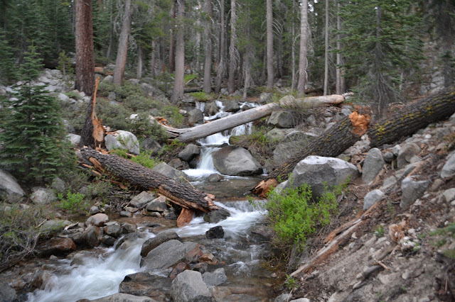
Sequoia National Forest Giant Sequoia National Monument Click for map. DAY 1  |  DAY 2  |  DAY 3  |  DAY 4 I am up at the first hint of light. It is easy to get up in such mild weather. Martha has not taken it as quite so mild, so I let her have the neoprene socks for the early morning foot soaking. I did mention I was overpacked. We collect ourselves together and head up the little bit of trail to the crossing to finally give it a try just as it gets light enough to see into the water. I feel like it got quieter about halfway through the night, but the water level really does not look any different. We drop down to the crossing with smooth running water consistently across a wide section and cross. It does not seem to pull much at my legs as I go. Somehow the snow melt is not even cold. Much ado about nothing. A bit of blur as the camera gathers enough light in the dawn. The trail crosses in the crescent below the broken log with...

Jennie Lakes: Belle Canyon and Rowell Meadow

Image
Kings Canyon National Park Sequoia National Forest Giant Sequoia National Monument Click for map. DAY 1  |  DAY 2  |  DAY 3  |  DAY 4 It was another mild night, but the mosquitoes very nearly vanished early on into it. The sun comes quickly here and the morning golden hour is really quite something. I enjoy it with breakfast and happily the mosquitoes seem to be slow to wake up. Our northerly view from near camp: the morning sun as it hits Ball Dome. Morning over Ranger Lake. We head out to the trail again and wander gently downward, still high above the valley bottom. The air seems a lot clearer today and the snow on the far mountains is much more defined. The snowy distances.

Jennie Lakes: Twin Lakes and Ranger Lake

Image
Sequoia National Forest Giant Sequoia National Monument Sequoia National Park Kings Canyon National Park Click for map. DAY 1  |  DAY 2  |  DAY 3  |  DAY 4 The night was almost too mild and a few of the mosquitoes stuck around through it. Also, I am way overpacked for such mild nights. It is what the National Weather Service predicted and what the history of a fairly local weather station confirmed, but how could I believe that in the face of knowing there is still snow on the ground? It sits in great lumps all around me. The morning brings wakeful campers, but not a lot of noise except for the one excitable dog. People seem to gather themselves up at a leisurely pace and wander away again, mostly turning back down the trail. It is the same with us, except that we are continuing out further. Jennie Lake has a nice rocky backdrop to the south. A few clearly do not yet want to get up. Far on the east side, I can see a hammock th...

Jennie Lakes: Shell Mountain and Jennie Lake

Image
Sequoia National Forest Giant Sequoia National Monument Click for map. DAY 1  |  DAY 2  |  DAY 3  |  DAY 4 The Forest Service does not charge anyone to enter the Giant Sequoia National Monument, but we cannot get to Jennie Lakes without passing an entrance station for one of the National Parks and they want some money. Martha just flashed her pass which not only got us in free, it allowed us to use the shorter, faster line past the entrance station on this crazy holiday weekend. After finding a far parking space to wait in line to chat with a Park Ranger in Grant Grove Village, we are still an hour later than we wanted to be at the trailhead. Permits to hike in Jennie Lakes Wilderness are self issue at the trailhead and that is enough to camp within the Monument and take day excursions into the two Parks, but camping in the Parks requires a different permit subject to quotas and fees. The only space left in the lot is the overflow parking and ...