Posts

Arcata Marsh

Image
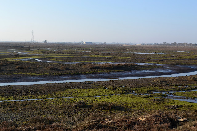
wildlife sanctuary area Click for map. I'd kept meaning to visit the marsh area between wandering dunes and beaches and big trees, but never quite made it. Admittedly, there are tidal flats and brackish pools in other areas, so I did get a little bit of the marsh but with a fair bit fewer people hanging around. Here, I've barely entered before a large and apparently organized group passes by. I do wonder where they parked because I only found an area with three spots. There is a little bit of education out here too. Signs tell about the area. The first one I find tells about river otters that can be found around here, but are rare to see and a little hard to spot. It gives a few tips for finding them. Heading into the well used trails. They are not the slightest bit marshy. Pools sit beside the paths with what might be the evidence of river otter, according to the sign. A railroad used to pass through here carrying away the redwoods. A short wander down one...

Clam Beach - Strawberry Creek to Little River

Image
Clam Beach County Park Little River State Beach Moonstone County Park Click for map. Back in Arcata, the obvious hikes are up under big trees or out in the dunes. Little River is a pretty little spot when zooming past it on the freeway, so I decided to go for some beach and/or dunes hiking to finish up there from Clam Beach. Perhaps now that I have learned to stop fighting the gentle downhills so much, I might be able to get across the really flat stuff without much pain too. Anyway, it is just 2 miles or so and I have managed that much flat before. There are a few lots for Clam Beach. The first one is at the corner just short of the campground and has a sign that is easy to miss. The lot is unpaved and seems to have been the staging ground for an old road on the dunes once. The regulations and warning of tickets if one should get locked in seem to have survived much longer than the road. A very well established trail of gravel passes by another sign warning me to ta...

Arcata Ridge Trail quick look

Image
Arcata Community Forest In the neighborhood again, so I thought I'd check on if the Arcata Ridge Trail is complete yet. The current map shows that the city owns the land, but no trail has been constructed. That was last updated in June, so there could be something more now. Anyway, it'll be partly built before it is fully built and they probably won't be updating the map for that. I have hiked the area before. (This is only the part marked with a black line in the previous hike.) The track for this hike is here , if you would like a map for this short hike. Since it is a short hike, I decided to see how Timmy would do on it and brought him. Walking under the big redwood trees. Timmy is learning this new walking trails trick at the age of 19. He has gotten to be a lot less timid over the years, but meeting people on trail is still not something he handles well. Luckily, he is easy to hold and he can handle bicycles and runners when he is in my arms. Most of the rou...

Mount Konocti - Wright Peak

Image
Mount Konocti County Park Click for map. If Mount Saint Helena is special for having 1000 foot prominence, then Mount Konocti is twice as special with 2000 feet. Unfortunately, getting to the top is another road walk, but that doesn't change the view at the top. Also unfortunately, it turns out my 120V outlets in my little trailer don't run off the battery, so my camera battery is still dead and I must contend with splotchy pocket computer (for some reason known as a phone) photos. Trail parking and a picnic area are at the end of 3 miles of well graded dirt road and a map is posted just before the gate. There are a few named peaks on the mountain, but the very highest is Wright Peak, so that's what I'm going for. The start of hiking. The gate prevents motorcycles and horse from proceeding. Dogs are also not allowed. The road past the gate is nicely graded too and easy walking. The one bit of trail comes quickly. It skirts around the edge of a walnut orc...

Mount Saint Helena

Image
Robert Louis Stevenson State Park Click for map. Mount Saint Helena was on my radar long before seeing it as the highest mountain on the San Francisco Area Nifty Ninety peak list. It was my real desire when I came out and hiked Table Rock and that was renewed when I saw it has over 1000 feet prominence. From the top, if you want to get any higher, you've got to come down a thousand feet first. It sticks out a bit from the rest of the landscape. The largest parking is in the same huge dirt turnout available for Table Rock. There is also a little on the other side of the road. The trail climbs to a utility road and there is a little more parking at the bottom of that as well. The big lot has plenty of room, so I go for that and then have to cross the highway to start. The start of the trail includes a large picnic area with a few old steps going nowhere. There was a bit more here once. No dogs are allowed past the picnic area. My camera battery is dead. It had a light...

Madrone Trail, Las Trampas Ridge, and the Corduroy Hills

Image
Las Trampas Regional Wilderness Click for map. I finally noticed that the East Bay Regional Parks have a trails challenge on. In fact, this is the 25th trails challenge that they have done. They have descriptions for 20 trails in the park system and challenge folks to hike 5 of them or a marathon worth of miles. My original plan for Round Top closely resembled one of their moderate hikes and my loop around Wildcat surrounds one of their challenging hikes . They also have one for those hills I was glancing over at from Redwood that just happens to pass closely by three more of the San Francisco Bay Area Nifty Ninety peaks so I decided to try one as described. Well, as described with the addition of the tenth of a mile or so needed to actually get to the top of each peak along the way. Ringtail Cat Trailhead only has a few spots. Perhaps there is some plan for an ADA approved trail because 1/4 of them are wheelchair accessible, which seems of dubious value as things a...

Sobrante Ridge

Image
Sobrante Ridge Regional Preserve Pinole Valley Park Click for map. This is just a bit of afternoon wandering in the local park area. I can climb up a little from the end of Silver Belt Drive to get onto the Manzanita Loop Trail, or I can take a fire road just short of the last house to get over to a slightly more official entry point. That point has brochures including area maps below informational signs. In comparison to a sign marking the boundary, it might be a lot more official. The two trails join quickly and then connect with the Sobrante Ridge Trail. This is another part of the Bay Area Ridge Trail. I head north on it, soon coming to some picnic tables with a view of the bay. Ready for a picnic above the cities and the bay. Mount Tamalpais is viewable off to the left just a few steps from the tables. Past the tables, there is an intersection and the ridge route swings out toward Mount Diablo. Mount Tamalpais is also a murky bump to be seen toward the afternoon ...

Redwood Peak and the Ridge Trails

Image
Redwood Regional Park Roberts Regional Recreation Area Click for map. My original thought for Round Top in Sibley Volcanic was a short hike and then take off for a longer hike at Redwood, but I went and gave it a little more time like it deserved and then there really wasn't the time for the longer hike after. So now I am back to put that previous plan into action. After accidentally going down Pinehurst (scariest road with a painted double yellow line I've ever seen as the outside is slumping downward and the inside doesn't have enough room to travel and there is traffic so you better stay on your side anyway) I was done driving and parked at the intersection where there are some dirt spaces. A proper parking lot is not too far along if you can stick to Skyline. The Ridge Route cuts through here for easy access to the park, so I can just start at the corner beside a park bench and get a little climbing going before dropping into the top of the valley. And t...