Sobrante Ridge
Sobrante Ridge Regional Preserve
Pinole Valley Park
Click for map.
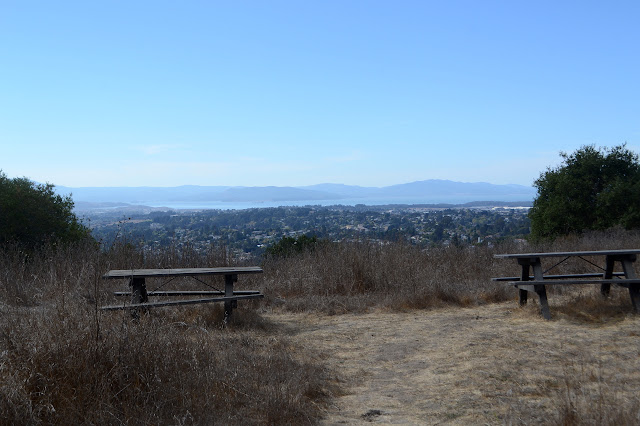
This is just a bit of afternoon wandering in the local park area. I can climb up a little from the end of Silver Belt Drive to get onto the Manzanita Loop Trail, or I can take a fire road just short of the last house to get over to a slightly more official entry point. That point has brochures including area maps below informational signs. In comparison to a sign marking the boundary, it might be a lot more official. The two trails join quickly and then connect with the Sobrante Ridge Trail. This is another part of the Bay Area Ridge Trail. I head north on it, soon coming to some picnic tables with a view of the bay.
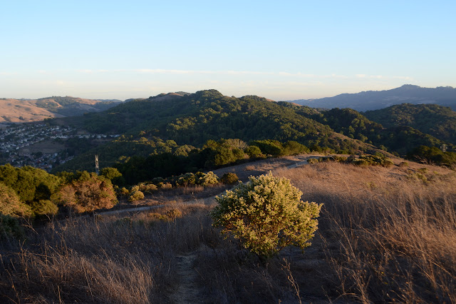
Past the tables, there is an intersection and the ridge route swings out toward Mount Diablo. Mount Tamalpais is also a murky bump to be seen toward the afternoon sun. I follow it as it until approaching another neighborhood. There is a trail off to the side into East Bay Municipal Utility District land, but I have not got a permit for that yet.


Since the road is coming to an end and I need a permit I don't have to continue on the Bay Area Ridge Trail, I turn back and follow trail down the other direction from the last junction. This leaves the preserve and starts winding down hill quite a lot.

The trail tucks into bay laurel trees and has plenty of poison oak that is currently not actually on the trail, just very very close. It splits and I go right. Left seems to be a neighborhood shortcut. The trees quite quite tall and it is dark under their branches as I come to road at the bottom. A bridge over the creek hints that this really is the bottom. Dogs are playing in the dog park and there are bathrooms and more picnic tables. All the things one might expect to find in a park. I head back up.

Heading back, I take a spur that pops out and then drops suddenly to another picnic spot. This one is just sheltered enough for the traffic noises to vanish. Of course, that means no view. I head back again to the next junction. Here, there is a small trail option that climbs up to the local high point. I took it yesterday, but it is so short I go ahead and take it today too. I feel more like I earned that high point today since I am coming from the valley instead of just the nearby road.


I head down again. I could continue on the Sobrante Ridge/Bay Area Ridge Trail, but I realize that the road it is heading toward is way down the hill. Maybe I don't really want to climb that hill again. I head for the Manzanita Loop instead.
The trail is fine along the route to the end of the road, if a little steep right at the end. I decide to actually take the loop this time, though. It is a curious thing. At the join point, there is a sign about the uniqueness of the area causing it to support manzanita better than oaks. The trail itself seems to have been an afterthought. It climbs up under the manzanita branches, but they seem to have not wanted to cut them so I have to duck frequently. It is thin as it returns, but at least there is no ducking. You certainly do get to experience a bit of manzanita.

Then as the trail really opens up, I take off down the hill. Careful, it is a bit slick with rocks.
©2018 Valerie Norton
Posted 26 October 2018
Liked this? Interesting? Click the three bars at the top left for the menu to read more or subscribe!


Comments