Round Top and round the bottom
Sibley Volcanic Regional Preserve

Click for map.
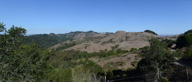
Turns out that last peak, Wildcat Peak, is on a peak list called the San Francisco Bay Area Nifty Ninety. Nifty. I've actually already gone up a couple on it without noticing the list. Nearby to it is another called Round Top. This is, apparently, the remnant of a volcano that erupted about 10 million years ago and now has been pushed over onto its side by the local tectonic forces for the joy and education of geologists. Some local quarrying operations have also helped out in uncovering information about the volcano. Just in case this makes visitors start thinking, "Well, let's learn about volcanoes!" the maps that can be found online and at the staging locations include interpretive trail information to do just that. My first instinct is to start at the Old Tunnel staging area, but since it is the weekend, I head for the spot with the most spaces and only get one through rather good luck. The place is packed, but the chatter indicates this is a rather unusual condition even for a nice day on the weekend. I grab a copy of the map, check out the labeled rocks on display, then head up to "geological marker 1" as the first stop on the guided tour of the volcano. It is around the back of the water tower past a rather nice view out over most the preserve.

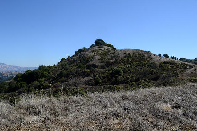
From the first marker and tidbit of information, I head up to the top of Round Top. Unfortunately, it feels like just getting something over with. The trip up is short and paved all the way. The top is a cleared area surrounded by trees so that there is little view of anything but a couple buildings that occupy the peak. The spot with something the most like a view is next to a witness post (for a benchmark I can't locate), through a chain link fence, and past a biffy. Woo-hoo?


So that's great, I guess. Now on to the nifty part. I head down and grab an old dirt road heading off to the left to continue around the loop around the mountain. This is down under more trees for a bit until it pops out onto fields. Through a hiker gate, I am out on the landscape that was spread out below me from the view point by the first marker.


There is a sign pointing out the route to the second marker, but no actual marker once I get down into the quarry. No worries, since the description is on the map as well as the marker. It takes advantage of the quarry to point out geological details. Other individuals have taken advantage of it to build a labyrinth of rocks in the bottom.

I return to the junction, then wander a little further through the volcano. This one, too, has a sign explaining the cows although there are no cows here at the moment. There are no signs pointing out the markers off the main trail, so I have to consult the map to locate them, but they do have their posts. Each points out a different sort of rock and how it got the way it is.


I explore a little more of the spurs that lead off the side even though they have no markers down them. All the bumps are well traveled and the ridge often has a bench. Then exploring again to get to markers, there is another quarry and another little labyrinth within. People really like their labyrinths around here. They are not simply there, the path marked out by the rocks is well worn by folks walking it.

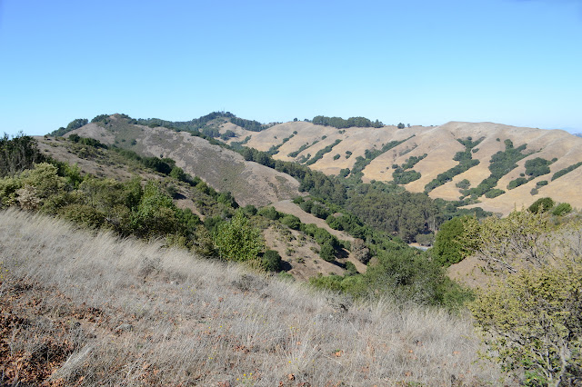
The tour of the rocks somewhat hidden beneath the softer sediments except at cuts and quarries comes to an end with a little more of an overview of the land around including its faults. I decide to stop by the pond marked on the map before swinging back along a second trail back to the parking lot.

And then it's just back up to where I started, this time along the lower trail.

I note on my way out that it was not the Ridge Trail that is closed for hazard trees, but a small trail with more interpretive possibilities. I had meant to return along the ridge, but messed up because I noticed something was closed on the way out. Arg. Insufficient attention paid. However, I do have plenty of time to explore a little, so I can. First, a little trail that actually follows along ridge line. It is across the road, but still in the same preserve.


Then off to the Ridge Trail where I should have been catching it near the Old Tunnel staging area. Here, it is nothing like an actual ridge trail. It is deep in the trees at the bottom of the canyon. It is a completely different sort of hike down here.

©2018 Valerie Norton
Posted 20 October 2018
Liked this? Interesting? Click the three bars at the top left for the menu to read more or subscribe!


Comments