Raspberry Spring
Los Padres National Forest
Locate the trailhead.We spotted the sign for Raspberry Spring on our way to Chorro Spring the day before. It was a little way down the hill on the near side of Reyes Peak campground where trailhead parking could easily be mistaken for campsite parking since a campsite was also there. The trail was a little harder to see from the road but easy enough from the sign. It is only 0.4 miles down to the spring.
Finding the spring itself proved a little harder. We came upon a campsite, since this is also a campsite like the other spring complete with campfire grills, and then another one but didn't see a way off to a spring or any sign of a spring. I followed an animal trail a little ways figuring it would go to the spring. It probably did in the other direction but I found a third site up from the animal trail a little way instead. Then I found myself at the first site again and spotted a people trail that headed to the spring.
The spring on this side is a little smaller. Very little of it looks to be flowing out. It still comes out of the pipe someone stuck in it long ago and fills a barrel that still has a few slats in it. A second pipe had just enough water in it to drip a few drops when lowered.
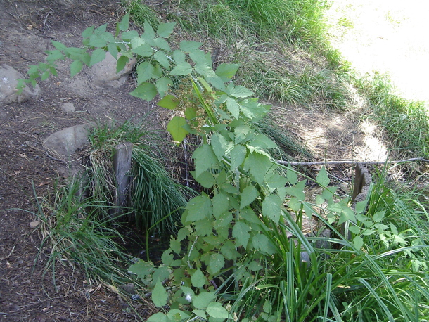 |
|---|
| Raspberry Spring as it is first seen by hikers on the small trail from the campground to the spring. Part of an old barrel still stands playing at catching the water. |
 |
|---|
| Raspberry Spring from the other side, you can see the pieces of barrel in a hole dug long ago that catches the spring water from an old pipe. On the far side, some sort of overflow pipe would have taken the water away too. A few raspberries can be seen near it. |
On the way back up, I spotted this odd tree.
 |
|---|
| A tree along the trail. It seems to have a sudden semicircle in its trunk like it's actually hinged. |
And there's also nice views, this time to the north instead of the south.
 |
|---|
| There seems to be a lot more view to look out over to the north. |
©2008 Valerie Norton
Posted 2 September 2008
Liked this? Interesting? Click the three bars at the top left for the menu to read more or subscribe!


Comments