Haddock Peak
Los Padres National Forest
Locate the trailhead.
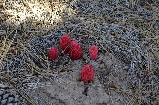
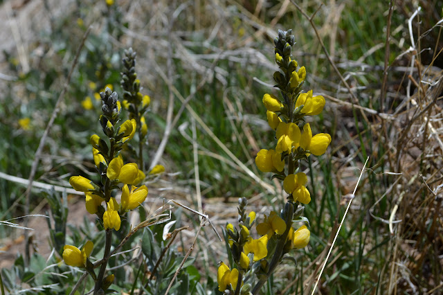
The road is open and the peak is easy again, so maybe it is time to wander along the ridge up to Reyes Peak, then down the back and up to Haddock Peak again. It has been annoying me that I have not yet found the benchmark labeled HADDOCK. There is one shown on the Lion Canyon quad in the far upper left corner, somewhat off the trail as it comes down the east side of the mountain. I checked the NGS database before coming, but it does not seem to be represented there. I am getting suspicious that it is the ones without reference marks that have been left out, which will make this one harder to find as there is only one chance instead of two or three. The snow plants on the way up are always surprising as they come up in big clumps or singles as large as the larger Jefferey's cones.
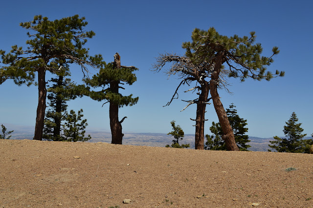
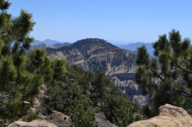
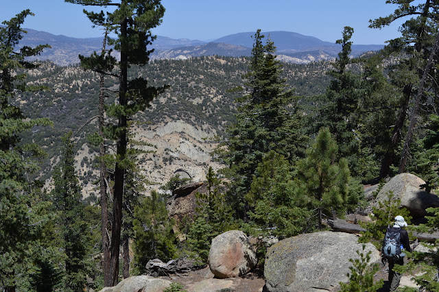
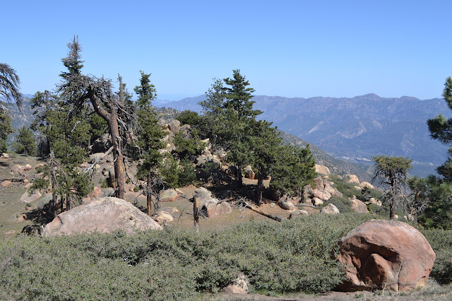
Once at the peak, Haddock is an impressive cliff far down the ridge. Basking in the sun and the view while having a nibble, then it is time to check on the old ice can stove and head down the other side. The register has been moved, so I put it back in its regular spot after signing. It still says "this side down" on the bottom, but I am not sure it is still my writing. The stove still sits beneath a tree looking south. The trail may be getting a bit better. I follow the ridge, but there seem to be lower ones taking a somewhat easier route to the north of it.

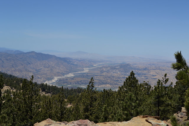
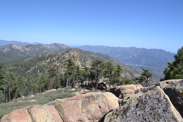
Back to the trail a little before it hits the ridge means catching a couple downed trees even though it was so recently cleared. One is a tangle of branches as well as the large trunk to help make things very difficult. As usual, I manage to get lost by looking at a cairn by a couple big rocks on the right that do not appear to have trail going between them, then looking left to see what looks like trail continuing that way. This time when it drops off, I know the real trail is above me and can get to it quickly, but I cannot blame the snow. The viewpoints that look down near cliffs at the south side of the trail have to get a few peaks as well. I manage to go up the peak without first going up the three or so false ones that look so tempting while approaching.


The register at Haddock Peak has also been moved. Someone seems to not like that you do not need to climb the rock to sign it and has left it in one of the depressions at the top instead. Unfortunately, the old coffee can has a hole in the bottom and the depressions in the rock hold water very well. The register is nice and soggy. It may not be as monumentally stupid as leaving the cans upside down so they can gather their own pool of water for the register to soak in (which inspired the writing on the bottom of the Reyes Peak register), but it is not much better. The register could use a new bottom can. I give the notebooks a little bit of time in the sun and the dry air, but then it is time to go, so tuck them away again in the traditional well drained spot near the bottom of the rock.
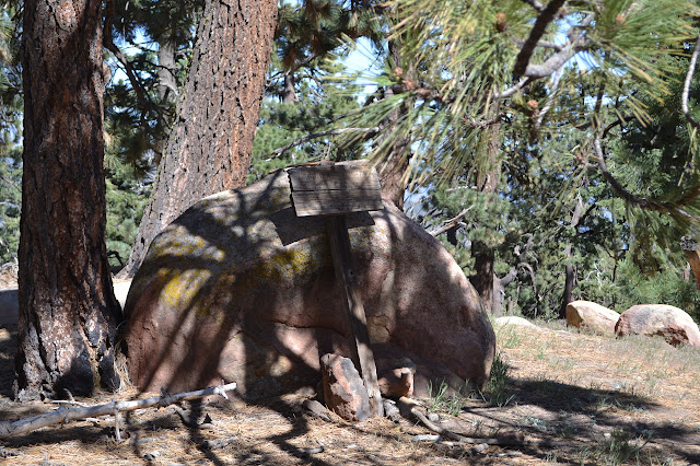
A little further down the trail, the old Haddock sign leans against a rock. It only indicates to those in the know that they have already passed the peak or are getting close if they are doing the real climb. Below it, the view opens up a bit. The trail makes the turns shown on the map and starts to go between two rock outcrops, the one on the north being much smaller. This is where the benchmark should be. I leave the trail and climb it, dropping the pack to get up a rock that seems to overlook it all. It does a good job of that and would be an excellent place for a benchmark that could be seen from a very wide angle. It does not have it, but the map indicates it is somewhere a little lower on the south side anyway. Scanning the exposed boulders below, I can see no dark circles or ovals standing out on the light rock. There is a thick patch of leaves in what looks like a likely area, but everything else seems clear enough. Ceanothus guards much of the area, but there are paths. I only have to push through about six feet of the stuff to get to the top of the rock and clear the leaves. They do not clear well and there is dirt below. It is a filled in hole in the rock and not a likely place for a disk. More searching and perching up in other high spots to look down does not help. Eventually I have to stop and notice my leg hurts a bit from the ceanothus thorn that has broken off in it. It does not look like the sort of place where a benchmark would go missing, but it could be under a different bit of ceanothus than where I looked.
Disappointed, there is nothing left but to turn around and follow the trail back to the car.

*photo album*
©2014 Valerie Norton
Posted 17 May 2014
Liked this? Interesting? Click the three bars at the top left for the menu to read more or subscribe!


Comments