M*A*S*H filming site
Malibu Creek State Park
(map link)
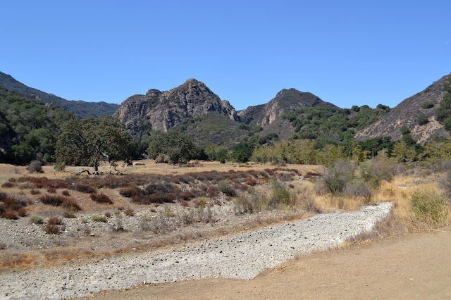
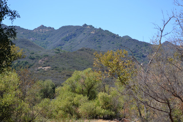
For a $12 day use fee (or free parking along Mulholland Highway and a bit further to walk in with more hills), Malibu Creek State Park offers quite a lot of easy hiking past popular swimming holes to the extremely un-Korea-like part of an old Paramount movie ranch where MASH was filmed. (A number of other movies and shows were also filmed there and in an old 20th Century Fox movie ranch on the way.) It seems like an excellent hike for an extremely hot day. A sign points to the "backcountry trail", which seems a bit of a stretch for the set of stairs leading down to an initially paved road leading to a large visitor center past a detailed information sign. The road crosses over the first swimming hole, a deep spot just below it in Las Virgenes Creek, then launches into the dry and hot park past the first of many signs pointing the way. It tells me that if I go a little further, I can visit something called "Reagan Ranch" as well.

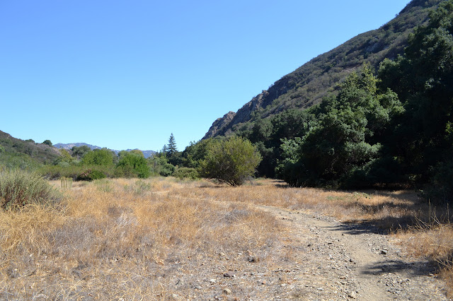
The road quickly splits, the left leading to the visitor center and Rock Pool, the most popular swimming hole, and the right making a wide curve above the large, dry wash of Malibu Creek. The people taking the trail are mostly in swimming clothes, often with towels draped over their heads. A kid in front of me is in such an outfit accompanied by a mom in a knee length skirt tight enough to force her to waddle and fashion sandals, and she is not the only one without anything approaching appropriate attire for a walk. There are a few hikers as well, and as I continue, they are quickly the only ones left. I take the high road to the right and quickly get a little bit of shade under massive oaks. Occasional picnic tables offer rest points in the shade.

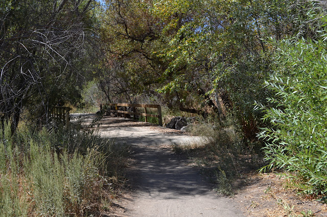
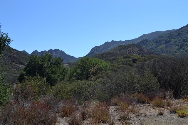
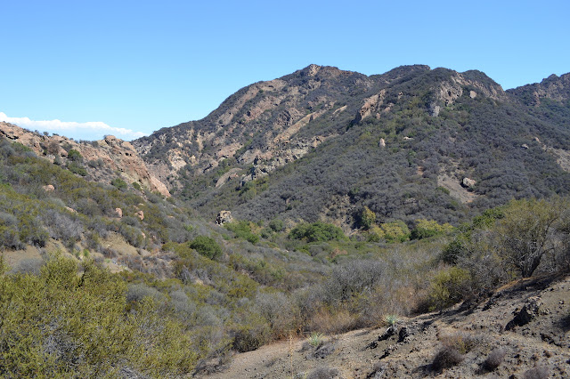
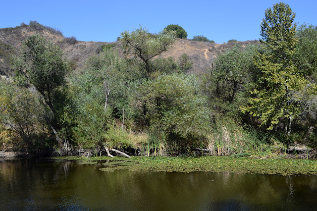
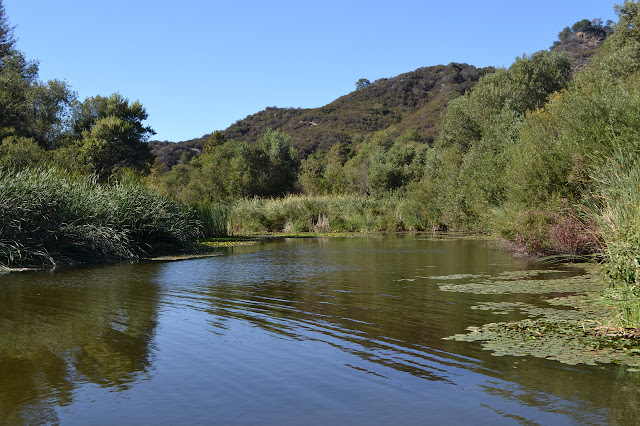
The roads join again after the Visitor Center and continue under the shade until the only hill along the way. The climb is not entirely shade free and short and gives a view into the rugged canyon. An unmarked trail leads off to the south while the road drops down to Lookout Trail heading upward and a road marked Century Dam heading downward. Somewhere to my left is Century Lake, but it is invisible in the shrubs. There are a few very rudimentary trails through it, but there are other easier ways to see the lake. A little further, another trail climbs Cage Creek up to Lookout Trail. The road crosses over a bridge and what could be another water hole, but the stagnant water below looks very unattractive.
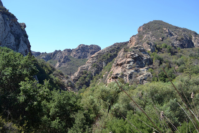
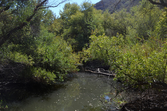
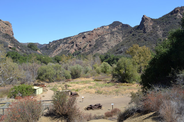
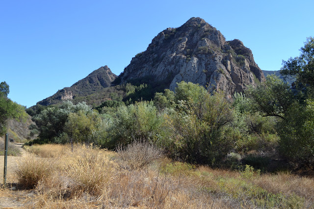
After the bridge, the Forest Trail heads off along the other side of Century Lake. Past this, the road quickly reduces to trail. When it widens up again, there are views of the Castro Peak area and then an old ambulance. It is painted up like a MASH prop, but probably was not left from the production. Further on, there are rusted hulks of another ambulance and a jeep that could have been. There are a row of picnic tables under camo shade cloth and a recreation of the sign claiming that I am currently only 34 miles from Seoul and 5610 miles from Burbank. There are a few signs around the place to point out locations. A shed with a few production still printouts on the wall completes the memorial to the long running TV series and movie. A couple trails up the hill to the south lead to the helicopter pad. It is nice without going overboard.


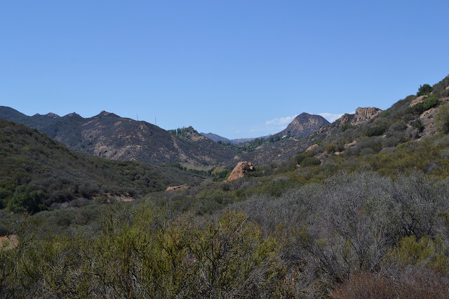
The Lost Cabin Trail leads from here around the other side of the Goat Buttes and the road continues through. I follow it that little but further to the bottom of the Bulldog Motorway only to find that now the Reagan Ranch is back the other way further than I have come already. It is probably up along the Lookout Trail although it was not listed on that trail's sign with the highway and a couple trail junctions. From here, I can climb toward the peak or continue to a neighborhood around Malibu Lake or turn back. I turn back and decide to wander down the various spur trails off the south side of the trail as long as I have water. The Lost Cabin Trail climbs a little more quickly than Crags Road, but still not very steeply, as it gives a different view of Goat Buttes, then drops into a tributary to Malibu Creek and stops abruptly.

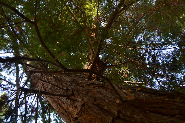
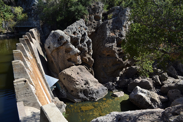
The end of the trail is labeled as the lost cabin site. The map would indicate that it is actually a large flat before the high point along the trail. Of course, they could both be sites of long destroyed cabins. On the way down, there is a fellow coming up who says he is going for the top of the Goat Buttes while I am thinking that it is too hot even to go downhill. The next spur is the flat Forest Trail and has a lot of high quality shade, not to mention views of the long, skinny Century Lake and a couple very large redwood trees. There is plenty of poison oak, but all off the trail. This one ends abruptly as well, this time at the dam. There are a few people playing in the water and jumping off the dam, but on the other side. A quick climb up the rocks gives a new view of Malibu Canyon.
It is tempting to try to join the swimmers, but it looks like there is more opportunity for getting shoes on relatively clean feet on the other side. It is the next spur along and turns out to be quite short.

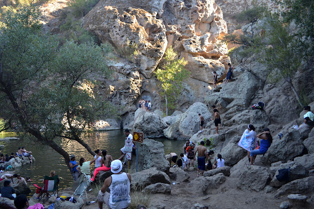
The other end of the unsigned trail is down near the dam, so it provides a nice, shady climb up to the top of the single little hill. Dropping down, I decide to check out Rock Pool to find it is an absolute mad house. There are people and trash everywhere. The state park makes an effort, but the provided trash cans are overflowing. There are two more a little way back down the trail toward provided port-a-potties, but no one can be bothered to carry their trash that far. Most of the swimmers here are out as most of the pool is already in shade.
It is nice to leave the noise and follow the road back, this time past the Visitor Center. There is a water fountain, which is nice since I am almost out of my own water. From there, it is a quick walk back to the parking lot with a small section of the crowd.
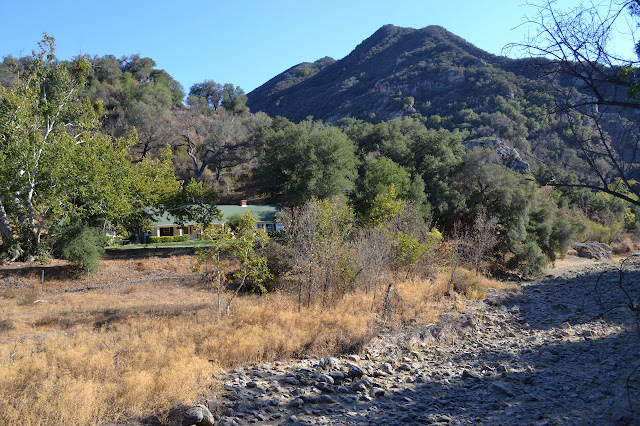

*photo album*
©2014 Valerie Norton
Posted 16 September 2014
Liked this? Interesting? Click the three bars at the top left for the menu to read more or subscribe!


Comments