Flat Tops: Shingle Peak Trail
White River National Forest
DAY 1 | DAY 2 | DAY 3 | DAY 4 | DAY 5 | DAY 6
I wake to find there is a mosquito inside my barrier and when I squish it it bleeds. Well, one is better than the multitude that undoubtedly tried. I look out on the meadow are more elk. Half seem to be hanging out by a small pool that is more mud than water. This group is different from the larger group yesterday. This group all have antlers. The mosquitoes are forgotten as I move quietly to the edge of the trees pulling on my coat. I hang back just a little bit and they do not seem to notice me.

The elk have gone again once I have eaten and slid everything back in the pack. I am not going to climb Turret Peak this trip, so the only climb left is about 80 feet to finish getting out of the creek below. It is all downhill from there. Every last step. One of them passing the only sign of bear for the trip, a rather large print in the dried mud.


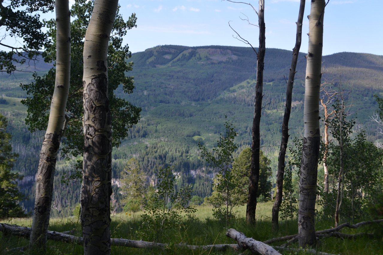
The vegetation changes as I drop. The sparse pines get a little thicker and then are replaced by aspen. The willows become more sparse. What I can see of the Sweetwater Creek canyon looks stunning. I sort of wish I had chosen to take that route, but there are special moments for this one, too.


The aspens still yield to wide meadows. There are a lot of flowers in them. Someone has been driving in them, too. It might be related to the rather dry ditch the trail crosses. Below the ditch, the trail is partly road.


There are some stunning bits of beauty along the way.


Movement to my side alerts me to a bird. A grouse hen is moving around and unlike the others I have seen recently, waits a moment for the photograph.


The trees yield more more meadow and the meadow starts to contain sage brush. Some of the area looks to have burned some time ago and scrubby little black oaks are starting up.


The trail got quite settled into the road area, but as the road takes a decisive turn for steep, there is a line of rocks to direct folks onto thinner trail. It winds down ever tighter through the tiny black oaks toward the start. Fencing along the way probably marks private property that it will eventually pass through. An older fence line shows more evidence of a fire long ago.


Soon I am back to the junction and the gate. It is a short way back to the trailhead.


I am back a little earlier than my deadline and take a moment to read the kiosk information this time. One side is devoted to Leave No Trace. The other side devotes half itself to rules and regulations. Half of what is left is a map of the area. The remainder is devoted to interesting tidbits of history. It says, "The Hilltop trailhead provides access to a number of trails, including several that enter the Flat Tops Wilderness. Arthur Carhart's 1919 visit to Trappers Lake in the Flat Tops inspired him to become the first U.S. Forest Service official to advocate for wilderness preservation. Carhart's recommendation that the area remain undeveloped for all people to enjoy set off a chain of events that eventually led to the signing of the Wilderness Act of 1964. Congress designated the Flat Tops Wilderness in 1975. At over 235,000 [acres,] it is Colorado's third largest Wilderness."
©2016 Valerie Norton
Posted 15 August 2016
Liked this? Interesting? Click the three bars at the top left for the menu to read more or subscribe!


Comments