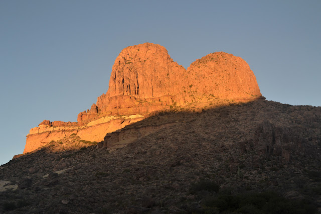
Superstition Mountains: Black Mesa and Weavers Needle
Tonto National Forest
DAY 1 | DAY 2 | DAY 3 | DAY 4 | DAY 5
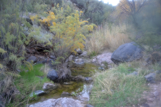
We wake soggy again, as feared, and spend way too much time waiting for the sun in the deep canyon before I promise we can stop at the top of Black Mesa to dry things out. There should be some quality sun up there, especially if it lives up to its name. We head across the wash to the junction sign, which is resplendent in a bit of ribbon to help people spot it from afar. Maybe a quarter mile up the trail, there are pools of water. A thin trail seems to climb up the hill, but does not go much of anywhere. The trail crosses the creek and there is an accessible pool below it, but the water just above the trail looks oily. We look for access above this, but there really is nothing. Somehow the lower pool looks nice enough in spite of the higher pool. And it has a tamarisk. We settle for it and grab water for the day.
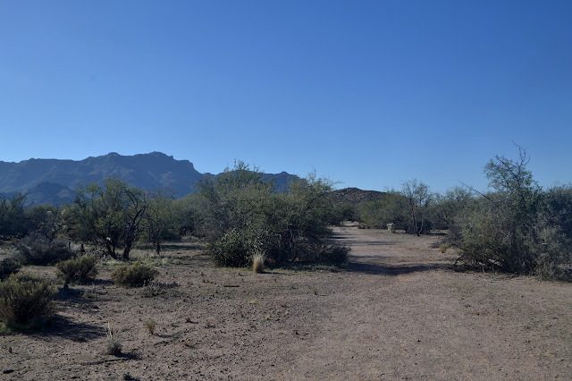
After grabbing water, we continue on our climb away from Boulder Canyon. There are more little pools of water higher up. We are off to see what sort of garden Garden Valley is. We expect it is a cactus garden.
The garden has some cactus, but also plenty of cats claw all well spaced. The paths are wide through it and the area is very flat. Campsites have been established everywhere and every site needs a fire ring, it seems. What they burn is still a mystery. It also has people as we meet the first we have seen since just after lunch on the first day.
A hole in the ground beside the trail must be Dirt Tank on the map. It does not look like it keeps water very long as it is not even muddy in the bottom right now even though we have been able to find many little pools from the recent rains. Rounding the signed junction, there is a rolled up paper tucked into a hole. Anywhere else, it would be a note from one hiker to a slower member of the party. Here, it is a supposed reproduction of a 1927 map to a gold mine, although not the Lost Dutchman Mine. We chuckle and put it back, then start up the last bit of hill to the top of Black Mesa.
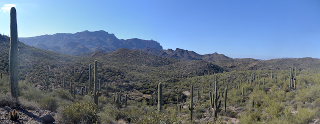
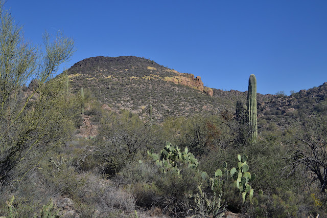
As we hit the top, we stop. Not sure I would call the area rocks black, but it is good enough. It is dry and sunny and will be perfect for drying out our gear. There is a minor pack explosion. We settle in for a little rest, chat with one last group of day hikers, and then get started on the rest of the mesa. It is a little warm on the south face of the mesa as we drop down. Those clouds of the last few days are gone and a little bit missed.
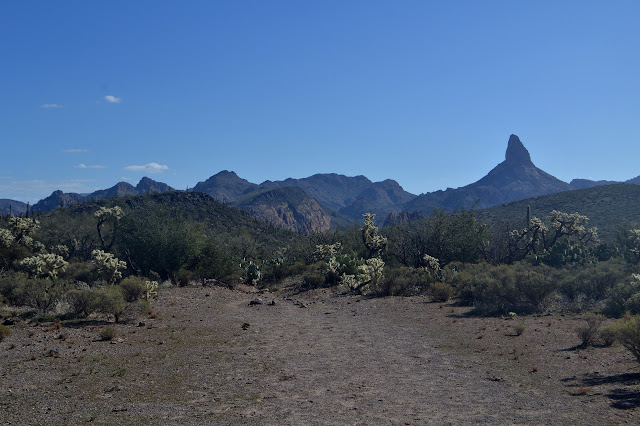
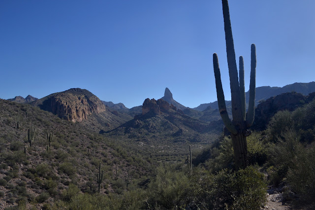

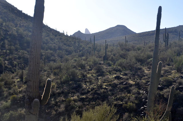
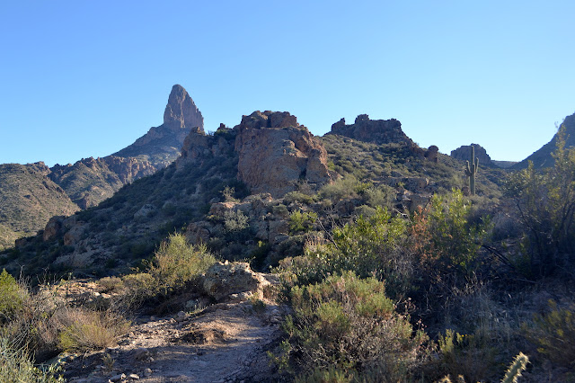
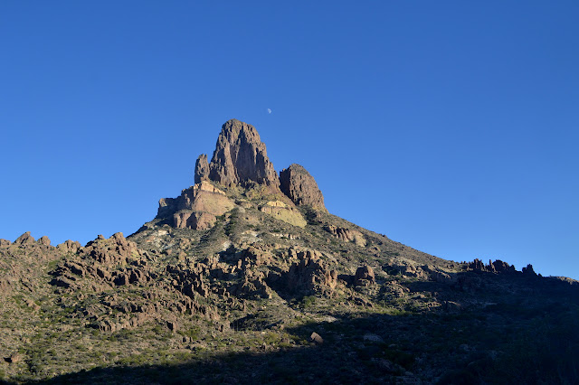
We come to another junction and turn again to walk on the Dutchmans Trail, but this time in the other direction. That Dutchman sure did get around. As we hike up the gentle slope of trail beside East Boulder Canyon, we fall into the pleasant shadow of Palomino Mountain. This could be the mountain in the silly gold mine sketch. Maybe. The arch is totally in the wrong place. We were expecting a couple more pools of water in the canyon here and indeed there is a little.

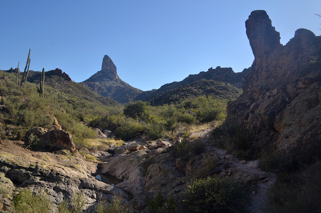
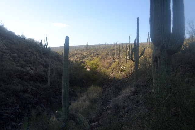
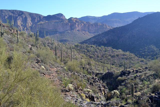
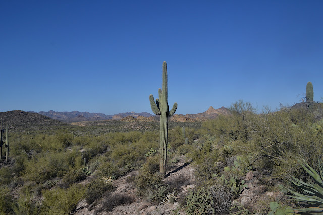
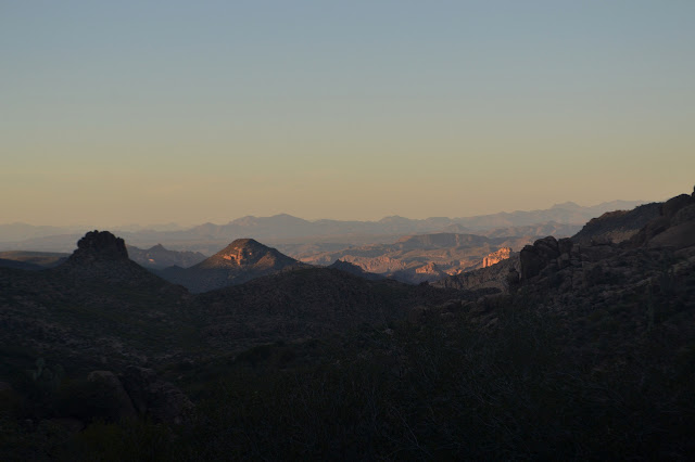
One last junction, and we turn away from the Dutchmans Trail to climb Peralta Canyon Trail. It is named for the canyon on the other side, we are still climbing up East Boulder Canyon, although heading quite high up on the side of it. Sometimes we are separated from the main canyon by bits of ridge. It is an interesting hike.

As the shadows lengthen, we are getting close to two possible water sources that will be the last we need to find. The first is Piper Spring, which is not on my map, but I jotted down the coordinates before I left. If the GPS says it is close to the trail, we can look for it. Otherwise, there should be pools near Piñon Camp, which is on a second scrap of 1966 map and my planned destination for the day. Finding either seems a little iffy.
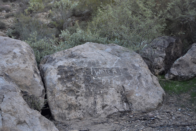
The spring is up first and it is near to the trail. The area around it shows extensive camping and the trail manages to get lost a little bit into this area. A helpful petroglyph points directly to the water, or at least in the same way my GPS points, but does not hint at how to actually get there through the wall of rock and vegetation. We go high, then low, to eventually circle around into the creek bed on the other side. There is a thin metal plate held down by rocks, and under it, there is a broken cement spring box. Bugs dance on top of the water and below that, it is dark. It comes out a little more yellow than all the yellow water we have had so far, but it is water. We are set for the rest of the trip.
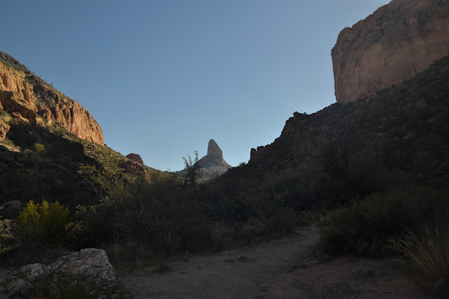
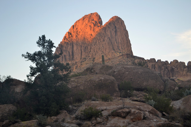
The site looks like it will be another wet morning with a very long time waiting for the sun. It sits in the morning shadow of Weavers Needle. Piñon Camp should not have this problem and I have hope that a higher camp will be a little drier. Okay, I also hope that a camp that was once marked on the USGS map will have the luxury of a picnic table. After a good long look at the map, I am sure it is just over the next rise which is just a little further away than it looks.
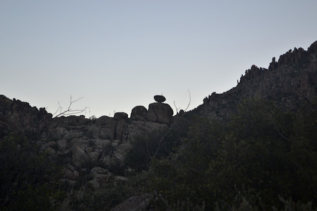
Over the rise, below a balanced rock, there is a pinon pine. Except for a couple high on the canyon walls that I am not actually certain of, it is the first pinon pine I have seen on this trip. It is the first pine of any sort. There is no sign, but what would make a better sign than this tree? The camping area is becoming overgrown, but there is still plenty of room for the two of us. The fire ring has not been used this season and has weeds growing through the rocks. The hoped for table does not exist. I am not certain where the water might be, but there is no pressure to find it since we already filled up. We are home for the evening.
Our bags are wet again before we finish eating. It may be a little less than the last two nights, but it is still annoying as we tuck in for the night.
Continue reading: day 5
©2016 Valerie Norton
Posted 16 December 2016
Liked this? Interesting? Click the three bars at the top left for the menu to read more or subscribe!


Comments