Browns Canyon to Oat Mountain
Michael D. Antonovich Regional Park
Click for map.
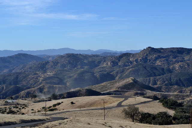
A group of geocachers were heading up Oat Mountain via the canyon just east of the one featured in my first, somewhat more elaborate attempt at the peak. This neatly sidesteps the requirement to poke through some private property wandering right past the ranch house. (Well, I could probably have done the cross country on cow paths up the canyon, which does appear to be park.) This is the more usual route. Getting to the parking requires ignoring a few signs that, as far as I know, were really supposed to be taken down when the park opened to the public. One sign demands that only residents are allowed to use a bridge. Beyond that is a ranch that boards horses and is mixed in how welcoming it is about the public using the road past it. At the end is public parking so the public is definitely expected to be allowed to arrive here. A $5 fee is required for parking, but today there is no envelope to use with the iron ranger. We park at the upper lot to continue up past the locked gate on road that continues to be paved.


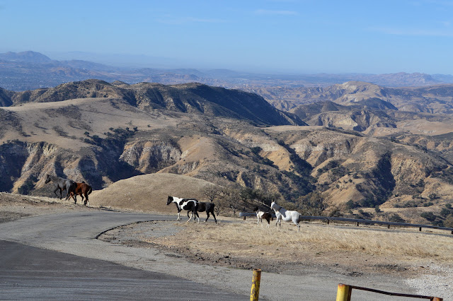
The wind is strong as we start and just gets stronger as we go. Some spots offer shelter from it, but much of the climb is heading right into it. It is strong enough to make it hard to breath. We have some concern with how hot it is expected to get today, but it may not be much worry with this to help cool off. The wildlife of the day is what is supplied by the nearby ranch.


We ponder the distant mountains to the northwest, especially the ones that look rather grey and the parts that might actually be a little smoky still. The Thomas Fire will be making itself known to us for a long time. As we head up the very last bit of the peak, we are met by a fellow in a truck who informs us we will not be continuing. The top is private and although historically people have been allowed to climb it, today does not seem to be our day. The rumor is the gas company is having some leaks, and they suspect anyone coming up might be taking measurements and are not keen on anyone knowing how bad it is. There are more caches past the peak, but there seems to be no interest in trying a trail along the south of it that misses the property at the top, so we head down again. I wanted that peak, which would still be missed, so am not inclined to fight too much for continuing the hike creatively.

Attempt two on Oat Mountain got a little closer to the peak, but still not close enough to call it climbed.
©2017, 2018 Valerie Norton
Posted 2 Jan 2018
Liked this? Interesting? Click the three bars at the top left for the menu to read more or subscribe!


Comments