Lost Valley trail work
Los Padres National Forest
Click for map.
The Los Padres Forest Association has a double header of trail work with camping at NIRA in between and I decided to join in on the fun. There is even tree felling promised for the second day, which I have not yet witnessed. Today is just ordinary sawyer work on downed trees in Lost Valley. Safety gear, safety talk, a gathering of equipment and tools, and we set off up the Manzana to Lost Valley. Everyone here today has done this before and it does not take very long to start.


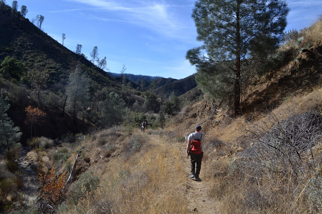
The junction is still hidden up a hill and probably will continue to be for the foreseeable future. Still, someone did manage to accidentally find it once. I wonder how that happened. Maybe got into camp, which is practically on the trail, and decided that was the wrong way then looked around for where it did go. It seems a plausible scenario. I suppose paying close attention at the junctions and knowing what other clues besides a sign might exist to indicate one is at them is sometimes necessary. It is just hard to remember to do when it represents a turn one does not mean to take. We pause a moment until everyone is in sight of the junction and then meaningfully take the turn to climb a little more steeply, at least for a brief time. The old trail is noticeably old road (only ever partly built) through here.


The trail navigates a few old road washouts getting into the creek from time to time. We follow the footprints easily enough in between road sections. Then there is the first tree. The other groups continue up to the next trees, but my group has arrived at our project for the day. It is actually two trees that have fallen across the trail and a third that has slide down the canyon side over the trail and they all have multiple trunks as they cross. Time to settle into some work.
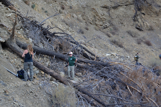

The sun breaks over the top of the canyon and brings quite a bit of heat with it. It sure was nice before it got here. Temperature is expected to swing massively today. While not freezing, it was very crisp as we started and could be pushing 75°F at the peak.


We are done a bit earlier than planned. The trees further up are allotted to other groups, so we head down to sort out a couple small things on the way. First is a tree we suspect is sort of holding the trail in, so not much is touched on it. Next, we replant the sign for Lost Valley Trail. Leaning and sometimes moving about, it is not as easy to see as if it stands on its own.

There seems to be a feeling that the sign is not a good one to have, anyway, since it list South Fork as a destination for Lost Valley. Both trails go there, after enough correct turns, but the other way is shorter. Missing signs seem more important, but confusing signs might need some attention too. It is still early, but we head back.

©2017, 2018 Valerie Norton
Posted 4 Jan 2018
Liked this? Interesting? Click the three bars at the top left for the menu to read more or subscribe!


Comments