Fox Mountain
Los Padres National Forest
Click for map.
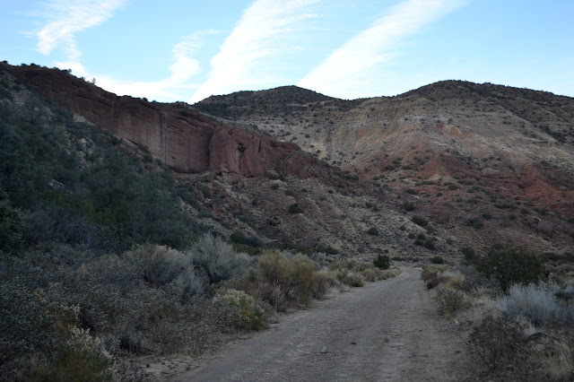
After the ordeal finishing off Thursday, I tried to sleep in as long as I could and generally recover on Friday. I had a message the sawyer project would be postponed, so that plan was out. My secondary plan was to climb Fox Mountain, but I was not in the mood for a bushwhack, somehow. I lazed, I read, I checked out the soggy roads that were preventing us working. Finally, I decided to do the mountain after all and I packed up to walk into the campsite noted in the Fox Mountain Peak guide. It is just a half mile in, so I figured it did not matter much that I had my car camping gear, not backpacking. I would even go ahead and bring my day pack instead of making due with the bigger one. Then I got to lining up the peak guide with the map and noticed that the gate that might be closed was actually the edge of a marked inholding where there is a broken up cattle guard full of mud, remnants of fence, and no gate at all and the hike was 2.5 miles from the actual locked gate, noted as "pavement ends". I shrugged and walked in all 2.5 nearly flat miles instead and never quite got my brain to think about it as backpacking rather than car camping. Just far enough away I did not want to go back for a second trip to get all my gear to the site. The GPS clocked 2.57 miles from car to site, so the guide is very close. The trail up the ridge line next to it was easy to spot even in the dying light, so I was very sure I was in the right starting place.
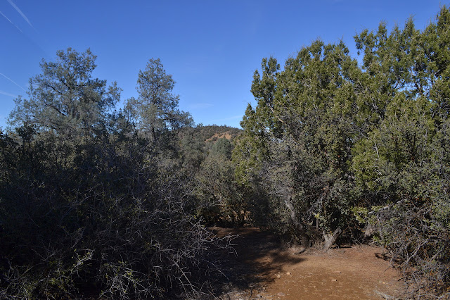
The track looks reasonably open. My already well bruised legs with a hundred yucca stabs and many long scrapes and even some rash developing between stomach and socks (seems I probably ignored some nude twigs of poison oak that did not ignore me) are quite thankful for that. I want today to be another rather lazy day. I want to go ahead and take basically all day for what really is just a half day hike. Late start, and slow on the way up. Maybe even 3 or 4 hours for the 2.5 mile climb. Yeah, take the whole time the guide suggests is required for this hike just on the uphill. Now that is a goal! But maybe not too late a start. Maybe more like 9 than 10. It might get warm, after all. But without looking at the time at any point in the morning, my start is when it is and that is a quarter to 10.
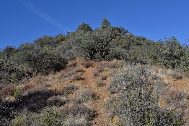
The trail is initially steep, but not so steep that it feels like the dirt will slide out under my feet. I am a little disconcerted that although heading northwest, my shadow is already pointing more northerly than my direction of travel. Still, the "occasionally obscure" trail seems quite clear enough, at least for going up. As I climb, there are a few places that are steep enough to worry about, but most of the ridge line is a gentle slope. The only protest from my legs come when a low, deep bruise gets two quick whacks with stubby scrub oak branches, not from the climb.


The trail flattens out and cairns become frequent. They do not seem necessary, but that is probably only because they are there and helping direct the infrequent users to a single path instead of a braided collection.

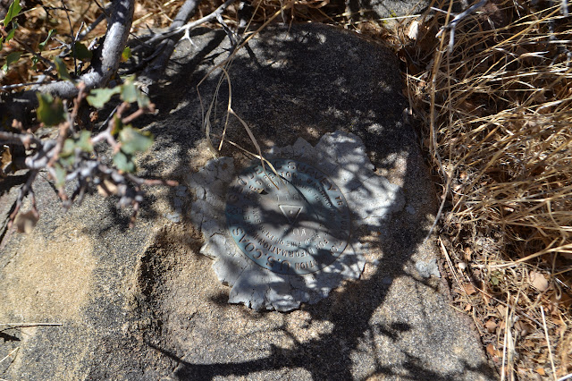
There are a couple brief dips on the way, but it seems most the climbing is done. The peak ahead is not that far above where I am now. The guide says to work to the left, but once I have crossed the saddle, it seems a little more left than it did before and I almost head on up the right peak anyway. The path to the left just keeps going and going further back and quickly it is apparent that this side is higher than the other. Finally, there is the top with a few trappings of the things humans, specifically surveyors and peak baggers, like to use to mark tops.


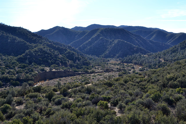
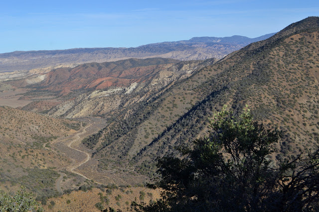
It took me three hours to reach the top. Not quite my goal, but the more real goal was to not add pain to my battered and tired legs. They feel good, so I guess I managed that one. Meanwhile, they have got me to quite a good spot. Badlands and Mount Pinos, the Cuyama Valley and Caliente Mountain and Carrizo Plain, Sierra Madre and its potreros, the rough and mysterious Dick Smith Wilderness stretch out all around me. Now all I need to do is settle in and enjoy it. And then get down and back to the car and drive home. But one thing at a time. Enjoyment first.


Eventually it is time to head back down. As I go, I can hear the sound of motorcycles on the closed road below. Illegally riding it or maybe the volunteer Bryan got to check on the road out to find that if we had ignored the puddles of soft mud, we would have been stopped by a multi-ton boulder.

The track is almost as easy to follow down as up. Interestingly, I do almost manage to head off in the wrong direct by following my own footsteps. The ground is generally too hard to leave much of anything, but at the top of a particularly steep spot where I had crossed and made a sharp turn, there are obvious prints. The turn, however, is not obvious. Today, though, I just came up the ridge so I have both some memory of where the track goes and a GPS track I can follow, so I make the turn instead of having a repeat adventure. It would be much easier to deal with out on these slopes anyway.

I make it back down to camp without incident. Well, maybe on slight slip. Everything is packed, so I just need to collect it and decide how I want to carry two packs on the way back. As I am dumping the dirt from my shoes for a more comfortable stroll, the motorcycle noises return. Four. I give them time to vanish and then follow them out. They will be quite gone by the time I reach the car. Somehow I still feel like I was car camping. It was within 250 feet of the road, after all.

It is a couple minutes past sunset as I drop everything into the car and take off. People like to say that as dangerous as the hiking seems, the driving is always more so. One might think the adventure Friday would be hard to beat, but with the 101 closed, 166 has become a bit of a death trap. Maybe they just could not understand how close I was with my dim old headlights that sit narrow on my small car, but playing chicken with the people trying to do 80 MPH and "needing" to pass a mile of other vehicles just is not fun. After pulling back off the shoulder we could fit about 2/3 onto, which is large shoulder for 166, the guy behind me gives me plenty of room to stop all too literally dead in front of him. I am very happy when I catch up to someone and can let them take on the bulk of the danger. Still, a good peak, and usually would not be so bad a drive.
*photo album*
©2018 Valerie Norton
Posted 17 Jan 2018
Liked this? Interesting? Click the three bars at the top left for the menu to read more or subscribe!


Comments