Posts

Showing posts from June, 2018

sketch

Image
I found I have really been neglecting my colors. Also, Pentel water brushes cannot keep their lids on well, so are not a good choice. They have a less packable shape, so I do not have many of them anyway. Just enough to see if they do long term ink holding better than the Kuretake brushes that are most my collection. They do not. The patchwork of burn and green north of Ortega Peak.

Santa Cruz: Santa Cruz Trail

Image
Los Padres National Forest DAY 1  |  DAY 2  |  DAY 3 Click for map. The map has reminders that when I have thought about being here at Santa Cruz Station in the past, I had wanted an extra day at least to explore. Down the creek, it claims there is a cabin to be found. Up the creek are waterfalls. The register box has a note pad and someone noted not just the waterfall (which they liked), but some rather large trout up there too (and they liked as well). I decide to note that someone should come down the fire trail with a chain saw. Or at least some flagging. Especially for the flatter areas. After a little more poking around, I am off. Had I not been planning to go out by the trail already, after coming down the road, I would have changed my mind. So that is via the trail. The trail junction. I went north yesterday, now west briefly before heading south. The old Santa Cruz Guard Station is kept locked up tight when volunteers are not using it. I should have poked

Santa Cruz: Santa Cruz Peak

Image
Los Padres National Forest DAY 1  |  DAY 2  |  DAY 3 Click for map. The morning is thick and grey, but I expect that will be gone by 10AM. It is higher up this today, so I can see actually the land around me. I get to see the outside of the barn now. It is a simple building and not very barn-like. Poking around the rest of the camp areas is nice, but it sets off one volunteer's dog. I like a spot a couple down from the station where a big oak has fallen and now it is nice and open over the table and camping area. Even next to nice big creeks like this one, I am starting to get wary about large oak limbs. I weigh down my camp gear so it stays where I put it and pack up and take off as the others start to fix breakfast, joining the mowed trail by the register and starting to climb along a tributary out to those meadows I saw in the gathering gloom yesterday. On the other side of the canyon, I pick out the trail going the other way, climbing in easy switchbacks below the

Santa Cruz: Santa Cruz Station

Image
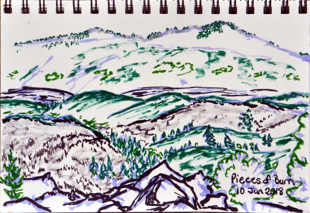
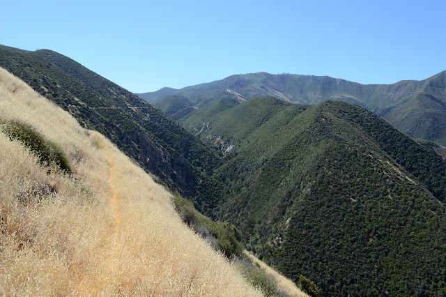
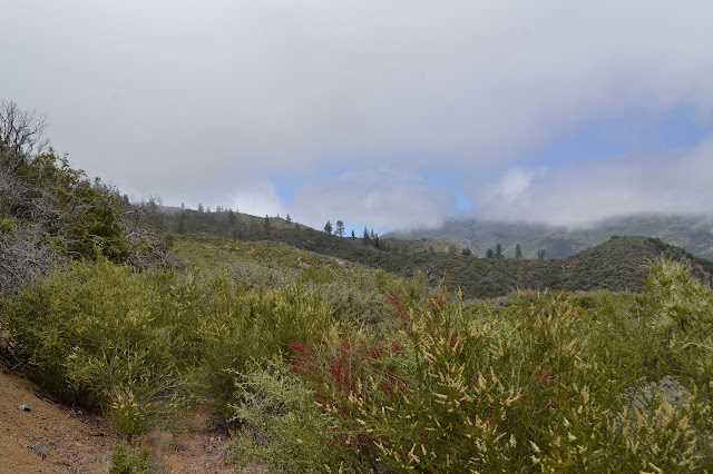
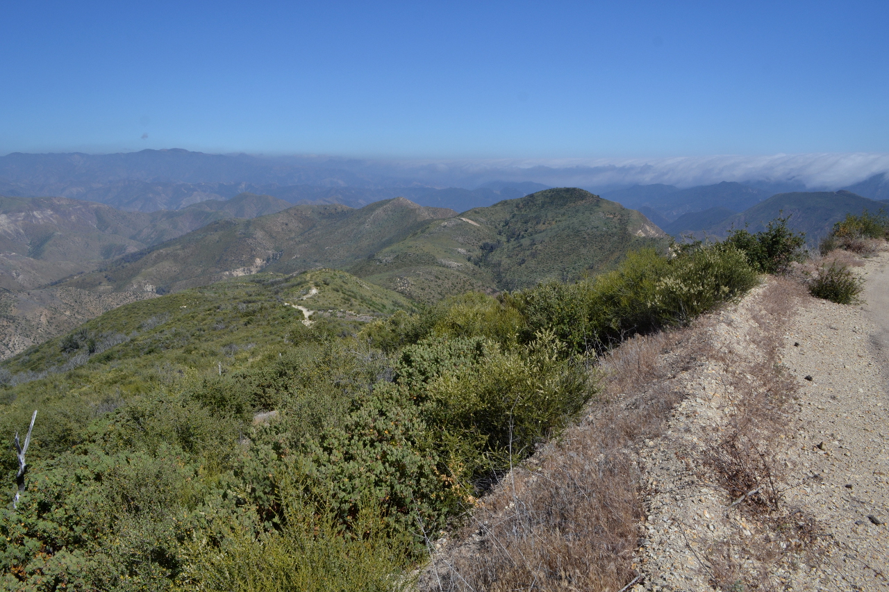
Los Padres National Forest DAY 1  |  DAY 2  |  DAY 3 Click for map. I am not looking forward to the miles of this day, but I still want to go up Santa Cruz Peak and I do not particularly want another go at McKinley Fire Road so soon. Besides, there is still the old guard station south of it that I wanted to check out. It should be a fairly reasonable hike in, mostly on lovely Santa Cruz Trail, for about 10 miles. The Rey Fire burned out the crib wall at a particularly unstable shale area and later rains made it even worse so that now it is considered impassible. I might try it on the way down, I will see what it looks like from Alexander Saddle. I will not be trying to get up it. Instead, I have to take the road for about 15 miles. But wait, there is more, as the late night infomercials like to say. First Crossing is closed, so I have to park a bit more than 2 miles from the trailhead. The parking around there is day use, so I am not certain how my car might be treated by

Ortega Hill and Ortega Peak

Image
Los Padres National Forest Click for map. While watching the progress of the Thomas Fire over the south side of Ortega Hill, leaving the north side alone, I decided I would hike Ortega Peak again once the closure was lifted. This time, I would give Ortega Hill a try too. After all, it is the actual named thing. I do wonder what historically conspired to give that lower hill a name while leaving the bigger peak with only a benchmark. Bonus, it is unlikely to still be the miserable, masochistic bushwhack without a single view that has been reported by both groups that visited it in the last 20 years. Okay, so that last might be why I would even think about doing it when there is a better peak right next to it. The Thomas Fire closure was lifted a lot earlier than expected, but I remembered my musings eventually and here I am. A slightly early start because the days are getting hot. This one only promises about 80°F instead of 85°F of the nearby days. I brought two bags of water

Matilija, Upper North Fork trail work

Image
Los Padres National Forest Click for map. Matilija has been a place that seems to suck in the rain. There have been a few times it has come down 15 or 18 inches in a single night and the creek surged for days, but the canyon took it. After the Thomas Fire, when the rains came heavy, Matilija got at least its share. This time the canyon itself flowed although just a third of the big dumps it had withstood before. We came up it for a day of trail work aiming to get up to Matilija Camp. That is a brief one mile from the trailhead. Since we are working, we got to park at the trailhead instead of behind the gate, which turns out to be at Murietta a little further down the road. The trail is obvious, but there is no evidence of the sign with a map in it. We gather up tools, mostly little saws and trail Smiths and Pulaskis, get a safety talk, and gather into three groups to see what we can accomplish. Quite a big group: about 30 volunteers. Standing within the burn. There is a l

follow by email