Santa Cruz: Santa Cruz Station
Los Padres National Forest
DAY 1 | DAY 2 | DAY 3
Click for map.
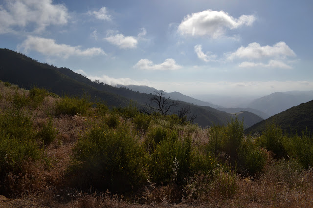
I am not looking forward to the miles of this day, but I still want to go up Santa Cruz Peak and I do not particularly want another go at McKinley Fire Road so soon. Besides, there is still the old guard station south of it that I wanted to check out. It should be a fairly reasonable hike in, mostly on lovely Santa Cruz Trail, for about 10 miles. The Rey Fire burned out the crib wall at a particularly unstable shale area and later rains made it even worse so that now it is considered impassible. I might try it on the way down, I will see what it looks like from Alexander Saddle. I will not be trying to get up it. Instead, I have to take the road for about 15 miles. But wait, there is more, as the late night infomercials like to say. First Crossing is closed, so I have to park a bit more than 2 miles from the trailhead. The parking around there is day use, so I am not certain how my car might be treated by authorities. There are gates on the lot that might be locked when I finish. Besides, I am not particularly keen to spend $30 on parking, especially not to a concessionaire that was sprung on the public quite suddenly. So there is a little more to be in a nice, big, free dirt turnout by the side of the road. At this point, it is about the same to walk over and through Aliso Canyon, so I guess I will. It gets a little bit of the day on trail. I will probably come out on the road because it will be the end of a similarly long day (but downhill, sort of) in the dark and I probably will not want the extra hill. Total miles expected for the day: 18. Total I seem to be able to do while playing with my camera and listening to the birds: 12. Total until my feet get uncomfortably sore: 15. This should be "fun".

The heavily overcast is drooping so low that I could nearly call it fog. The wild turkeys are out on the road and they have lots of little turkeys in tow. I have never seen little turkeys, just big and bigger and on display. They run off reminding me of very oversized quail, but only a little. They are less jaunty in movement. It is a bit further than I remember to get around to the ford to the canyon. The ford is dry, but there is a big puddle with frogs behind it. Sage Hill Campground is nearly full with some huge groups in the sites. A bunch of people are up and looking industrious as I pass. The hiker parking at Aliso Canyon is $10 per day according to the forest service, but there is not a single fee area sign and the information at the campground entrance, a quarter mile back, is specific to the campground. It looks free to me.

I was walking in some camp/river shoes because I was not sure what the ford would be like. Now I pull on my boots. Usually it is trail runners, but I did something to my foot (in the home where most accidents happen) and so it is boots for this trip. It actually takes some tape to stop hurting, so that goes on first. The heavier footwear can only make the miles feel worse. It is possible I only need the tape, but, well, injured foot equals boots go on. A pair of day hikers park and head in while I am messing with my feet. I follow them in after a couple minutes. The canyon is dry. The grass is dry. Most the flowers have gone. Although I like the loop trail better, I stick to the canyon because it is a little shorter. The climb out of the canyon is not as bad as I remember it when last coming down.

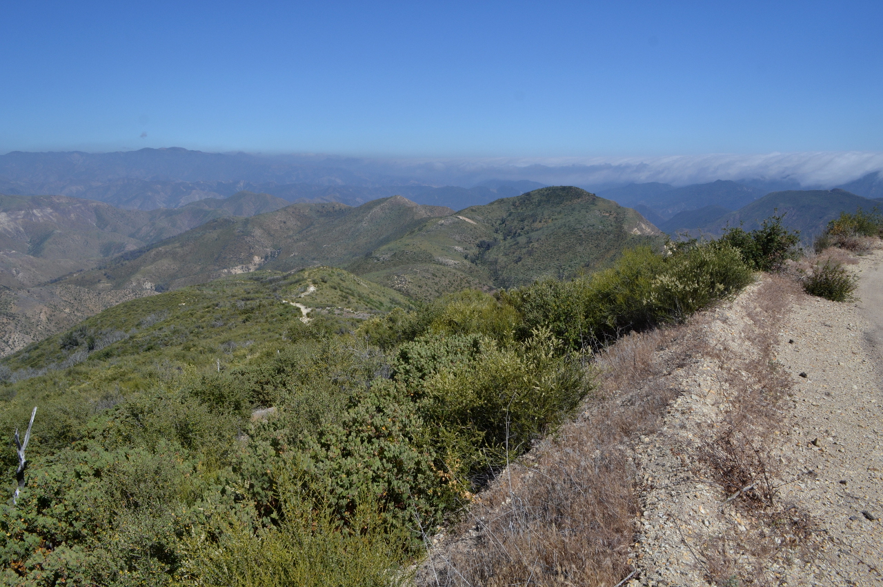
Although cool under the cloud cover, it is starting to feel downright muggy to me by the time I reach the top. The sky in the distance is already promising to replace this with simple hot. The new trail around the slides coming down into Oso Canyon seems to have settled in nicely. My trail finishes in a trail coming from the empty camp. I turn the other way, where the trail soon crosses the thin creek and ends again, this time at the dirt road that will be the route for most the day.


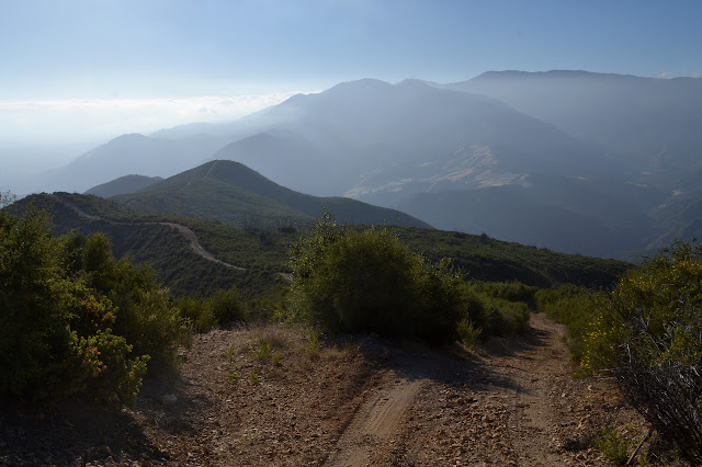
I am passed by a single bicycle who wonders where I am going. He has never heard of Santa Cruz Station although he is very near a sign that says it is 10 miles away. The little bit of Santa Cruz Trail considered open at this end offers a non-road route up through 19 Oaks, but this time I go along the ever so slightly shorter road. As I go, I start to look out over the saddle I just crossed to this canyon and the golden hills at the top of Little Pine Mountain. Little Pine is quite pretty in all seasons with its hills and cliff.

A loud buzzing puts me in mind of being near a bee hive, but nothing nearby looks promising to house one. I watch the bees a little and they dart in and out of holes in the road bed itself. They are ground dwelling bees. The "Beeman" may have mentioned that most of our native bees are ground dwellers. I have been walking across the top of the hive with no ill effects, so just keep on going. As the road comes back near the same area, but much higher, there is more buzzing. The bees are here too. How big can a colony like this be? I imagine long tunnels that wander between here and 200 feet down. (I have no idea. It looks like that is probably not how their homes work.)


The bees are buzzing strongly near the Camuesa Road Connector, too, but this time out over the dried grass of the large meadow it crosses. I see no flowers there, but the activity right at the level of the empty seed husks, is frantic. They seem to be circling wildly, but what is all the movement in service of?

It is not too much further to where the trail through 19 Oaks comes out. There are no more bicycle tracks above there, just truck tracks from volunteers. I might have company once I get up to the station. (I was warned in advance, though.) A little further is Hidden Potrero. It is a lovely little camp, but after the fire it only has half a bench and two thirds a top between two tables. With the crossing closed so often recently, it has not been used much and there is a thistle growing out the middle of the fire pit. Oh, and it has water! The trough at the far end is full of some that looks quite lovely and clear.

Onward and upward! The gate just past Camuesa Road sure got singed, but the signs did not catch. Then my upward is disrupted by some rolling. Oh, and the bees. There is more buzzing and, when I look, more bees. It is rather disconcerting because they go on for 100 or 200 feet sometimes. I move smoothly over them, trying not to let any bit of myself pinch just in case there might be a bee trapped. It works and my total lifetime bee stings is still zero. I just worry because I am probably allergic. Besides the bees, there are also some tent caterpillars attacking some sticky monkey flower. Why did I have to see these in Nevada before noticing them at home?


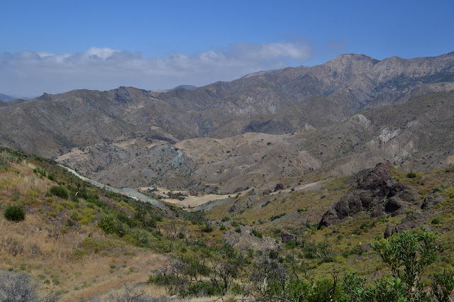
I pass hillsides of tall yellow flowers and squat yellow flowers. All seem a little thin in the amount of vegetation. The Rey Fire finished in September of 2016, so it is not quite two years. More buzzing means still more bees. As I get to the chalk cliffs that make the east side of Little Pine Mountain imposing, it really is time for onward and upward. The saddle surprises me with a few juniper trees. They seem out of place, probably too low. I see three of them and the skeleton of a fourth. The climb beneath the reflective south facing cliffs is a little bit warm. The higher I get, the more I can see of the thick marine layer pressing up against the coastal mountains.


Up at the top, the road rounds a corner beside a memorial and a sign to mark the corner. The bullet holes somehow get to me a little more on this one since the memorial seems to make it rather clear why it is there. A bit of red catches my eye. There are huge stalks of bright red larkspur that tower over my head hanging out over the road. And bees. Of course bees. And a little shade under some oaks. It looks nice for a brief rest, and maybe a nap. Just a wee nap. I got such poor sleep the night before. I try to take it, but my napping skills are quite lacking. It is not long before I am walking again, but I do still feel a bit better.


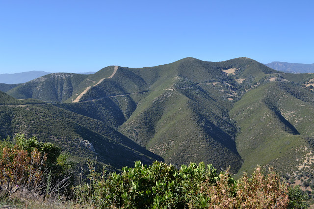
I see Buckhorn Trail coming up a ridge not all that far below and eventually, after wondering if I missed the top and the sign burned, I finally get to it. A little more on the steady climb, and there are a few pine trees. They are standing just over the top at the junction to Happy Hollow. I bask in being at the day's high point and marvel at how close Bluff and Big Pine are, then notice the corrected miles down on the ground. Everything is actually half again as far as it says on the sign. That is not bad for the mile or mile and a half up to Happy Hollow, but the 11.5 or 18 miles to Madulce seems like an vast error.


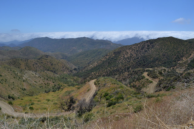
Not quite all downhill from here. It looks like there is a chunk of uphill at the start of the road down to Santa Cruz Station, but then all down along the ridge and then the north side as it turns back and drops down.
There is a locked gate on the road and it is constructed to be very difficult to pass, even for hikers. I squeeze past and start the last climb.

Or what I think is the last climb anyway. The road drops steeply and climbs steeply and drops steeply again. It is more than a mile and a half before I am about level with the saddle at the junction. As downhill on clear trail (road) this is rather hard work. I would mumble something about 250 foot contours, but it has already been internalized as a fundamental truth of the things. I was a teen when I got grumpy about some 80 foot contours on a 15' map and every experience since then has reinforced the feeling that it has to be 40 foot contours except for a few times feeling 40 was not good enough either. Just know I really like lots of curvy lines on my map. I settle in for a downhill that will feel a lot longer than I thought it would be as the sun gets low.
I pick out the trail across the valley to the south and think I can see it not all that far below the road in places. Maybe I just want to drop down on it. However, I am not certain enough about it and the trail segments are not all that close. Up and down, just hoping to see the road take a corner off the ridge. It should get better then. Meanwhile, I can be fascinated by some of the antics of the dust. A truck came up recently (and passed me as I was nearly the high point) and where the dust is particularly fine, it acted briefly like water under the tire. The center was sucked up and now it stands in a sort of ripple.

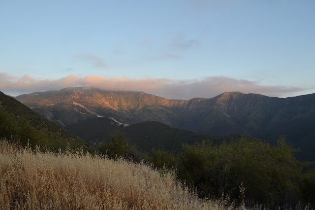


The road does finally turn off the ridge line and flattens out. It stays that way just long enough to lull me into a sense of security, then takes off steeply the rest of the way. I can pick out a bit of the trail heading north that I will take tomorrow. As I pass above the old guard station, I can hear voices. So it is occupied tonight. It is dark as I hit the creek. The road was newly plowed right up until that point. The creek is cliffy upstream and it looks pretty. It is full of frog noise at the moment. Past that is an open gate and past that is the old out house sitting over a brand new hole dug earlier in the day. Hey, if you want to drive out here, you have to put in some work. Past that is a table with no gear around it and frankly, I will take it. I am ready to drop. First I need to get some food in me so I can be powered for tomorrow. The barn is dark on one side of me and there is light coming from the windows in the station on the other. I have never seen them before, and I think that will just have to wait for tomorrow. Well, I do poke my head into the barn. It is full of equestrian related gear and has a very unhealthy layer of rat droppings of all sizes. I think I will stay out by the table.
Next day ⇒
©2018 Valerie Norton
Posted 23 Jun 2018
Liked this? Interesting? Click the three bars at the top left for the menu to read more or subscribe!


Comments
The guy who posted this (https://www.youtube.com/watch?v=PyQ-bzqqdh0) was hanging out in Satwiwa from mid-April until mid-June documenting the bees.
I've seen lots of ground bees over the years in Satwiwa and other open road-like areas in the Santa Monica Mtns.
--Jon