Santa Cruz: Santa Cruz Trail
Los Padres National Forest
DAY 1 | DAY 2 | DAY 3
Click for map.
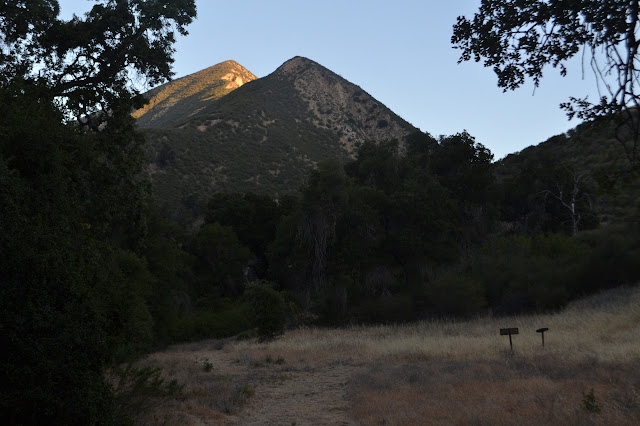
The map has reminders that when I have thought about being here at Santa Cruz Station in the past, I had wanted an extra day at least to explore. Down the creek, it claims there is a cabin to be found. Up the creek are waterfalls. The register box has a note pad and someone noted not just the waterfall (which they liked), but some rather large trout up there too (and they liked as well). I decide to note that someone should come down the fire trail with a chain saw. Or at least some flagging. Especially for the flatter areas. After a little more poking around, I am off. Had I not been planning to go out by the trail already, after coming down the road, I would have changed my mind. So that is via the trail.


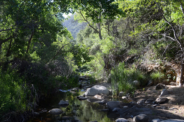
Down the creek, there is a sign pointing out trail as it turns a corner to cross the creek. There is no worry losing the trail where the sign is (possibly because the sign has been there long enough, the trail is overgrown to the creek anyway), but there is trail down the side of the creek and the trail on the far side splits. I am certain the one going downstream before crossing is wrong, but not so certain about the other side. I choose the one on the left which heads back upstream, but also up the hill. Passing through a hole left by a gate in the old fencing around the guard station, it does seem to be the correct one.

There are trees down across this trail too. The first is small, but still too large for me to drag it off to the side on a whim. Some are just a general mess and encouraging up to three versions of walk around trails. Even with the trees, it is far more pleasant to climb than the road was coming down.


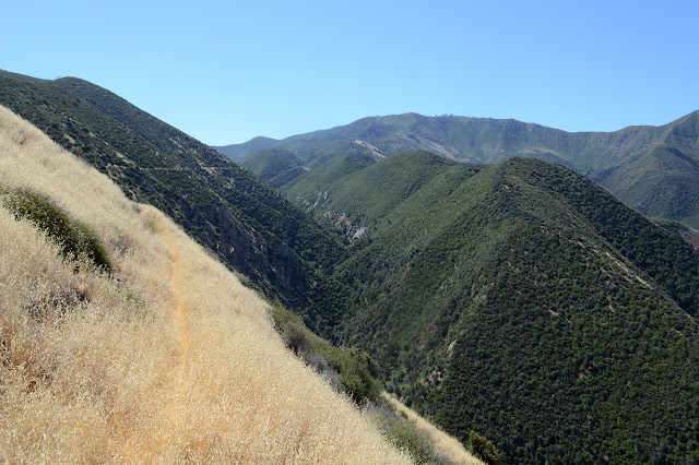
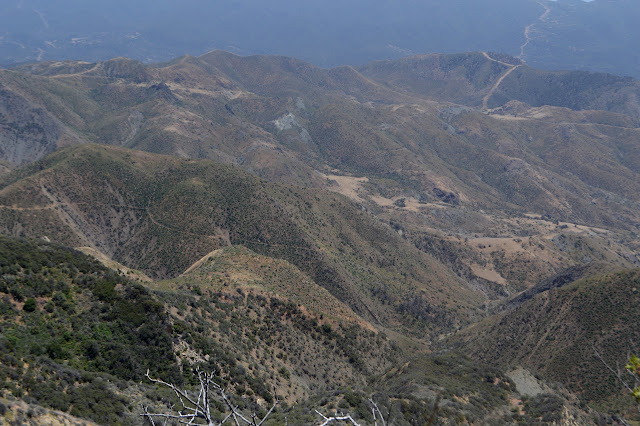
The switchbacks extend further and further west as they climb and then the trail comes around the rocky crest of the ridge the road follows down. Time for one last look out over Santa Cruz Creek.


The map says "40 Mile Wall" whatever that means. It certainly is not 40 miles long. It seems to be a long stretch of slope that gives the impression of being featureless except for the trail carved through the middle of it. Looking down, it feels quite steep. A lot of it is grass and it would be hard to find the little level line along the otherwise constant slope from the top to the bottom, but plenty of feet before me have been stomping down that grass. There are still some places along the trail where I am not certain what I will find when I place my foot.

Looking across to Little Pine Mountain, I think I could imagine where trail might switchback down from Happy Hollow at the top to Little Pine Spring, somewhere down some little fold. The trail is nice as it goes across except for a few spots where it is a bit like cement was poured down the hillside across the trail. It is a rather poor quality cement and can be broken up with some determined kicking, but as I step carefully across each one, I feel like I could end up skittering down the hillside if I step badly.

Some strange vocalizations coming from down the hill draw my attention to a little golden bear scrambling to hide behind a bush. It does not look very big and, once hiding, rather invisible. The vocalizations continue as I make my way and I keep looking back wondering what is wrong/happening. Then there is the little bear, climbing up toward the trail. As little as she is, she must be full grown. She has two tiny bears following along behind her. They hit the trail, pause, then suddenly she is barreling down again, the little ones trying to keep up.

The trail approaches the bottom of the canyon. There are a few more oaks around, but the dry and grassy lasts nearly to the turn. After the turn, it is a green tunnel, but not for long. There is poison oak to dodge, but not for very much longer than the tunnel. An obvious use trail heads out on the ridge as I cross over. I wonder if it goes out to the oak on a little patch of grass that caught my eye before. The main trail goes out onto a big patch of grass. One trail that looks to get some traffic suddenly cuts directly upward. A little more established is trail that goes at a more normal grade around the side of the hill. I am uncertain, but then notice I am on a wide flat area that might have been cut by a bulldozer many years ago. Now confident, I head out across the grass. The flat gets narrower and narrower until there is not much to it. My confidence dwindles. Tripping over dried stalks of old mustard plants does not help. I stumble and try to find my footing on the dried straw only to slip down the hill, landing on my knee. At least there is a nice straw mat to cushion the fall. The hillside gets steeper and I get the impression I am too high. Or not high enough. Something has clearly gone wrong with my route. The only way to go is to jog downward about 10 feet, so I do. And then my track seems to be headed into a spot where the brush has been cut back before. To my right, almost hidden in the growth, is a sign for Little Pine Spring. All of that really was trail.

There is no trail visible climbing from near the spring. There is no trail that looks quite associated with the sign, either. There is a track following the edge of the grass and I start down it. Being steep and uncertain, I only get about 200 feet before deciding not to try the quarter mile and see the spring and camp after all. It is going to be a long day. There is a lot of grassy hillside on the other side of the trail that could look like this last bit over and over again and I am not certain I want to face that. So I leave it and decide to stop blaming that big rattlesnake of many years ago for distracting me from finding this trail I cannot see and seeing the spring. I head onward.

The trail is solid for a while, but then there are some more of those short washouts where the hard slanted dirt does not offer much for foot placement. And they get bigger. Then there are soft washouts. These are covered in phacelia so I cannot see where I am putting my feet, but my feet do stay solidly wherever I set them. There are yellow flowers in with the phacelia that stick like Velcro to my trouser leg. I am contact with plants up past my knee and many of them keep grabbing onto me and trying to pull me back before breaking off from the ground and starting to grab at their buddies while attached to me. Somehow in the middle of struggling through extended soft washouts, there is a bit of trail improvement in one fold. Then there is another. I am on trail? There is a wide, hard washout with a tree trunk down the middle and I have to climb to get to something like a safe crossing and past the tree. I know the trail must be lower, but going down looks even more dangerous than the crossing was. Someone walked through here before me and I follow their footsteps. After a lot of struggle and glaring at the trail below me, I finally find a way to get down, only to find that there is definitely not trail below me. My best place to be is now 20 feet up and not easy to get to. Much of the surrounding dirt is hard even if what I was stumbling through the plants on seems soft, and this is part of that. Plants for handholds, I get up anyway and struggle on. Then it drops me off on actual trail, which is right there level with the track I have been working along, for the last 200 feet. All that is not even a mile of really rather easy grade and yet it was an exhausting struggle to get every step. And I thought I could see trail across all that from the other side. I am really done with this trail.
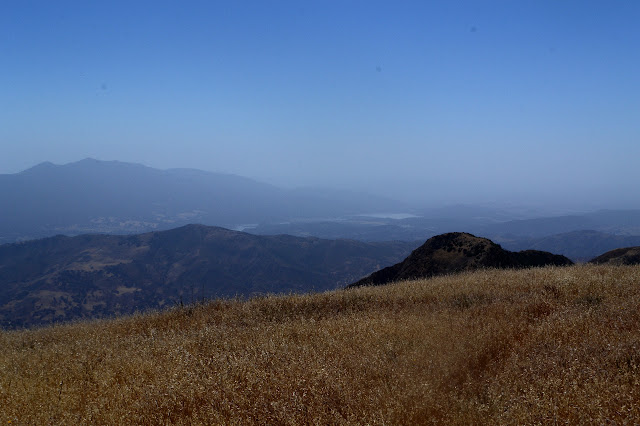
The signs to mark the closure are just blank sticks now. The trail actually looks fine across the grassy portions. The grass does not appear to have grown so tall or full of mustard this year. Further down, I can see slides. There are a lot and all of them seem to be unmarred by footprints. That is not a good sign. I expect there are plenty of people who would push it, but that does not seem to be happening here. All the road offers is pain from being a little too easy. I had a waypoint in my GPS for the saddle and on the way started checking it to see when my life would stop being in danger 0.2 miles ago. Pain sounds better. First, the peak.

The most obvious trail currently is down of Little Pine Mountain and on up Alexander Peak. I wonder why. Unusually, the switchbacks seem to be getting the most use rather than the old fuel break on the ridge line itself. The little wood sign to direct people off the steep ridge is burned, but still there. Very little traffic seems to be going up to the actual top of Little Pine Mountain. Well, there is a higher point to the northeast, but this is the one with the views and the unimproved picnic area of grass that people like to call the top. I wonder why so many are wanting to go to Alexander Peak instead.


I head back the way I came, taking the rest of the trail directly from Alexander Saddle. It might be shorter than continuing on the vanishing trail over the top. It is certainly is better used. Happy Hollow has changed. The motorcycle barrier is no longer capable of being effective. More importantly, the felled trees from when the Zaca Fire decimated the area (in the particularly bad way where about 10% is left) have been reduced with the Rey Fire. Maybe my memory exaggerates, remembering tree upon tree criss-crossing the area and making it difficult to walk around.

The sign marked "Oso 7" getting overgrown in a bush teases me. There is a much shorter way. I head down the road as it winds its way out of the hollow to the road I walked in on.

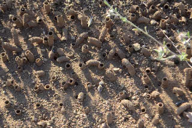
The trees at the junction seem to be the healthiest up here. My shoes are feeling like sweat bathtubs again, so I stop in the mostly shade to dry them before moving on again. The bees are still there, of course, but they have had more time since someone drove over them and now there are holes and tubules along those tracks as well. It is even more uncomfortable for me to walk across the top of it all, but it still comes with no stinging.


As I get to Hidden Potrero Camp, I do want to take a closer look at the water. Then I want to sit beside it and listen to it and let my feet dry out again. Waterproof boots really can be annoying. I should check my water. I am suspicious it is a little low. But it is cooling now and will be dark soon enough and I will not be put out by running out of water now, so I decide to forgo the weight.

Once the sun is low, the bees are a lot harder to spot. The buzzing is gone so that does not alert me. When I do find an area where they live, there seems to be fewer holes than before. Perhaps they close up at night. The long pounding does take a toll on my feet, but I seem to have managed to stop putting on so much brake when trying to just roll downhill and my muscles hurt a lot less than when I have come down this way before. Curiously, if I relax my feet, they hurt a lot less too. It is hard to do with the pain already there, but oh so rewarding.
It is getting quite dark once I reach Upper Oso and indeed have no desire to take the trail as expected. The growing moon overhead is enough to light the way when the road is smooth, but a light is useful further down when there are potholes. I cannot quite relax my feet enough to make road walking hurt less. It seems a long time to the bridge. I listen to the creek below a moment when I do. It has a lot more water visible here than it did up by the camp. Then there is the ford. It seems that there is a pool of standing water over it and this is what has closed it. It does not look very deep, so I take advantage of the waterproof boots and plunge in, then turn right back around again because it is quickly getting too deep for them. An amazing amount of mud flows off them. River crossing shoes are not really needed, but since I have them I put them on and splash in again. The cold feels quite good on my sore feet. The water seems to only come up about 8 inches. There I was thinking First Crossing only closed for 12 inches. The post used to mark the corner (this ford curves as no ford should) is floating in the water. I can see round stones scattered, but otherwise it is all brown. Out of the water, my feet are cooled so much by drying that it becomes a new and worse pain than I started with. And there is all kinds of grime locked away. I keep calling it water, but it is really a thin mud. Whatever, it is only a short way back to the car.
©2018 Valerie Norton
Posted 27 Jun 2018
Liked this? Interesting? Click the three bars at the top left for the menu to read more or subscribe!


Comments