Santa Cruz: Santa Cruz Peak
Los Padres National Forest
DAY 1 | DAY 2 | DAY 3
Click for map.
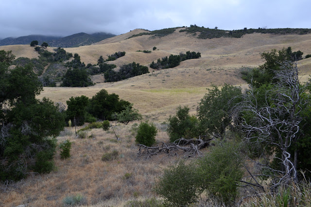
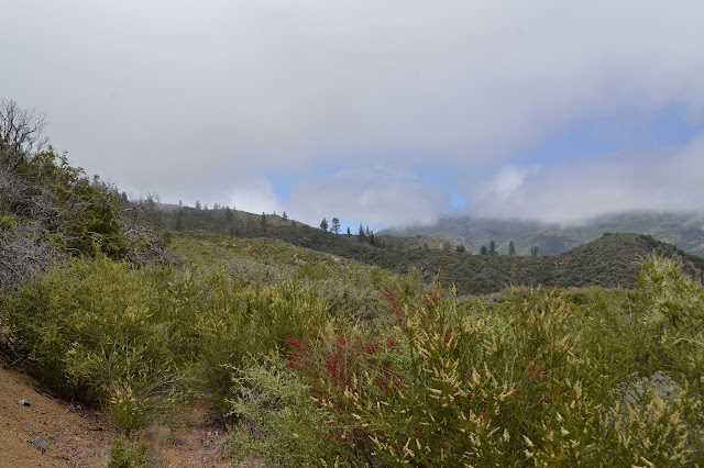
The morning is thick and grey, but I expect that will be gone by 10AM. It is higher up this today, so I can see actually the land around me. I get to see the outside of the barn now. It is a simple building and not very barn-like. Poking around the rest of the camp areas is nice, but it sets off one volunteer's dog. I like a spot a couple down from the station where a big oak has fallen and now it is nice and open over the table and camping area. Even next to nice big creeks like this one, I am starting to get wary about large oak limbs. I weigh down my camp gear so it stays where I put it and pack up and take off as the others start to fix breakfast, joining the mowed trail by the register and starting to climb along a tributary out to those meadows I saw in the gathering gloom yesterday. On the other side of the canyon, I pick out the trail going the other way, climbing in easy switchbacks below the steeper road.

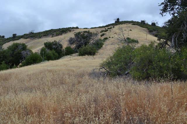
There is a small tree across the trail. What are these volunteers out here for? (Digging the new latrine hole.) Further along, the trail skirts around some narrow gullies that get quite deep just below it, but the trail is holding. Past that, it all becomes meadow. The trail here has had enough travel to distinguish itself from animal trails, at least generally. The most obvious trail eventually puts me next to a trail sign and a metal wilderness sign at the south end of the "fire trail".

The signs indicate nothing about the direction I want to go. By them, this is just a wilderness entry that happens to also point out destinations in either direction. My trail is not particularly apparent except for a track of pressed grass leading off directly up the hill to reach the ridge line above. It is not a very pronounced ridge line. I follow it and just before the top, it swings to the left where the shape of an old bulldozer track is just visible in the slope. At the top, I quickly lose the trail among the brush. A little experimentation shows there is something a little more like a trail a few feet to my left where things are easier to push through. I was hoping thinking I might find something a little more clear. I thought I saw a fresh line of dirt up on Santa Cruz Peak from the north but whatever cut it had not come from the north. It clearly did not come from the south either. I do not even know how it would connect with the scraped road on this side. The brush releases me onto grass again and I can easily follow the trail until it runs into some more brush. I push through along what looks like it could be trail, find a stopping point, adjust to the side, and push through again. Rinse and repeat and repeat and repeat.

Tracks go over the top of a grassy hill, but I stick to the track. Some of the brush in the part the tracks skipped is particularly difficult to push past. I guess that is why it was skipped.

There is a large path coming down the next grassy hill, too. I do not like it, I could see from further away how the brush sits between trail and grass at the top. Still, as I hit the brush following the old bulldozer track, it looks like it again has little path through. Another trail takes a diagonal up. Whatever, I go for it. At the top, there seems to be nothing to get me through the brush to the top, only trails around the edge. I try them and skirt around the edge where things are light, but am pushed higher by gullies. It is an awful way to travel. As things get toward a shallow saddle, the brush looks like a wall at first but seems easy enough to push through and even usually comes below my chin. So I push. There were a lot more trees here before whichever fire, maybe Zaca, and I have to climb over a couple, but I just push and hope I will recognize the trail for what it is when I hit it. It is an obvious track along a wide dip, so that works out well. It is also ever so much easier to travel along.

Although the sun comes out a bit, the clouds seem to conspire to keep me mostly in the shade. It is quite nice of them. The track splits and one side goes up a very steep hill while the other cuts around the side for a switchback. I go for the switchback, but there have clearly not been quite so many people pushing through that way. I have to roam a little more than usual to find a path. Once around the bend and back up at the top, I am still suspicious that it was the easier way. That hill is steep.

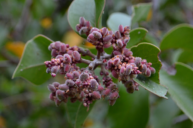
Ahead, things are about to get unpleasant in a new way. The ceanothus (maybe, this particularly sort does not seem to be thorny) up ahead is just as covered with berries as they were once full of flowers. Each of these berries is covered in a thick layer of slime. These berries line the little slot I am trying to hike through much more tightly than I am wide. I do not actually know about the slime at first, but it quickly becomes apparent. A bumblebee alights on one and rub the stuff all over its furry head and I watch in horror. What could it want to do that for? The berries break off easily, and I try whacking at the slot with my sticks before I get there like I did with the snow not too long ago. It is far less effective here. I just have to take it. Most of me is covered, and it dries in off-white splotches all over my clothing, but my exposed fingers have a thick, uncomfortable layer.

And if that is not enough, the camera suddenly starts showing me generally dark images as the result of clicking the shutter. Bringing up the exposure compensation seems to help. Add to that, the clearing of cloud cover never seems to include the peak and seems to be coming back in now anyway.

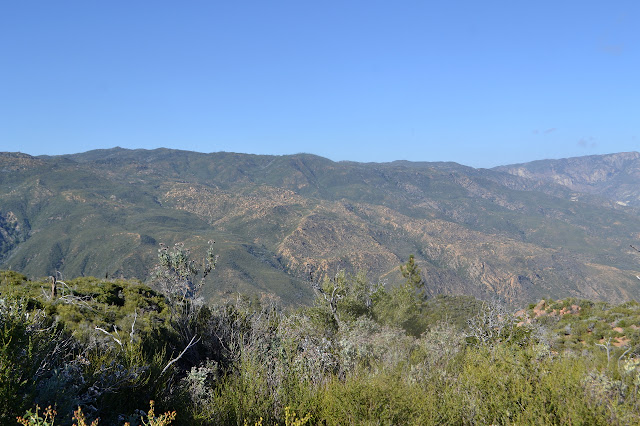
Trees up ahead make me excited for the change of vegetation. They were more numerous before Zaca came through, too, and now quite a few have fallen across the top of the ridge where the fire trail. That means plenty of trying to get over, around, under the fallen. I find myself pointed at what I am sure is the wrong ridge and finding it hard to find the old track. A little looking around finds a very clear track down the hill a short way to my left. I missed a corner somewhere. I just keep on working my way along. All the time, I have just enough view out to the west of stuff I have not seen yet to tease me into wanting more.

The track curves around to the north side of the mountain and as it does that, the vegetation just gets thicker and thicker. I find myself doing a ceanothus push on faith. I stick out my foot and if I do not kick a trunk, I launch myself through to the next step. I twist and turn by instinct, physically feeling for the soft spots where others have been pushing through and breaking off the branches in little ways to make it easier. Somehow it works. It feels a little like magic. Then a crawl under a tree (where someone lost a pair of clippers) and suddenly I am under some oaks with clear road, except where two oaks have fallen. It cannot last long, but it is nice while it does. It lasts long enough. Very shortly after the oaks, a fuel break starts to climb. At this point, it is time to climb.

So I climb. There are footprints and a bit of a trail, although not in the same place. Toward the top, the track in my GPS takes a sudden turn. There is a cairn to mark it and past a bush, another fuel break traveling to the side. This descends quite a ways to a saddle before climbing again. No one follows the break much past the saddle. Instead they start up through a trail cut through scrub oak. It is steep and it has a few options. It breaks out into rocks and then I find myself doing a little loop and not finding the way out. I push at the most promising thing, and it is hard, but eventually works to put me one stout bush away from obvious trail. I am not the first one and there is a way. I add some breaks to help increase the way, then try to scramble a little closer to trail. It is mostly obvious. There is constantly one more peak a little higher behind the one I have just climbed. On and on until there is a little red can. I look a little further and indeed it starts to drop off after. The brush at the top is all up around my ears, so there is no view anyway. I think.

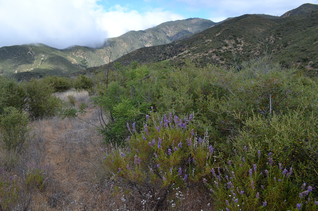
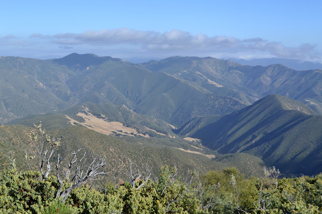
The last person up was the guy I met on San Rafael Mountain the same day while he was hiking and biking the two with McKinley Peak in a single day. It is later than I had hoped I would get to the top but somehow I find a reason to dally just a bit even without views. I do hope it will clear. It does not bother. However, once I start down and have got a little way, it does start to clear. The peak may not have views, but the trail along the ridge to it sure does.


Back on the main trail, the route up to the mountain is much more obvious than the continuation on the fire trail. There just happens to be a line of bushes that direct someone upward. I wonder how many they have set astray. I enjoy the level, open trail (except for the two falls) beyond them under the oaks, then grab the clippers while crawling under the end and into the blind faith bushwhack. I really do not have enough time to use them, but their owners will probably not bother to come back for them and if I leave them on the sheltered porch of the station, they are far more likely to get put to some use before they are ruined by the elements. Besides, from this side, I can actually see where the track goes through the ceanothus.

Down is completely different from up and I manage to lose the track in new places for it. Now, at least, I can check the GPS to move me back to where I should be. My feet have been feeling the effects of being stuffed into big, waterproof boots, which is to say they are in sweat bathtubs and feeling soggy. I had meant to dry them out at the top, but got distracted with the register. Now I have the sun, I go ahead and let them air out.

My feet dry out quickly, so I stuff them back in and tie the boots up. I have to tie the boots several times afterward as well because the brush keeps pulling out all the knots for me. I lose trail wandering around a tree and then staying too far to the ridge. That just is not always where the track is. Then ever downward.
I like how this track goes around the bumps rather than right over them and has switchbacks a few times. Still, I skip the switchback when I come to it. It is actually hard to see going off to the left, but I catch where it should be. I do not want to be slowed down by all the brush since it is getting late. Instead, I am slowed down by the slope, which sometimes threatens to throw me down. It is more open. From there, the ridge flattens out. I keep catching myself not looking for the little dip that I was automatically looking for on the way up. Result, more lost trail. For the most part, it is not bad, even once I am past where I joined the trail on the way up. There are a lot of ways one can go just sort of sticking to the top. The brush is over my head as I get close to the corner in my GPS track that should see me rejoining the trail, but I seem to be getting further from it. I work back toward the west, sometimes having to go upward, and come out with a little grass between me and the track. I had been starting down a different ridge ever so slightly. I get up to the track just two feet higher than where I left it. It is enough to see how the trail of sorts takes a sharp corner around a bush as it enters, then is strong and easy as it continues. I really messed up when I did not try that and followed the tracks in the grass instead.

The rest of getting back is easy. I stick to the track by the next hill, then keep on going as is somewhat familiar from the morning. I am back to the junction shortly before sunset. I thought I would have some time today to play with the watercolor book, but I guess not. Just enough time to rush down the trail. Rush, I do, but the root ball sticking out toward me of the burned log across the trail is ever so tempting. I reach out and grab it and it moves until the tree is along the outside. Excellent! Trail cleared and it only took an investment of 10 seconds of my dying light. I get back to the station with a little light left, so I must have had the few seconds to spend. I finished off my water shortly before finishing the trail, so I suppose I should be very grateful for the clouds. Without them, I would not have had enough.
The camp is empty now. I drop off the clippers and try the station door, but this one is kept locked. Oh well. I grab my stuff and move it down, but not all the way to the spot I checked out in the morning, just to the station area. There are some clear spots there too. There are no dried beans to go with my Knorr side. That is a nuisance, but it does explain why I could not remember which sort. A mixed end to a mixed day. On balance, a rather good one.
Next day ⇒
©2018 Valerie Norton
Posted 25 Jun 2018
Liked this? Interesting? Click the three bars at the top left for the menu to read more or subscribe!


Comments
Found a tick the next day that was undoubtedly from this day. I saw a few during the day, but much less than I have been seeing. The ones out now match my tan trousers well and the molting from white berry juices and black burned sticks didn't help in spotting them.
I was suspicious my previous plan for the peak, coming up from Kellogg Camp (which would have been a bigger push than usual to get to the day before, but went awry) and battling the brush up to the peak, then having to continue battling for almost as long up to the top would have been a very late day. There is more travel above there, so it might not be so bad. The vegetation changes with the climb, so the difficulty above is not entirely predictable based on the difficulty below. Going the other direction does not seem so bad, but going up is pushing against both gravity and brush for quite a bit of extra effort.