Posts

Showing posts from July, 2018

Upper Sisquoc trail work

Image
Los Padres National Forest Click for map. I signed up for a little more trail work, this time along the trail I bailed along when it got just a bit cold and snowed on me . At the time, I hopped over, around, and even under quite a few trees in just a few miles. Since then, there have been a lot of work to clear them all out. They said 300 trees have been cleared. Surely it was not quite so much? Then again, maybe it was. Another 20 remain and that is what we are out for today along with plenty of brushing and a little tread work. (It isn't that I have any influence. I'm just lucky to have hit the trail shortly before the work was done.) We drove the 20 miles behind the locked gate up to Bluff Camp for the night yesterday afternoon, so had a few miles drive still to get to the trailhead at Alamar Saddle. Safety talk and tool grabbing is quick with a group that mostly has been around and done this sort of thing. So we head down with a plan to make the trail nice from Upp...
Garnet Peak

Image
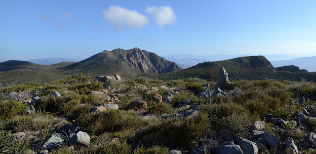
Cleveland National Forest Click for map. Garnet Peak, not to be confused with Garnet Mountain, is sandwiched between the two hikes yesterday and is the rather peak looking thing in the near distance of both of them. It is the last of the Hundred Peaks Section listed peaks for this trip and has its own trail up, but approaching via the Pacific Crest Trail gives me a few PeakBagger bumps to grab on the way. Also, I suspect Penny Pines, a place where water is available, to be easier to find. It does have a sign, but it is far enough off the road to miss in the dark. The paved pullout is just south of a big orange snow gate and cattle guard, so that can provide a landmark to find it, too. There is no indication of where the water is, but two trails head off marked as PCT. I grab the north one since I want to head north from here. It is just the longer route to actually join the PCT on the other side of a low hill. The long way from Penny Pines to the PCT passes the donor and...

Garnet Mountain

Image
Anza-Borrego Desert State Park Cleveland National Forest Click for map. With a few hours of light left in the day, I have plenty of time for the short hike up Garnet Mountain. It is easily accessed from a sliver of land between Cleveland National Forest and Anza-Borrego Desert State Park. There are a couple folks enjoying the view at the end of the road as I start and one more coming up the old road bed that hosts the Pacific Crest Trail looking like he is chugging through a chunk of it. He is quite a picture in plastic slip on sandals, hauling an army duffel with pack straps, and cradling a gallon of water in his arms. He adds to it all a greeting of, "Beautiful country, isn't it?" with so much glee underneath it that there is no mistaking that he is really enjoying being on this trail. But it is, so there you go. I follow behind him a short way. Entering Anza-Borrego Desert State Park with Garnet Mountain above. The shape of old greyback, that is San...

Monument Peak

Image
Cleveland National Forest Click for map. After being in San Diego for unrelated nefarious reasons that only slightly involved being a bit of a jungle gym for an enthusiastic child aged 1 year and 2 days, I headed out to the Laguna Mountain Recreation area to go after three peaks listed on the Hundred Peaks Section peak list , each very near a segment of the Pacific Crest Trail. My first target is Monument Peak. It has a few named peaks nearby and someone has marked a few of the minor bumps that just happen to have a poorly surveyed elevation on PeakBagger. Except for Stephenson Peak, they are all near to the trail and look easy enough to get to. Signage on the road is lacking, but my first guess at the right bit of parking contains interpretive signs referring to Storm Canyon, a boardwalk overlook, and steps down to connect to a well established (but unmarked) trail winding its way through the area. This is probably the right spot. I doubt the boardwalk helps to get a bette...