Angeles National Forest
This is the second and last part. For the first part,
go here.
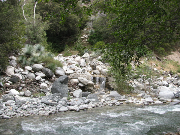
 |
| More little bits of stream along the way. |
 |
| Just before a final narrowing, a cactus could be found on the slopes. There was also evidence of a trail leading up the side here which I decided against trying. |
  |
| Something aluminum in the stream bed, so likely newer than most the artifacts somewhere above. |
 |
| Another bit of stream, this one with an old pipe sticking out from under some rocks it has managed to get wedged into. |
The canyon got even smaller than before so there was little more than the width of the stream.
 |
| A spot where the canyon is only a few feet wide. |
Everything seemed to be getting louder while approaching the narrow space. Turning the corner showed the goal of the current quest, the first waterfall (or last depending on your point of view) in Allison Gulch.
 |
| The first glance at the falls. With the trees and rocks, I can't step back far enough to get the whole thing into view at once. |
 |
| The pool at the bottom of the falls is quite small and very round. The rock at the bottom is much more shaped than the rock above. |
 |
| The channel is very smooth at the top of the falls, much like it has been sliced. |
 |
| This is about as best I could get a picture of the falls. |
 |
| Not all of the water went over the main falls. Some came seeping down the walls to nourish plants. |
 |
| Enough water to be dripping came down a rocky section by where I sat to eat some more and sketch. This nourished mosses. |
I carefully picked my way back down the stream. The sections that were hard were much less so. The section I had missed did prove to be difficult and I even crossed the stream a few times, but it was much better than the uphill downhill I had done. It lost elevation quickly in that section. My knees started mentioning their presence as I went.
 |
| Presumably, this is the hillside that once had a trail leading up to the old gold mine. This is one of two trails to the place. |
 |
| More detritus in the form of a shovel head. That would not have been useful for digging into the rock, but would be used by today's prospectors who are panning the riverbed. |
 |
| This rail was much smaller than those used on your common rail road track. This is definitely debris from the mine. |
 |
| This is about the only time that a view can be had along the way once inside the gulch. |
 |
| A larger piece of unknown debris. It seems to be some sort of drum on an axle, but really not sure what to identify it as. |
 |
| This yucca at the head of the gulch had a shell of cucumber vine all around it, the spiny fruit hanging down among the leaves. |
Emerging from the gulch again, it was time to cross the river some more on the larger trail to the "bridge to nowhere". As I walked up the trail to an easy climb down spot, I saw a 3 mile marker. The cold water was welcome to my knee and it actually didn't hurt at all the rest of the way down after than dunking. the rest of me wasn't so happy with it.
 |
| The stream from Allison Gulch adding its small water to the torrent that is the West Fork of the San Gabriel River. |
 |
| I guess it sort of, kind of, maybe, might look like a swan to someone. This is from below the 3rd river crossing where trees don't obscure the extrusions in the rock. |
 |
| Here is a better view of that bridge with a few logs tied to reinforce the weak tops of the trees that could be said to be a bridge. Managed not to further wet my boots on this second crossing. |
The last hour or so, the wet feet started to be too much. The area was getting to be all shadow due to lowering sun. My feet were cold and trying to drag the rest of my body with them. That first crossing was better for me this time. A couple guys in toed shoes with their dogs were crossing when I got there. The dogs were not happy to cross, especially since they were having to swim the swift current a bit. They seemed to agree that it had gotten too cold to be dunking any part of ourselves into the river water. Everybody seemed to get back in one piece, though. The search and rescue team had packed up and gone home, so there was no one to pick us up if we started floating down the river by then.
The write-ups for the "bridge to nowhere" route talk about rock hopping and one says he asked regular goers about the river height through the seasons and found it didn't vary much. These went through at the end of summer. Perhaps they just asked the wrong people, but given that there isn't the remotest chance of rock hopping this river in May as there are no rocks not under many inches of water, the river does vary quite a bit between the beginning and end of summer.
©2011 Valerie Norton
Posted 23 May 2011


Comments