Jennie Lakes: Shell Mountain and Jennie Lake
Sequoia National Forest
Giant Sequoia National Monument
Click for map.
DAY 1 | DAY 2 | DAY 3 | DAY 4
The Forest Service does not charge anyone to enter the Giant Sequoia National Monument, but we cannot get to Jennie Lakes without passing an entrance station for one of the National Parks and they want some money. Martha just flashed her pass which not only got us in free, it allowed us to use the shorter, faster line past the entrance station on this crazy holiday weekend. After finding a far parking space to wait in line to chat with a Park Ranger in Grant Grove Village, we are still an hour later than we wanted to be at the trailhead. Permits to hike in Jennie Lakes Wilderness are self issue at the trailhead and that is enough to camp within the Monument and take day excursions into the two Parks, but camping in the Parks requires a different permit subject to quotas and fees. The only space left in the lot is the overflow parking and the box for signed permits is stuffed past capacity. The permits are surprisingly far down the trail, just after a big new bridge reeking of creosote, and there are still a few left for the next few folks along. The trail is abuzz with people, most of them day hikers. Somehow, they thin out a bit as we make our way up the trail.

The trail climbs slowly through sand and rock. Through the trees, we can spot huge slabs of granite in a vaguely domed form spotted with more trees. In the far and misty distance are snow capped points of tall peaks. Nearer at hand are a few explosions of color in all the more open spaces.


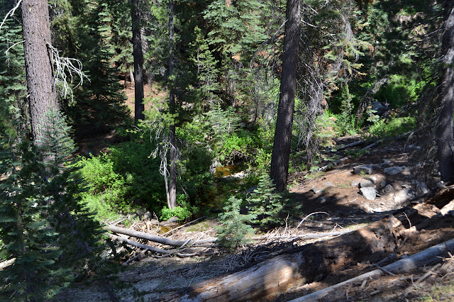
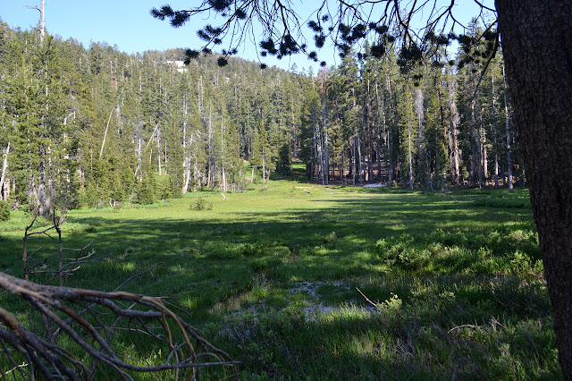
We walk past a few more little creeks and the odd bee hive in the long crack of a tree beside the trail. The trees thicken again and the trail splits just before we get to the wilderness proper. Being already afternoon, it is tempting to flip the trip around and go for the closer Weaver Lake, but Jennie is supposed to have more sites and that may matter with this weekend. Water pours out of the ground in a couple spots along the trail as we get to Poison Meadow, but the map does mark a few springs along here. The meadow is lush with some thick patches of shooting stars. Just past it is the first tent along the trail, taking in the murky view off to the southwest.


We wrap further around and up toward Poop Out Pass. It seems pretty early in the hike to be doing any such thing and I am not sure what this might be a bail out option for, but that is what it is called. As we go, we get a few more snowy peaks as part of the distant view.


The trail comes up from Stony Creek Campground to join ours a little before the pass. As we are nearing the top, I stop because I want to head up to the top of Shell Mountain. It looks like an easy walk from here on the map. Martha is uninterested, but happy to hang out with the trees and the few birds and a few of the heavier items out of my pack. I start up.


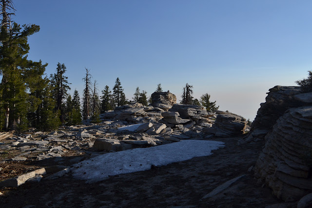
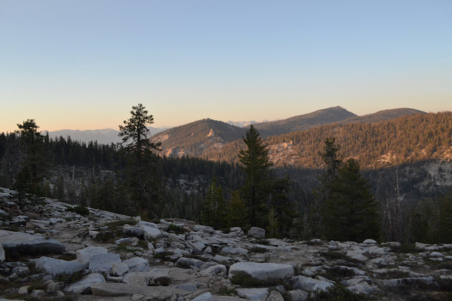
It is as much of a walk up as it looks. Most of it is not even steep. There is a bit of snow in the wide crack between the lower and higher peaks, but it is just small islands melting into a creek we crossed on the trail below. The very top has a distinct summit block, but this too can be walked up. There are a lot more directions to look up here. Unfortunately, the quality of the air has not improved any in the short time from looking below to climbing.


While at the top, there is a register, geocache, and letterbox all secreted about the place to sign. Heading back down does not take very long, but the whole excursion took a little longer than expected. The pack feels heavy again as we climb the last few feet up the pass and start down the other side to find the lake.

Some day hikers are just returning as we head down. The sun has set and darkness is closing in as we get to the lake. Beside the trail to Jennie Lake, there is a map of the official sites along with the rules about not camping too close to the water and burying human waste. It is a little difficult to find a spot and impossible to tell if the one found is official or not. Someone has built a fire ring there, but the person did not sign their work. Not needing a site suitable for a tent does make it a little easier and 2.5 inches of pad mean there are a lot of lump I would never notice. There must be at least a dozen campfires burning about the place. It is crowded nearly as bad as I remember Trail Camp getting, except that with all the trees we can only see our nearest neighbors. Besides one dog that keeps giving out a shout and one party that camped as far down the west side of the lake as they could get, the place is pretty quiet. We settle in under the big moon for a bit of supper, or at least I do. Martha insists she is not particularly hungry.
Continue on to the next day ⇒
©2017 Valerie Norton
Posted 8 July 2017
Liked this? Interesting? Click the three bars at the top left for the menu to read more or subscribe!


Comments