Jennie Lakes: Twin Lakes and Ranger Lake
Sequoia National Forest
Giant Sequoia National Monument
Sequoia National Park
Kings Canyon National Park
Click for map.
DAY 1 | DAY 2 | DAY 3 | DAY 4
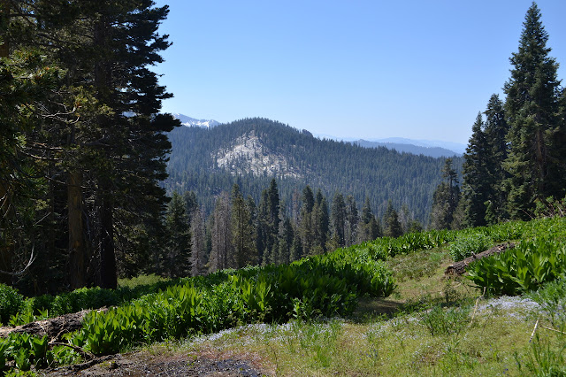
The night was almost too mild and a few of the mosquitoes stuck around through it. Also, I am way overpacked for such mild nights. It is what the National Weather Service predicted and what the history of a fairly local weather station confirmed, but how could I believe that in the face of knowing there is still snow on the ground? It sits in great lumps all around me. The morning brings wakeful campers, but not a lot of noise except for the one excitable dog. People seem to gather themselves up at a leisurely pace and wander away again, mostly turning back down the trail. It is the same with us, except that we are continuing out further.

A few clearly do not yet want to get up. Far on the east side, I can see a hammock that is clearly still occupied, but that is the side to be on for the latest morning. A slab of ice slips from one of the rocks as we leave and it sounds just like rockfall as it goes. The crossing of the outlet at the trail looked rather soggy last night, so we head over at the first good crossing we see, grabbing a little water for the day on the way. We were warned of snow on the trail above here, but that is not what makes it hard to find the trail on the other side. After the huge trail all the way up to the lake, I am not quite looking for the more normal faint track it has become and pass right over it the first time. A little better looking near a cairn shows the trail climbing through the woods on another meeting.


The snow on the trail does make it a little harder to find along the way, but old blazes and consulting the map a little help keep us there. We hit a saddle marked with a NPS Boundary sign leading to a brief belief we already at JO Pass, but the map suggest climbing along the ridge a little first. That explains there being no trail down the other side or sign for the junction. Turning upwards instead, the trail is not hard to find again. The pass comes soon enough and although it does not have a sign, the sign post is there and a wilderness sign is just south of it with a small park sign facing it.

We head down the warm south side. The snow is gone, but there are a few trees across the trail to try to send us in the wrong direction. It is a bit disturbing how many of the trees we have had to jump over have green on them. Not camping by dead trees is straightforward enough, but how do you know which green tree is dangerous? Still, the map indicates the trail stays more to the ridge than the creek and that clue is enough to keep the trail under our feet.

The creek beside us has grown a bit as we get lower, so I look for a flat spot to cut across between the trail dropping down from JO Pass and the trail climbing to Twin Lakes. If we follow the trail, we will have to cross this creek after it has just joined up with another at least as big, then cross back over the unknown creek, so I would rather find a way across this. The 120 feet of climb it saves looks nice too.

With a little looking, there is a dry feet crossing on some rocks. The cross country is not simple. Fallen trees and gooseberries attempt to stop our progress. It feels a bit longer than the tiny stretch that it is and then there is a very distinct trail climbing up the canyon. Avoiding the bigger crossing is complete. We start the climb up to Twin Lakes.
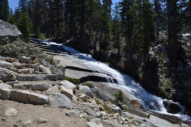
The trail climbs a while and then there is a great sound of rushing water. Around a corner is a great cascade. The builders seem to have chosen the route to give a good view of the cascade before heading back to dryer places. There are a couple more close passes to the creek, but not so close when there is not so much to see.

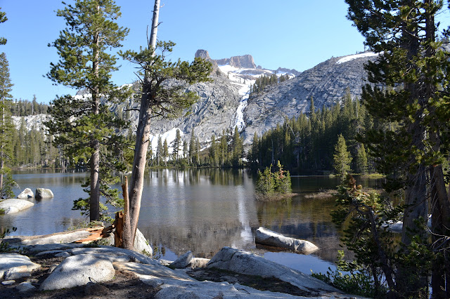
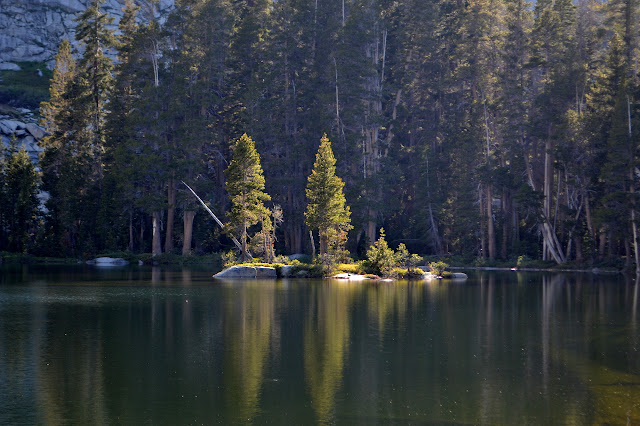
Twin Lakes are a beautiful little spot, especially the large lake. Besides one day hiker sneaking past, we see no one, not even the ranger we were told was up here. It also has a map of official campsites as we enter the area, but it also shows bear boxes and a toilet. Luxury in the park!


Finding the trail out of the camp area is not so simple, but we just move up the hill until something looks promising. Once climbing, it is easy to follow. The trail winds upward in short switchbacks that keep on crossing the creek. One swings right into the creek just to turn around right in the middle of the flow and climb out the other way. One last crossing is just too much and I head upwards cross country saying it will just come back again. It does.


The top of Silliman Pass is quite a wonderful spot. The little Twin Peaks, just a short way away and undoubtedly class 3 or better, are tempting. They look easy enough, but I am interested in making a few more miles. There is a silliness to them since they are right next to a higher, unnamed peak. On the other side is Mount Silliman itself. I actually looked into climbing it, but the class 5 from this side is way too much for me.

We head down. There is more snow on this side, once we get down a little way. Footprints across one snowed over meadow almost get me off trail, but there just are not enough other clues around. I wonder how many trail clues I look for unconsciously. I saw no blazes along the trail up the pass, but as I get back to the trail there is a triangle marked on a nearby tree. The corners have grown in and started to hide the shape, but I can see the cuts in the wood at the center of the sides. Someone cut this triangle. I have never seen a triangle blaze, only read about them in the various reaches for benchmarks. My first instinct is to pull out the map and see if there should be something nearby to look for. There is nothing. A little way down the trail is another triangle. They are all triangles along this bit of the trail. And they are very nice for confirming the route.

The trail turns to creek a bit, but it does not seem quite so purposeful as on the other side and the blazes really help direct me until one last one that just seems to have no trail near it at all. Turning to my right, there is a very built up and dry bit of trail heading out into the rocks away from the creek. A lot of work has gone into this bit of trail as it leaves the blazes behind. I wonder where they are going. The rocky trail is easy to follow and after establishing its character, suddenly swings out wide. Again, it is like the trail builder had an idea of one spot that the trail simply must pass by for the view.


The trail continues down in its well built manner to the lakes below. The trail to Beville Lake looks little used, but has some current footprints on it. There are some moist areas on the way in, but keeping the feet dry is not too hard. I head for some rocks beside it for a vantage point. It is quite nice, but the mosquitoes are annoying.
We climb down off the rocks again after a snack and continue on the short distance to Ranger Lake. Ranger Lake has more official sites and a couple bear boxes mapped out at the entrance. Martha asks if we are stopping here and is very determined that we should be, perhaps, stopping here. Not a couple miles further along. So we are. The mosquitoes seem maybe a little better and our only neighbors are a couple guys halfway along the side of the lake. We do, however, seem to be finishing the day short one water filter.

Continue to the next day ⇒
©2017 Valerie Norton
Posted 9 July 2017
Liked this? Interesting? Click the three bars at the top left for the menu to read more or subscribe!


Comments