Lockwood Peak
Los Padres National Forest
Click for map.
I realized that those peak baggers in the Hundred Peaks Section would be about as much in the neighborhood as they get as they headed for Lockwood Valley to bag Lockwood Peak. Honestly, it looks like an inconsequential bump to me. It is only on my radar because it is on the list, but I am perfectly capable of finding my own inconsequential bumps to climb. It is near a second listed inconsequential bump that should be on my radar because it is the basis for the name of the map quadrangle it occupies. The best guess for the weather seemed to be low or mid 80s, which is hot, but not quite too hot. The hike is short enough to deal with that. I decided to do it and the short hike up San Guillermo Mountain and sent an email off to the head leader, Bill Simpson, with somewhat less than my usual one week lead time. I got in and found out they would be doing an even shorter route that is more convenient to going up the second peak. We met at the end of Grade Valley Road and traveled just past the end of the pavement to the Pianobox Loop, then off the end to Yellow Jacket Trail.

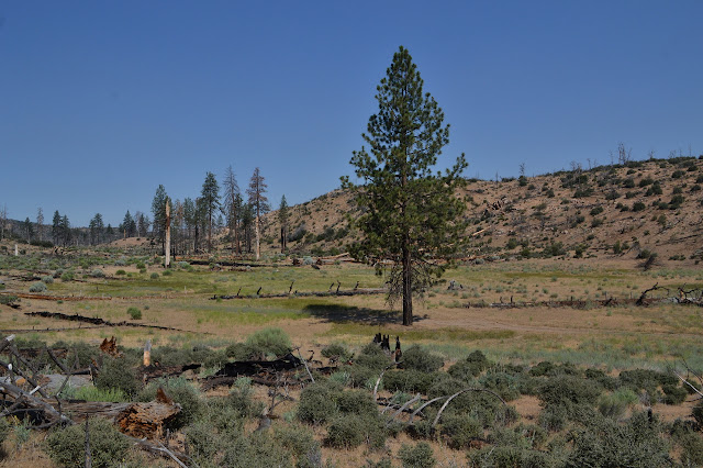
We find ourselves facing off against an intermediate level motorcycle trail. The day is a bit into getting started and not particularly warm yet, but we all make sure there is plenty of water in our packs. The shade around here is not what it was before the Day Fire in 2006. It is starting to look like most of the standing dead trees have now fallen. We head down along the variously sandy or rocky track among the dried grasses. There are still a few bright flowers in the mix and only half of them are various types of buckwheat.


We follow the trail over short and easy ups and downs for about two miles before coming to a spot somewhat below a gully coming off the mountain to the southeast of us. Somewhere up that mass is our peak.
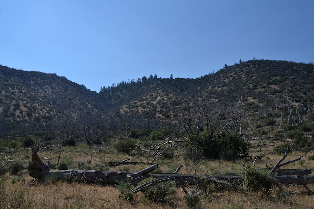
There is a cairn and a faint trail near it. We follow this up a little bit excessively. After all, the trees have not been removed from this cross country route so we have to allow for going over or around them instead of where the old trail might lead. These hillsides seem to have had a particularly hard time in the fire, but we do manage to find a tree or two to offer shade along the way.
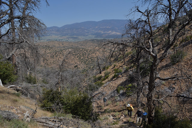
At the top of the gully, we make a left and begin climbing toward where there is no more to climb.


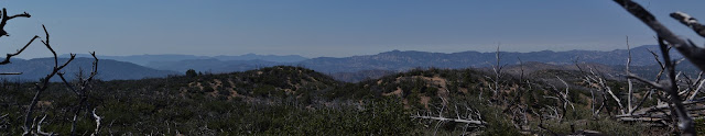
We take some time for snacks and the views. That second bit is a little hampered by smoke. Today's fire is the Whittier Fire, which seems to be burning the bits that the Sherpa Fire last year saw fit to fizzle out and leave. We try to pick out the lookout on on Thorn Point, but nothing looks quite right. Further out, the coastal range is a grey shape in the smoke.


There is a demand for a group picture from someone prepared enough to have his hiking stick turned into a free standing monopod so that everyone can be in it, so we collect up for that. The newsletter needs to be fed, after all. Then we collect up ourselves and head down. As usual, it is steeper on the way down. How does it do that? The effect seems particularly strong today. Still, we hit the easier slopes of the motorcycle trail without even the worry of an incident and then head back to the cars.

©2017 Valerie Norton
Posted 15 July 2017
Liked this? Interesting? Click the three bars at the top left for the menu to read more or subscribe!


Comments