North to South: Lake Sabrina, North Lake, Loch Leven, Piute Lake, Piute Pass, Muriel Lake
Inyo National Forest
Sierra National Forest
Click for map.
DAY 1 | DAY 2 | DAY 3 | DAY 4 | DAY 5 | DAY 6 | DAY 7
A poor sleep, nothing to do with the moment and everything to do with being in a cycle of poor sleep, showed that all my little roof blocked was the very bright moon as it crossed the sky and then the view of the stars. A few clouds played, but mostly it was clear. Home seems to like to cloud up and rain at night, but these mountains like a good afternoon clamber with clearing at night. Still, the late evening activity hinted that there might be a little more to the current weather than just what the mountains generate. Morning is clear and George is shaded by the mountains with plenty of fish jumping.

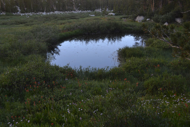
The trail along the side of the lake has a tree, still green, fallen across where it is difficult to get past, but from here the map considers this maintained trail again. Below the lake, there are lush meadows full of wildflowers in at many distinct colors. After a boulder filled creek crossing, it descends gently through trees. After a second crossing on a bridge, it gets a little steeper before dropping over the side and really getting into losing elevation quickly.

The path drops down onto a much better used trail next to a leaning wooden sign set in rocks. I quickly figure out what it is most used for. As I head out, there is a group of backpackers and a group on stock headed up to Blue Lake. There are a few day hikers starting out the day, too.

Past the wilderness sign and the dam and the spillway, the trail drops to the trailhead on this side. This route does have the disadvantage of a bit of road walking. It would probably be pretty easy to hitchhike, but that is not my style. The area around the trail is entirely reserved for day use. Backpackers must park all the way down at the end of the highway where the road turns off for North Lake, so that bit is not even extra road hiking compared to what backpackers using this trail usually have to do. Much of the route up to North Lake is extra. The thin, winding road is generally paved as it winds upwards and back toward the lake.


Just past the lake is the backpacker parking, but the trail is through the campground. People are paying $24 a night for a crowded little spot with no trash service. The trail is signed at the end and passes by two empty campsites that are walk ins before getting going quickly into wilderness again.

The trail comes to a ford, but a side trail goes off to a bridge of a couple thin trees. Little meadows are full of the showy flowers. There are tall stems of large larkspur and the comparatively tiny, but still quite large relatives of the Humboldt lily. Bog orchids and sierra onions take their places too.


The thick trees and meadows do not last long. The trail climbs upward steadily while North Fork Bishop Creek takes some impressive cascades downward to the side.

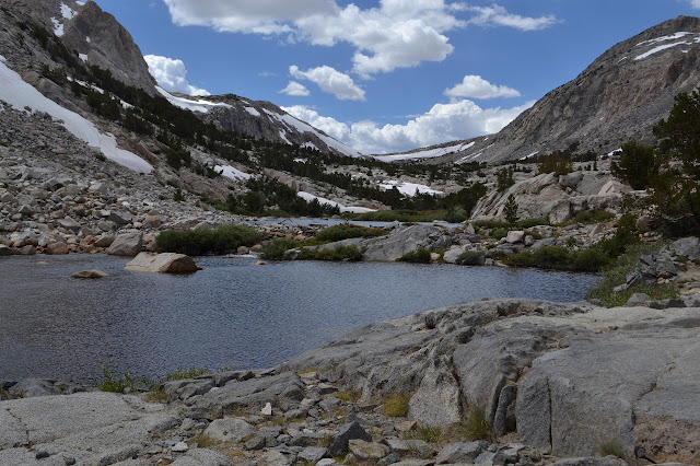
The trail settles into a series of climbs to a bench above, then flat along the side of the lake. Sometimes it is barely above the water. As the it gets into some rocks, there is often a smaller trail meandering off to the side and back again as people get lost. It keeps giving me an intense sense of deja vu, but I doubt it is from my 2004 trip through here. I finally tease it out to McGee Creek, which is not too far north of here and was worse for these little lost trails.

There is a long winded sign nailed to a tree way off trail and I just have to investigate. It is just an old snow survey system. Above the sign is a cable that once stretched between trees but has now come down. Not so interesting after all. I take the stop to do a little experiment with Jello pudding. It is a common enough thing for others, but I have not tried it. The instructions want whisking and refrigeration, I have a cup with a lid and a cool stream. A cup worth of chocolate pudding and a cup worth of dry whole milk, and in this case a teaspoon of cinnamon, added to a cup or so of water and shaken vigorously for "2 minutes", or until it feels a lot thicker and I am tired of shaking, then in the stream to chill does seem to make pudding at least as well as at home. Maybe halve the cinnamon for next time. Or go for chili.


There is a surprise over the next bench. On the far side of Piute Lake is a cabin. The outflow is a bit daunting to cross, so I leave it uninvestigated. It is probably also to do with snow surveys.


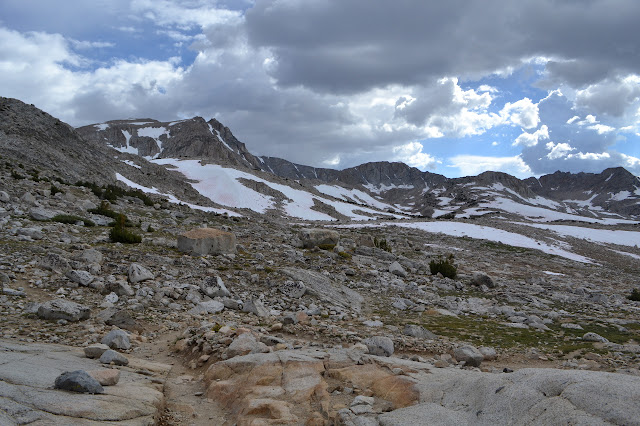
I have been looking up at a brown line that crosses the snow to get to the pass and worrying that that may be the trail. It is. Surprisingly, there are actually two trails. The brown line was created by stock as they crossed this, but the more used trail is lower and gets out of the snow sooner.

Somewhere very near the top of the pass is a faint, unmarked trail that is supposed to take me to my final destination for the day in a fairly flat mile. It takes a little faith to believe it, but there is a trail.

The trail heads off into small bogs, for that soggy foot feel. It passes a small lake still with a little snow and ice in it. It gets lost in a snow field, where I go completely wrong before just turning toward the lake and making my own route. It does drift up and down a little, but that is expected even of "flat" trails in good, shapely country like this. Around the long way, there is the trail again, near some mildly sheltering trees that look attractive for camping as the weather is looking rather unsettled again.
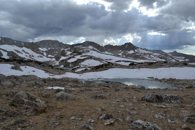

The unsettled sky only rumbles a couple times in the far distance, but it does make an astonishing sunset.


Continue reading day 3 ⇒
©2017 Valerie Norton
Posted 12 August 2017
Liked this? Interesting? Click the three bars at the top left for the menu to read more or subscribe!


Comments