North to South: Tyee Lakes, Table Mountain, George Lake
Inyo National Forest
Click for map.
DAY 1 | DAY 2 | DAY 3 | DAY 4 | DAY 5 | DAY 6 | DAY 7
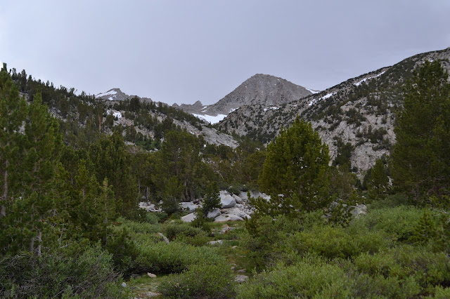
In planning the loop through Evolution Basin, a location commonly claimed to be a favorite along the Pacific Crest Trail through the Sierra Nevada Mountains, most will get a shuttle or plan to hitchhike between the North Lake and South Lake. Not me. I planned to connect the two by the Tyee Lakes Trail and the George Lake Trail and the short up and over seems like a good start day for the trip. It needs to be short because there is also the matter of the long drive up and grabbing a permit on the way. This year, walk-in permits are being released at 11 AM the day before, but they are still free for Inyo National Forest. Arriving at the Interagency Visitor Center a mere 23.5 hours after the day's permits were released, I easily got one of the 10 total, 6 that may be reserved, that are offered. This is also a nice trail to start at since it is the only one in the area where a backpacker can actually park next to the trailhead. South Fork Bishop Creek roars under the bridge as I start and quickly stop again realizing I have not eaten anything since an early breakfast. Food will be required to get up this hill.

It does not take much climbing to pass the sign into the John Muir Wilderness officially. The trail actually looks quite familiar from snowshoeing on it the March before last. It looks like there must have been about 1.5 feet of snow then. I remember spotting blazes on the trees and being surprised that we were really on trail. Now the trail is too obvious to notice the blazes, but it winds through the same trees and past the same rocks. We probably cut a switchback a little, but otherwise it seems the same route. The GPS even clocks the same 1.38 miles to the spot we turned around on that all too short hike.


The views are nice enough, but I wanted to see the lakes too, then and now. This time I get to, but first I have to give up those views. It takes a bit more climbing up through the forest to find the lakes.


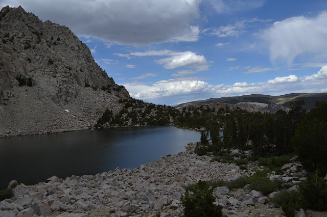
The first lake is just the start. A little climb to the next bench brings on another lake. This one seems to be turning to meadow. It is the long time fate of such things, but these Sierra lakes nearly always seem to have a long way to go.


There are small ponds across the canyon as I climb to the next one along the trail. Gaining elevation is losing greenery, even right around the edges of the lakes.

There is snow along the trail on the way to the last easily accessible lake. Past that, a snow bridge crosses the creek. It is short, but full of holes. There seems to be no way around it, so I just have to judge the thickest part and go for it. Well, that or turn around already. There are footprints across it from earlier that seem to have been less worried about getting close to the holes.

There were camp sites along the creek far back, but this lake looks like it is the usual destination for folks backpacking this trail. Besides me, there are three people with no gear poking around the edge of the lake. They must be my competition for those few spots in the quota to enter at this trailhead. It is probably a little more fierce on Saturday. Here, the trail does not even wait to pass the lake to start to climb. My map shows this part of the trail as "unmaintained", but it seems fine to me.

As the trail nears the top, it looks as though there is a very minor cornice to get past. Closer, it is just a bit more snow and the trail only glances through a shallow section. It is no concern to me because there is a minor mountain to climb and I want to go off trail. Well, most of Table Mountain is climbed already, but the peak is about 0.3 miles off to the side. Instead of crossing the snow, I turn toward that, crossing what little bit of creek there is up here and climbing the easy slope through meadow spotted with shooting stars.

Things become harder as I hit the trees. They grow low like bushes and are lovely and windswept, but they offer quite good ground coverage in some areas and are hard to get around. Working my way through it all takes a bit of work in some spots. Usually, there is some sort of softer spot where others, be they people or deer, have pushed through before. Eventually, I am at the higher rock outcrop that is the summit block of this flat topped mountain.
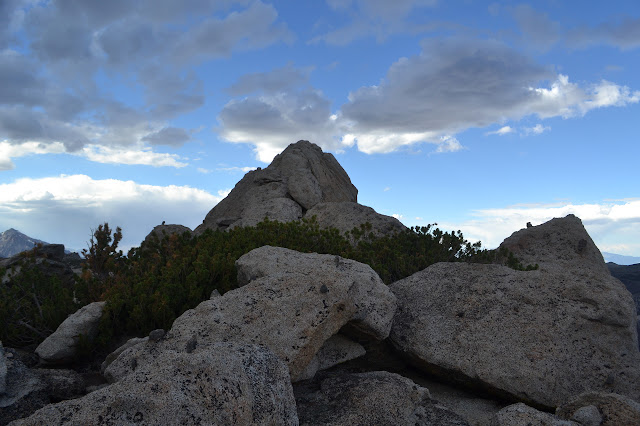
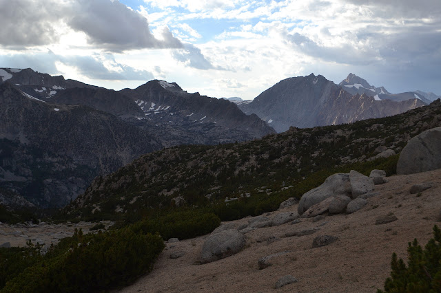
The summit block does take some very minor climbing to get to the very top. It is next to the edge above the Tyee Lakes and that edge drops off quickly. It is a surprisingly good view. Thunder has rumbled softly from very far off and from here, I can see a little of the storm. An amazing bolt of lightning cracks its way from high up in the clouds to far down in a valley in the west. I count to 11 before the rumble finally finds its way to my ears. A second follows in a few minutes even further away and this time I count to 14.


Catching the trail again on the other side of the snow is not hard, especially since I could look down on it while coming down the mountain. As the trail starts down again, it is not so hard to believe that this may be unmaintained. It is steep and in some spots braided as it makes a way down the soft, sandy, but somehow very steep hillside. Still, it makes its way inevitably toward George Lake below.


The lake has plenty of campsites. I poke around for one that is not next to the trail and not too close to the water. There are certainly a few popular ones that are more like 50 feet from the edge than the 200 I was told. It looks like I have the whole lake to myself, so really, I could go anywhere. With the stormy clouds, I choose something high that looks like it will drain, then get together some supper and set up the roof against whatever might come. I am not sufficiently convinced to actually get my quilt into the bivy, but it is out just in case it is needed.
Continue reading day 2 ⇒
©2017 Valerie Norton
Posted 9 August 2017
Liked this? Interesting? Click the three bars at the top left for the menu to read more or subscribe!


Comments