Cucamonga Wild: Cucamonga and Etiwanda Peaks
San Bernardino National Forest
Angeles National Forest
Click for map.
DAY 1 | DAY 2 | DAY 3
The night was about as cool as my sleep system could go without a little help, but I did not have to sacrifice my pillow for the warmth of the jacket within it. Bright stars shone through the breaks in the trees when I looked. Today, there are mountains to climb and then a stop at Kelly Camp before climbing some more. I expect the established camp probably has a spring associated with it, but there is certainly no water source to be seen on my map. The rangers at the station googling were able to find the suggestion this may be true and that it was dry in May. For a stream, that would be damning, but springs run on their own offset schedule. Not knowing where to find it, I really need to get water where it is known. That means either here and carry it up 2000 feet or from a spring on the other side that is out of my way, but only 1000 feet below the saddle. The 30 feet of surface water making lovely music beside me wins out. One bag for hiking, one for camping, and one for hiking again. Just 15 pounds of water. Glad I did not need to add in things like rain gear or a tent for this trip.

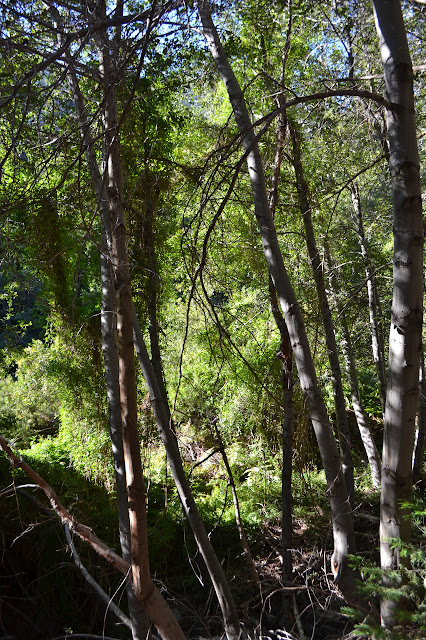
The trail up from beside the water is not so hard to follow in the day. It simply has some bushes reaching across it. I break a few of the larger branches as I pass. After about 200 feet, there are more flat spots and these have fire rings. I was very nearly in the camp after all. Past Third Crossing, the trail had seemed a bit less used. The same holds here. There are more spots with brush reaching across and quite a few fallen logs, some with rather awkward routes around them. Everything seems to turn green and there is a larger sound of water after a quarter of a mile, so I did have another chance for it. There does not seem to be any established route to get down the last few feet to this water, though.


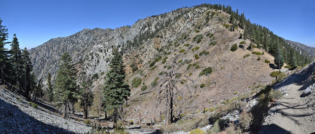
It is a steady climb up to Icehouse Saddle on trail that is generally not crumbling away into a steep slope. Many trails come together in the saddle and the one I have just come up is the least used by a lot. Even a trail leading around the southeast side of Timber Mountain that has no signs to tell where it is going and is not indicated on the trail sign found in the saddle is better used than the Middle Fork. I poke down it briefly to see if there might be a sign further along. There is nothing, but it sure looks built. More important is to find a nice bush to tuck 10 pounds of water and a fair bit of gear under. The saddle gets a lot of traffic, so it is worth it to put a little time into hiding my stuff. While I climbed the last 20 feet, a pair with similarly shrunken backpacks passed by toward Cucamonga Peak. While I pondered the extra trail, a day hiker came up, looked about, and went down again. While I stashed my stuff, another pair came up and started toward Ontario Peak. It really is a busy place. Another pair of hikers come up as I follow the backpacks toward Cucamonga Peak.

The trail has a few carved out of the cliff moments as it moves around the side of Bighorn Peak. A bit of dug out rock hints at the original use of the trail. One high shaft and one low shaft are still visible and go back a few feet, but seem to be filling in with broken rock.

The trail comes around to a thin saddle where the wind is blasting through. Past the saddle, and it begins to climb to the peak. Sometimes it swings back into the wind, but it is less stiff than below. A smaller use trail climbs up Bighorn from the saddle below. It looks pretty good from the saddle and continues to look fine as I climb and can see more of it. I think I will take it and do those two peaks if I get back before 3 PM.

The old sign post for the spur trail up the peak has fallen and has now been incorporated into a minor wall to prevent hikers from continuing down the main trail. Plenty of footprints on the other side show that there are a few who know this is not the end of the line. Most go up to the top and for now that is me, too. The trail up is not the same quality as the one traveling, with a little bit of a scramble quality to it, but it gets there. In the rain, it probably gets there with soggy feet. My benchmark search turns up a drill hole, but nothing more.

It looks a little like there is a use trail down the ridge to the east to get to Etiwanda, my next peak, but I go around along the trail I came up. As it gets near the ridge, there is another long fallen sign post with a couple of bolts and no sign beside the trail. A little further, there is a cairn marking the current route up this side. I guess I could have shortened it.

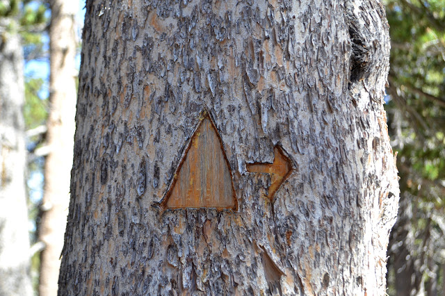
A triangle mark with an arrow cut into a tree distracts me briefly. Surveyors sometimes cut a triangle blaze to help in locating a mark, so I figure I will just pop up to the rocky outcrop it is pointing to. There is nothing there, so I investigate the slightly larger bump next to it. Still nothing. I am suspicious it is a vandalized tree.
As the trail wraps around Etiwanda, I wonder if there will be a trail for it. There very much is. It is only marked with a cairn rather than a large, blocking row of rocks, but it is almost as bad as at the other spur. There is very little traffic that continues on from here and the mass of feet going upward have pushed down enough rocks that it partly blocks the trail. I add my own footsteps and climb upward to the peak.

There are log books at the top for both a geocache and the Sierra Club. Based on the geocache description, the peakbaggers have usurped that container and left it with a rather inferior container. I flip through both, sometimes seeing people logging that they are doing 6 and 10 peak runs that include this. There is a twinge of jealousy as I read these until a memory of a reading a log from a similar peak run pops up. The person called being on a peak for a whole 15 minutes an "overstay". That is definitely not my hike. Being on a peak for 15 minutes is a just start to enjoying the fruits of the effort to get there. Still, with a little planning knowing about the shortcuts and having a little less lazy a start, I could have strung these four together without too much sacrifice.

It is getting a little late to get back to the saddle by 3 PM when I sit down to play with my pens instead, sealing the deal that I will not. Eventually, I follow the trail back around the way I came to pick up my gear at the saddle.
My gear is just as I left it tucked under the bush at Icehouse Saddle. I still have water left from the part for hiking today, so my pack is still quite heavy once loaded up again. At least there is only a mile to go and not a lot of elevation. It is starting to get quite cool and windy. I am a little worried that this camp high in the mountain might be a little exposed.

When I get to Kelly Camp, I am even more certain that there must be some water source somewhere. It is not simply a campsite for a couple backpacking groups to find enough flat space to sleep. There are foundation remains for at least three different buildings scattered around the place. It would have been very expensive to haul up water for such a place.

The camp is set in a north facing bowl. Breezes do come down through it, but do not seem all that strong. I expect the far east side would be most sheltered, but as I watch the trees for clues about how disturbed each area is by the winds, it looks rather consistent. The east will be the last bit to get the sun, but I still go for this area. There is a wall to tuck in next to which seems like the sort of thing that will help with shelter. Although I have not seen anyone in a while, there is one last visitor with his dog in the dying light as I eat my supper. There is brief excitement as the dog runs off something larger than a squirrel, but no one else sees what it is.
Continue to day 3 ⇒
©2017 Valerie Norton
Posted 25 September 2017
Liked this? Interesting? Click the three bars at the top left for the menu to read more or subscribe!


Comments