Mount Hillyer
Angeles National Forest
San Gabriel Mountains National Monument
Click for map.
I hung around the area to go climbing one more peak in the morning. Very early in the morning, I noticed my stars vanishing, and by sun up they seemed to be doubly gone with the slightest bit of moisture coming down. The weather has changed. Traveling to my planned hike, there was a moment looking out over the clouds, which was quite nice, but then I was back in them. At the trailhead, I seem to be under them ever so slightly. I live in hope as I stuff puffy things and the emergency poncho into the pack in case things get quite cold and wet. Maybe this peak is high enough for that over the clouds view.

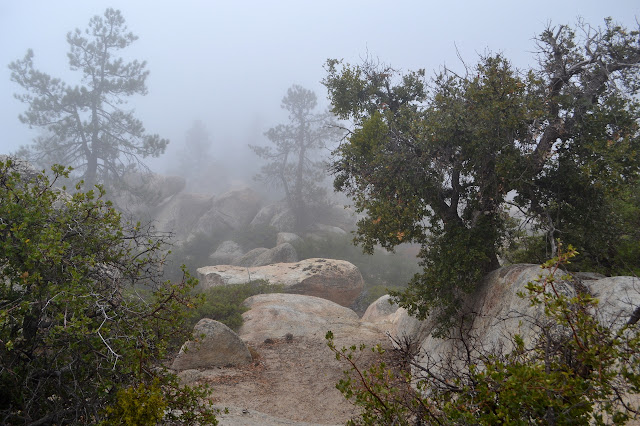
The trail gets on with climbing quite quickly with a few switchbacks. What I can see of the view is surprisingly colorful, full of all different reds and greens surrounding grey rocks. All too quickly, I plunge into the cloud above.


The trail seems to get to a top and starts traveling for a bit. There is a junction and I leave the national recreation trail for the peak trail. It says it is another 2 miles up to the top of Hillyer Peak. The other trail will wind along for 10 miles to get to the area I was in yesterday.

The trail quickly passes next to a campground which would be another place to start up to this peak. It is set up to take horses. There is one car in it currently with a climber's crash pad sitting out in the wet behind it. I see no one and suspect they are in the car as I continue on. The trail starts to climb again and it is quickly obvious why someone with a crash pad might be out here. There is an elaborate rock garden of granite boulders all around me as I go. Trails weave off and around them, sometimes making it slightly unclear where my trail goes.


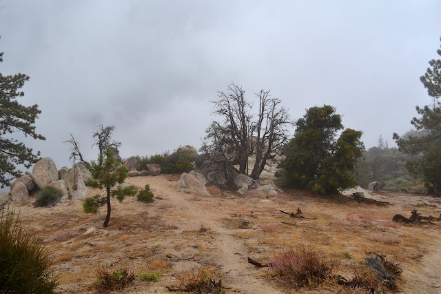
The rocks get more spaced and the trail starts to travel across a fairly flat area. The wind blows quite well up here. Off to the side, there is another cluster of rocks, but these do not look like an exciting climb. Still, many walkers clearly go out to them. Past them, the flat area seems to hit a high point and start to drop. I head back up to the gentle top to pull on some warm pants and a coat against the wind and pull out the map to estimate some coordinates for the peak.


It is a long, flat top on the map as well. It shows the trail stopping at the peak, which would be handing for knowing I was there, but the sign indicates this trail continues one more mile to meet the road, which is the shortest hike up. As near as I can tell, the peak should still be further down the trail. I may as well find it while I am here, so I go looking.

I head back to that first outcrop of rocks that looked like hikers rather than rock climbers were checking it out. That is probably what is being considered the peak. That is certainly what my instincts told me as I passed it the first time. It should at least be a good view point.

The sun comes out nearly halfway as I poke around. A sure fire way to be sure that this is the peak. At least if one believes in luck. I do seem to have a few nice peak experiences with the sun coming out just for a short time while I was on the peak and otherwise being well shrouded.

This certainly was not the right day to come up here. Not only can I not enjoy the view, but I cannot even say for sure where the peak is. Nothing like starting down the other side thinking, "Oh, did I miss it?" to make a peak seem rather minor. Still bundled up, I turn to roll down the hill.

The climbers have picked up their mat and vanished by the time I get back to the campground. I am mildly soggy but still warm enough by the time I pop back out from under the cloud and finish the trail. It did not get to raining so hard that I wanted to get out the emergency poncho or even that I would call it rain. I guess it is time to go home.
©2017 Valerie Norton
Posted 28 September 2017
Liked this? Interesting? Click the three bars at the top left for the menu to read more or subscribe!


Comments