Mount Lukens
Angeles National Forest
Click for map.
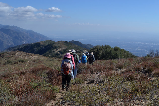
I came out to join a group of peakbaggers from the Hundred Peaks Section hiking to the high point of the City of Los Angeles. I thought that when I crossed into the city way out at the 5 and 14 split, I would not be out of it again until late afternoon, but I seem to be standing in the City of Glendale as everyone gathers up. I expected a large a-lot because it is Bill's birthday, but there seems to only be a small a-lot of just over 20 for the hike. Bill says he met his wife hiking this peak, so now we know why it is special to him and why he wanted to mark year 70 here. He is a bit of a romantic. Getting everyone together, waivers signed, introduced, and starting down the trail seems to get done fairly quickly. We hit the trail and start climbing just three minutes after the meet time. Admittedly, it was a very easy meet time to make.


After a short climb, our trail suddenly turns downward and tucks into a narrow canyon with a clear liquid flowing down the middle of it. The mythical water that has a 20% chance of coming down on our heads. Most hop across but some splash through it. There is a brief moment when the trail is carved into a cliff as we climb out the other side. It is more daring than we had expected! As we continue, there are a few small slides on the trail and overgrown bushes above the trail set to see if they can get us off and down the side at a few choice steep spots. The group piles up a little at a couple, but nobody pauses very long for any of it.

The trail splits and we take the left route. This side sends us downward again, then wrapping around the edge of a small ridge and up a very steep hillside. This part has even more slides and pushing brush. It feels like it has been developed for exercise and we are out with a destination in mind. Not exercise! Well, that is not the stated goal. Things settle down into good trail again as the other trail rejoins. It looks like it had very nice tread on the part we missed, too. Better luck next time, I guess.

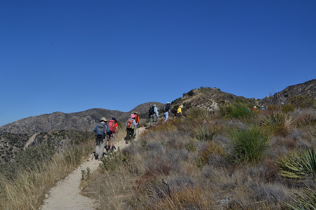
The trail joins an overgrown fire road. As we climb, we variously pass or are passed by a few mountain bikers. It is a long, easy grade upward, but constant. There is no rest for them except that that they take. There is a suggestion that we might take a ridge to cut off a little length, but today we are taking it easy and keep to the road. It joins another which is being maintained and we just continue upward.


We pass right by the road to the towers and antennas and whatever else populates the top of this peak. Bill is standing next to a use trail making sure everyone finds their way to the false peaks where the register is kept, so I get permission to mutiny and run up to the high point, check out the benchmarks and the view and actually be there at the top. The benchmarks do not come in a complete set anymore, as is usual at a site like this. It is surprising there are any at all.
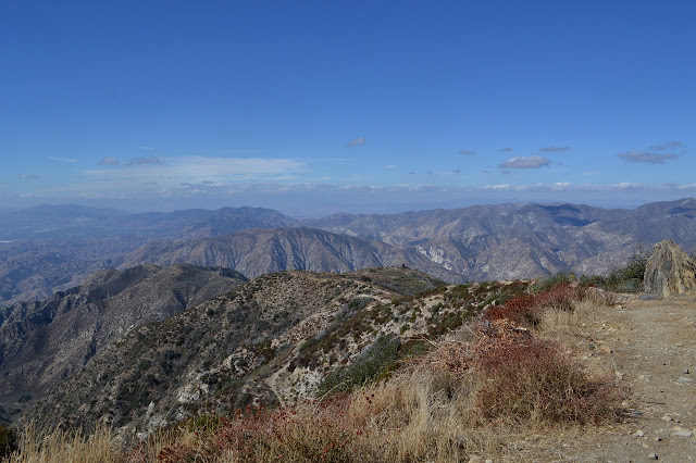

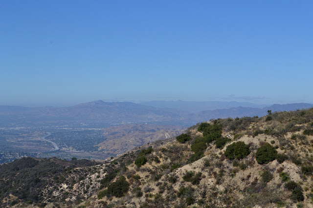
I hurry back. As I turn onto the trail, I notice the big arrow someone drew in the dirt to make sure I would find it. He said to keep to the right following this trail, but I could see them from the road so I know where I am trying to finish. Keeping right works well. While the high point has views open to the west and south, this has view opening to the east and north. It is nicely complementary. Of course, there is celebration so there is champagne. I expected as much and even brought my own cup, just in case, although cups are provided.


We took a little longer coming up than was quite expected, so we are not all that long at the top. Besides, the champagne has run out. It is enough for looking around and a quick snack. We continue along the ridge line on use trail until it meets up with the road again below, then follow that road.
The road winds down to a saddle where a very obvious trail winds up. This is our route down. There seems to be not one single uphill step on the way as we follow a wide cut out onto the ridge and then wind downward on narrow trail.


It is not until a few minutes after Wasim tells me there was another benchmark up where the group was that I realize the cup mysteriously bubbling on the rocks had probably been poured for me to make sure I got some and then placed on the benchmark to make sure I saw it. I almost asked about it as it sat there. Twice. Almost just does not count. I never actually did see the benchmark (which was an azimuth, a rarer type) and the cup is probably still up there going flat. Arg. Again, better luck next time.

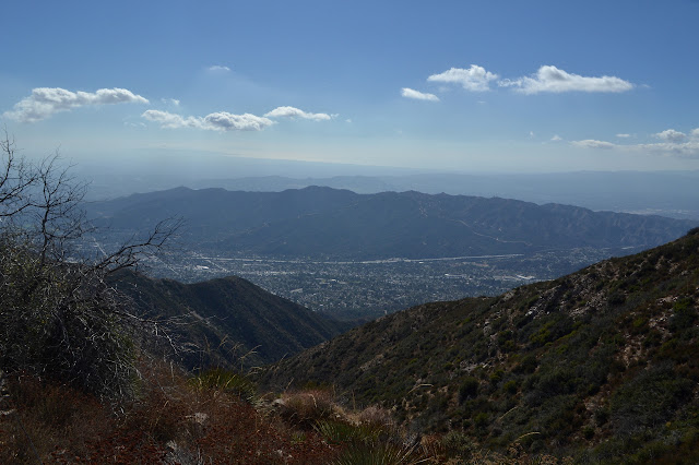
The sky darkens quite a bit as we wind down on the edge of the ridge and past a square of rocks. Across the way, we can see the trail we climbed on, or more likely the section of better trail we skipped. The downhill goes quickly and suddenly we are in the wide canyon. Ah, there are a couple steps somewhat upward to get out of the wash after crossing it. Potluck and conversation and cake finish off the party before we head off. As we eat, it almost looks like it might be sort of slightly sprinkling in the high elevations that we left. Maybe there will be more of that clear liquid around later.
©2017 Valerie Norton
Posted 6 November 2017
Liked this? Interesting? Click the three bars at the top left for the menu to read more or subscribe!


Comments