Rose Valley and Howard Creek
Los Padres National Forest
Click for map.
I have never hiked with the Ventura Sierra Club and thought I might when I noticed they were planning a hike including Howard Creek, a trail that has so far escaped my stomping. They arrived punctually in another part of the parking lot for the carpool, but eventually the two of us who were misplaced got found and everyone was piled comfortably into three cars. Upon arrival at Howard Creek Trailhead, we dropped off one car and continued a little less comfortably to Rose Valley Campground. Hiker parking is just outside the campground gate. Even down in the valley bottom, views already look good in all directions. But it is cold. All these campgrounds tucked into the north side of Nordhoff Ridge seem to be good cold sinks.

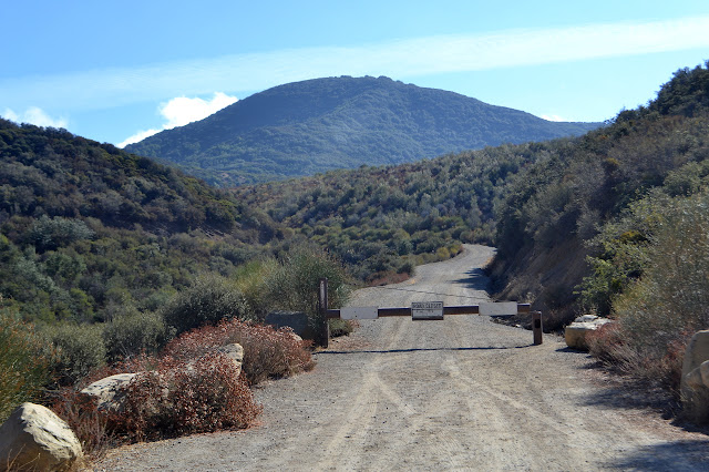
We keep right as we walk through the camp and quickly come to the locked gate and the start of the climb. It is hard to tell if we warm more from getting out of the cold pocket that is the bottom of the valley or from the work of the climb, but everyone who was dancing and shivering when we started is now stripping off any extra layers to get more comfortable. We have to dodge one car coming down as we climb. The road may be locked, but there is a set procedure for gaining permission to pass through and a few fun campsites at the top that people like to stop at.


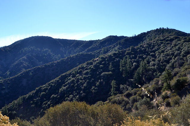
It is a long and steady climb. The word relentless is heard here and there. Just road grade, I say, but 1600 feet in 2.5 miles is a bit more than the 400 feet per mile that a road typically gains. Besides some short and shallow dips, it really is relentless. Ever upward and ever more views. It is hard to get unhappy about getting those views.
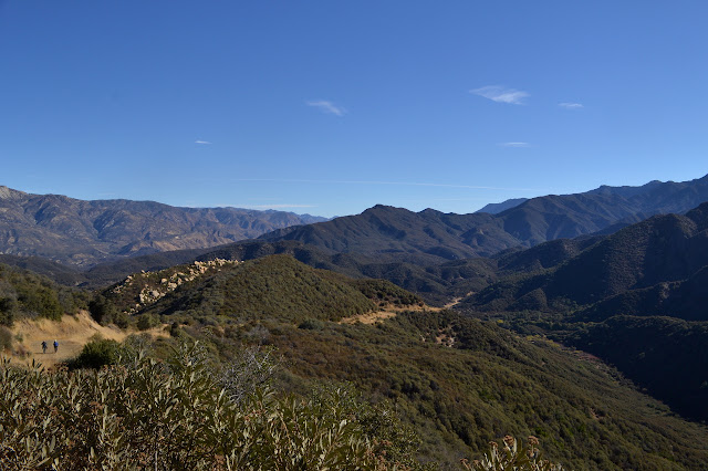


Nearly everyone is gathered at the road junction at the top when I arrive. They are snacking and chatting, so I grab something to nibble and wander over to the other side to take in that new view. I am dreadfully unfaithful when it comes to views.


We do not spend all that long with snacks once everyone is up at the top. They get a little rest, but it is all downhill from here. Of course, the road quickly has very similar views as near the junction soon after we start down. I did not have to pick my way up extra road and around a little gully and out into the brush a bit to get it after all.


We stop by one of those fun little campsites just short of the Howard Creek Trail junction for an early lunch. The picnic table is not quite big enough for everyone, but no one standing seems to care. The site even has a hitch for our horses. Too bad we forgot to stop by the ranch and hire a few. When done, we follow a flagged shortcut trail to Howard Creek and start down it. The old trail dropped a little faster and got to actually see the creek as it joined up with the ranch driveway. The new trail crosses a rocky, dry tributary, but does not seem to get anywhere near the creek. As a nice change, there is no squeezing through spiny oak leaves or other unpleasantness.


Someone said the trail down would be largely shady, but we must have been faster than expected. We have not quite gotten to the afternoon sun which would give a lot more shadows on the east facing slopes. There are some north facing slops, steep and full of thin, young oaks, that are nice and cool. A few small creases are sheltered enough to still have a little moisture from the light weather the night before. We pass the band of conglomerate stone that forms such lovely waterfalls in Lion Canyon, but it does not seem to have anything like that in this canyon.


As we near the end, there is a section of trail that makes me think we are walking across an earthen dam. This feeling is strengthened as the trail distinctly becomes a road with a deep cut through the ridge and some half crumbled paving. It is really just a perfectly ordinary saddle, though. The purpose of the old road is wholly mysterious with the old maps giving no clues. It seems like it should have been slightly important to get paved. Further down, we meet another road that is clearly still in use. The maps also give no clue to this one, but other clues mark it as a storage area for road barriers and the like and perhaps a helipad. There is a marker along its side to help people find the trail, which does not have the best transition onto the road. It is a short distance out to the public road from there.
We relax by the road, mostly in the shade, while the drivers head out to retrieve the other two cars. It is not all that long before we can all climb in again and head back to the carpool point, a few snoozing on the way.
©2017 Valerie Norton
Posted 11 November 2017
Liked this? Interesting? Click the three bars at the top left for the menu to read more or subscribe!


Comments