Liebre Mountain
Angeles National Forest
Click for map.
I may have been spending too much time staring at Thomas Fire information and worrying. In those first few days, I looked at that footprint and thought this close bit coming at Carpinteria may look threatening to Santa Barbara at first glance, but it is really this bit almost at the furthest side of the fire creeping up Topatopa Bluff that is dangerous to us. That part raged across Nordhoff Ridge one night to breath its menacing breath over the entirety of Ojai and then kept on going. It jumped the highway and started in on devouring the Santa Ynez Range. It dropped into Matilija Canyon with a dreadful finality to many homes there. It raged to Romero in another jump sending those in Toro Canyon fleeing on the way, then crept over to San Ysidro. It followed the path I expected and feared it would.

It jumped again two days ago. It reached down into Montecito and raged all the way to Gibraltar Road and spotted into Rattlesnake Canyon and Parma Park. These are our city parks! Okay, so the part of Skofield Park that is Rattlesnake Canyon is an inholding in the forest and many do not realize it is city, not the feds. But Parma is an island. I walked down to Shoreline after dark to see where things stood that night. The air looked foggy, but without moisture, as I went. Even through the N95 mask kindly provided by the city, it smelled thick and dreadful. When I yielded to an itchy nose, I found out what I smelled with the mask on was just a tiny fraction of all the "amusing notes" in the concoction that passed for air that night. Nothing could be seen from the park through that gritty air. When I got home, my clothes smelled like I had been hours at the wrong side of a campfire. And then there was calm for a day and more calm promised, at least until Wednesday night. I really had to get away from it all, so I abandoned the cats, hopefully not to too much fate, and drove past a lot of recent burn on 101 and 126 and all the way to Angeles to an unsigned dirt road along Oakdale Canyon Road a few miles from the Old Ridge Route (both N2). The half of the Los Padres next to me is currently closed for the duration.

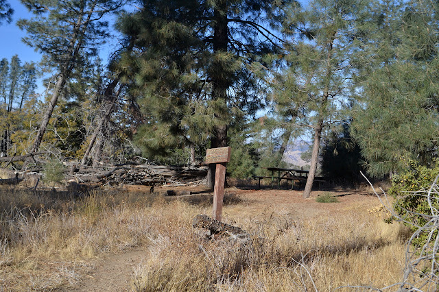
It is time to climb Liebre Mountain. I sort of know the trail because I hiked it from where it crosses Oakdale Canyon Road a mile to the east to up past the camp when I was otherwise in the area and still had the whole afternoon. I noticed the road then (although there are clues on area maps). I could probably have rolled through the eroded bits to the parking next to the trail, but there is plenty of parking on the road and the Hundred Peaks Section guide finishes the driving directions with 0.1 miles on this road, so I did not see the point. After what probably is not even 0.1 miles, there is the trail just as I remember it, passing as a tangent to the oblong parking area. Taking a right, I pass a sign that is slightly more meaningful to me now. It is 10 miles to Sawmill Campground, where I camped last time I played around this mountain, and eight miles to the Atmore Meadows junction where the road at the top was closed. Yeah, this peak can be a drive up. Past the sign, the trail begins to climb.

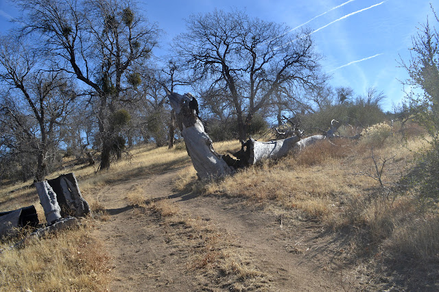
The area is not one to go to forget the fire altogether. The bleached white trunks and branches of trees stick up among the bushes as a reminder of the 2004 Pine Fire that took on most the north side of the mountain. What is left is shorter than I am and brushy. The ground is covered with some sort of large fruit from somewhere, but it does not look like anything around could be producing so much. I would think they were oak galls except for the rind around the hard shell. Breaking one open, it is like a green brain on the inside. There are a few very similar galls around, but this definitely is not one.


A few twists past the memories of mountain lion spotting and up some wide steps and I am already to Horse Camp. It has a multitude of signs, all leaning on something, and a metal post with a taller metal tube dropped down it to mark it and the start of trail down to a spring. I did not bother to look for it last time, but figure I could go today and still be up to the top not much after noon. It is only 0.3 miles, after all.
The trail out the other side of the camp past the leaning sign for the spring looks well established. The sign actually says 0.7 miles. Still, not so bad. It drops down steeply with a few thoughts to wiggling a little on the very steepest parts, to the bottom of the canyon. Decaying pink ribbons mark it even though it is easy to follow. Well, until the bottom. Some trail goes up; some trail goes down; only the trail back to camp is well traveled. So, which way is the spring? I really should have reviewed that before thinking I might go looking for it. There is a cairn in the middle of the creek slightly up and irrigation line runs that way. It must be coming from something and it could be making gathering water easier for those at camp coming from a spring above. It is clearly not being maintained. I decide to head up. There are some obstacles to going that way, but nothing too hard to navigate. At one split, the irrigation line follows both canyons. I rather suspect this was not laid for hikers. The branch on the left looks more likely to have a water source, so I take it. As the GPS says I might be getting halfway there, if I chose correctly at the bottom of the canyon, the obstacles are starting to get to me.

It is probably the patch of roses that get me as I pass over yet another minor obstacle. They seem to come with every 100 feet, but they do not promise pain the way the roses do. This patch stretches out to what was my path before I noticed them and is definitely not after I feel them. If I am going the right way, they could only become more numerous. If. I decide to take a big loop around the roses to cross to the other side of the canyon where I can try to stay high and maybe have less travel difficulty and less steep hill to climb at the end. Over there, there is a rather good game trail heading up to where the trail should be and my GPS actually says I am all of 350 feet from a geocache. That has to be on the trail, so I follow the game trail up a little side canyon. It splits, some getting into the thick brush in the bottom of the drainage, but some kindly going around the edge of the white thorn to pop out in a little saddle. Considering the steep downhill and gentle uphill, it is surprisingly little climb to the trail. For the record, the spring is so far down the canyon that to find it, I would have had to loose all but about 100 feet of the elevation I had gained from the start.
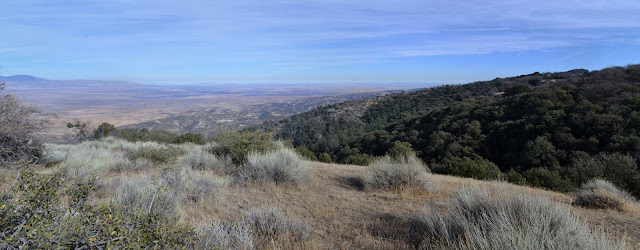
Climbing a little further, I get past where I had been before, up into open lands spotted with oaks and, for some reason, the unmistakable evidence of someone driving their pickup truck on a trail that does not even allow bicycles. Just below a rough spot is a place that everyone else who could not be bothered to read the signs turned around. Further up, someone thought it might be fun to take a turn around a tree on the hill and sank into the soft dirt deeply and dislodged a rather large rock in their struggles to get back up onto the trail. The trail starts to feel as hard as any road toward the top from all the people too illiterate to even understand what a picture with a motorcycle with a red line across it means. There are more and more tracks left over the years by people who do not like leaving a place as nice as they found it. There are also a few views.


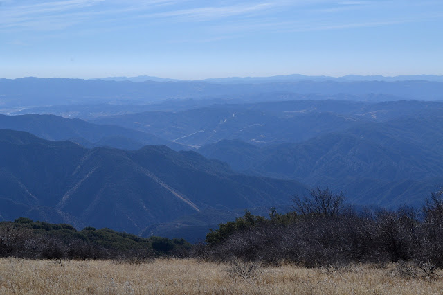
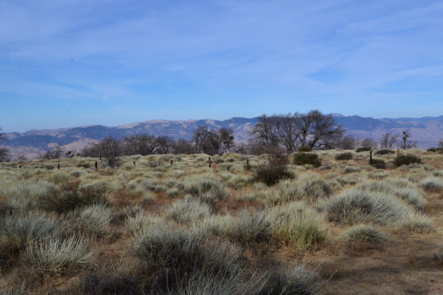
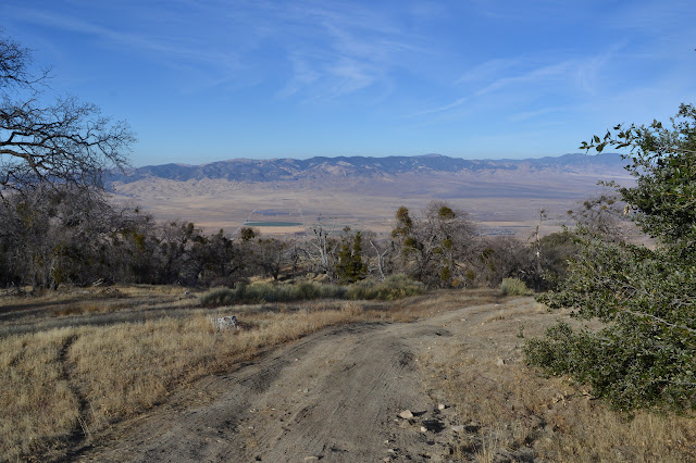
At the top is a sign and a very long fence to try to keep the vehicles out. It stretches between two groups of trees. Of course, the vehicles have just gone around it because the oak savanna and flat mountain top pretty much make that easy to do. At the top, I leave the trail and wander across some more roads until reaching the far side and the only road that is actually supposed to be here and quite a lot of new view. Redrock Mountain and Warm Springs and quite a lot of other rough terrain is out there. I can pick out Castaic Lake quite easily, but it is quite misty.


Now to find the peak. Again, that lack of proper preparation for the parts of this trip that would be new is coming into play. The big, flat mountain top does not really support simply hiking upward until there is no more to go. Somewhere off to the west is the peak on the map. I plan to wander a bit anyway, and start along. But first, a little trail and a geocache and since it has caught my eye on the way to this geocache, a short investigation of a burned post that might be marking a benchmark. Or, as it turns out, the high point with the HPS register. It is a lot closer to the PCT than I expected, although had I bothered to read the hiking portion of the peak guide, it would have told me to come here.

There is no view from the designated top, so I wander off to a boulder pile that has a break for the northeast view of desert and distant mountains for some nibbles because there should be a moment to enjoy any peak. (Tried a Pro Bar Meal bar in chocolate peanut butter. At 3 oz, it is nothing like a meal, not even lunch and I rather expect it would be torturous to try to live off it for two days. I did make it through the 3 oz without hating it by the end, which makes it 4 times better than any Clif Bar I have tried to eat.) Then, off to wander some more. There is still a lot of peak to check out.


I wander around a bit, then stick to the road. It gives a better view south than up at the top anyway. It also shows me the puffs of smoke from the Thomas Fire, or more likely from a firing operation to more decidedly contain it. At the far west side is some mysterious fencing that I go to investigate. It seems to surround a cement foundation for nothing. I wander down the ridge a little where there are tire tracks from a single yahoo who thought driving here made sense. The tracks go down one side of the wide ridge and up the other and will last who knows how long. They are already old. They cross a trail that, legal or not, is a motorcycle trail now.
I dither about it, but decide to follow the motorcycle trail back. It shows some signs of being ad-hoc. There is not so much view from it as it follows the north side of the mountain. It is probably more pleasant hiking in the summer when it is a bit warm, but today is wonderful even in the sun. Along the way is the relic of the previous generation of drivers who were not bound by silly rules.


Nearing the peak, at least as far as HPS is concerned, again, I take one last look out to the south before dropping off the mountain to the north again.

For kicks, I follow the tracks when they head off the trail because there is no longer a route for them on trail just to see where they go. It is easy enough to do even if it was only driven on once. They do not go far. Just a hundred feet or so to a big oak, where they seem to have turned up the hill and let their front tires dig in, then parked. They then proceeded to excavate enough flat area under a large oak to put a cabin tent, cutting a couple pesky branches in the process. A mutilated toy sits under the tree. Maybe it was a dog toy and there is no next generation being taught to recreate in destructive ways. At least the hillside is not a collection of paper plates, plastic cutlery, and beer containers. They are probably very proud that they took most their trash while endangering a big oak.

Then all that is left is to roll back down the hill on the unmolested part of the trail.


I try not to roll down too fast to miss the golden hour. I pause where I saw the mountain lion a few years ago and look down on the trail below where I stood. It is easier to recognize from this vantage point because I cannot quite tell exactly where the trail is from below. At least not without the lion on it. I also pause to notice that not quite all of the bleached white wood is actually nude, dead stuff from the fire. Most of it is actually a bush with very white bark growing up around the tall trunks. Dead leaves hang from the stems from the season gone and buds are starting for the season to come. Among the leaves are more of the rinds from the mysterious fruit scattered all over the trail. These things that look, at first glance, like just more dead twigs are the source. That is part of the mystery solved.


Then I am back to the car. It is barely sunset and there is still some light left, so I head over to check out the Old Ridge Route a little. It is a strange road showing a rather odd paving history. The county warns that there is no maintenance on the road, then warns again on the next curve. I stop at what turns out to be the Liebre Mountain Summit (there is a sign to say or I would not have known it was a summit at all) beside an interpretive sign that has faded to a few black marks. Whatever else it had, there was a photograph including the curves up ahead and a unique curve warning sign. Another on the way back shows what might be a school bus in front of a couple buildings. It merits some research and some exploration.
©2017 Valerie Norton
Posted 20 Dec 2017
Liked this? Interesting? Click the three bars at the top left for the menu to read more or subscribe!


Comments