Santa Paula Canyon, clean up to the punch bowl
Los Padres National Forest
Click for map.
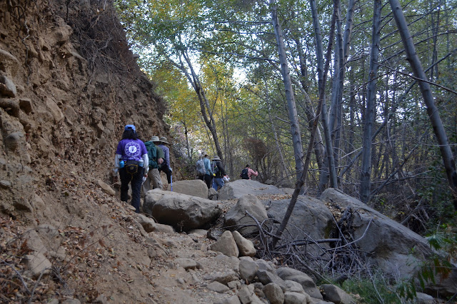
There seem to be certain trails that attract a class of thoughtless hiker that acts like the greatest value the place they are hiking through is as a land fill and tosses their trash off to the side as they go. Unfortunately for Santa Paula Canyon, it is one of these trails, so Los Padres ForestWatch organizes regular clean ups along it. And for the volunteers, Figueroa Mountain Brewing has provided free beer. This is not so cool because it comes in the form of a coupon that is only good on the same day. They have also provided bags. This is very cool because they are former grain bags and are tough enough to take on lots of broken glass tossed within and plenty of thrashing into bushes on the outside while being a reused item. We will have no trouble tackling whatever trash comes with these. After signing three forms and listening to a safety lecture, we are ready to head out to the trail. First, there is the paved hike through the college. Handy frequent signs direct us along the way.

The group is split into two at the start. One will head all the way to the campgrounds near the punch bowl, then pick up around there and on the way back. The other group will do the trail closer to the start. Almost everyone seems to head off in the first group going for the further hike. Together, we walk the paved roads, past the oil wells, around more oil well, and finally into something like nature down into the canyon and across the creek. It is quite full with water. The trail beyond is well traveled and easy to follow. The difficulty really comes from all the options. Still, it seems likely that all the options get there too.


Although there is plenty of trail to follow, people have enthusiastically marked it with paint and markers, often next to other marks. There are a few names too. We are seeing it on one of its better days. I look a little closer at the other rocks and see the muted paint covering over previous marks. The trail heads up to climb along an old road while some more trail drops right back down into the creek area. We head high. Except for a washout and the growth of plants, the road is easy to travel. It drops us right into the first campground.


A sign marks the campground, but has been painted a muted color like the rocks. I look closely and can just make out the raised triangle of the tent picture that once showed on it. We get to cleaning it up and marveling at all the things that people say, with their actions, they do not mind and even like looking at along the trail. Most surprising are some carpet segments with the padding.

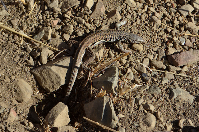
I follow a little trail here and there because these seem to be the places people really like to drop off litter. One heads up steeply to a viewpoint where someone hoped their orange peal would not be long lasting litter because it is organic. Somehow, that does not work out. Things need to be buried to decay quickly and acidic orange peal can be quite hard for the local organisms to deal with.

We head down from the camp along a much narrower trail. A sign points to more trail downstream and a few take that to clean up under the waterfall before heading out, gathering up those carpet pieces as they go. The rest follow more trail across and upward to get above the waterfall. We follow the creek again, then climb steeply, edging past the sides of pieces of portable landing pad that shore up the official trail as it climbs in nice switchbacks. They are buried and overgrown and would be difficult to take today.


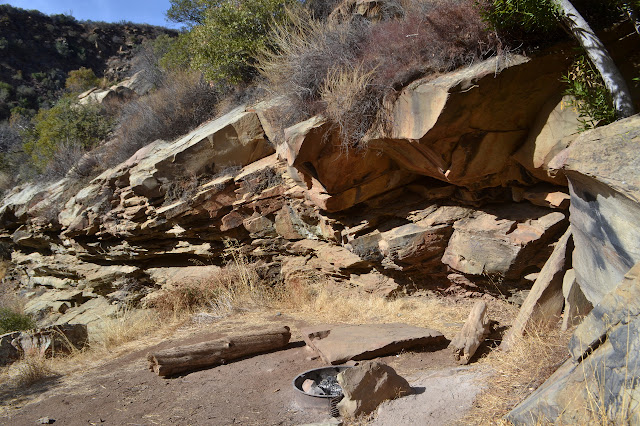
Once in the camp, we wander about picking up more trash. I once again go wandering up a trail to a viewpoint. From here, I can see a taller waterfall with a lot less water. Most the water was coming from the other fork which we crossed between the campgrounds. I also spot a well established campsite complete with large metal fire ring across the creek. It clearly needs some cleaning.


Getting to the campsite proves a bit of a challenge. The canyon has a touch of the slot here, too. I navigate different trails down and back to the camp area, finding yet more trash, before trying to tackle crossing the creek. The others have already moved on to some other spot. I take a trail that looks to be getting to the creek faster than the main traveled route and immediately find a shoe. They probably did not go this way. The creek is pretty in its half canyon as I come to it, but I am not thrilled to try to get down a rock wall almost as tall as I am and into the pool below it even if getting out again on the other side will be easy. I head upstream a little instead to find a nice rock crossing. The walk up the rocks on the far side is nearly straightforward and does bring me to the campsite. It has plenty to clean up.
Trail heads up from the site so when I am done, I head up it to find more Lunchables and clothing and tuna cans. I hear voices, and it is the rest of the group returning. I walk over to find there is a 40 foot cliff between us. I am told the trail is heading to Last Chance, and I should probably get back the way I got there instead. Navigating the rocks is easier heading back, so that is no problem. We head down the way we came up, but I purposely choose the offshoot trails as I go. This takes longer, but people have not cleaned it. I go after bottles and end up with bottles, cans, and hiking socks.
I do not seem to be the only one. One fellow decides to head down the fire scared hillside next to the road where quite a bit of old trash has shown up along with a few new pieces. I had just consciously decided not to go after similar items because it looks steep enough to be dangerous, so I stop to make sure he makes it back to the old road. The group has generally wandered far ahead by the time he finishes. Still, I keep wandering the extra trails as we go. There always seems to be one item of clothing along these routes. There is even a ruined soccer ball beside the main trail just before the oil wells. Below there, I notice one other straggler still picking up trash. He followed a trail I left alone and found party central, which had taken quite a long time. We head out. Being two hours late on our return, we do seem to be left holding our bags. Hum.
©2017 Valerie Norton
Posted 4 December 2017
Liked this? Interesting? Click the three bars at the top left for the menu to read more or subscribe!


Comments