Butterfly Peak and Rock Point
San Bernardino National Forest
Click for map.
The day starts early with the blue moon in total eclipse, which is pretty cool even if it is only an accident of the calendar.

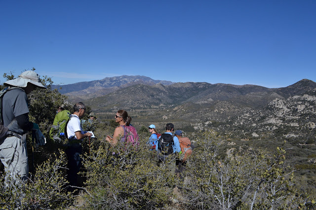
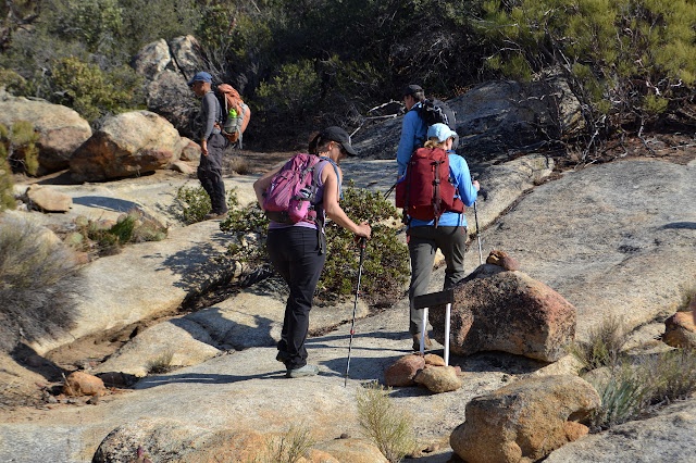
Today, the plan is to join a scheduled Hundred Peaks Section hike and climb a couple peaks on their list. Everyone is welcome to come on a hike if they are capable of completing it, you just have to email the hike leader. The trail we are starting at seems to be a little more exclusive. I expect someone asked permission at some point and this group is a rather good guest, not known for carving on or cutting fences and more likely to pick up trash than to drop it. They gather and we all sign the standard waiver and then we are off.
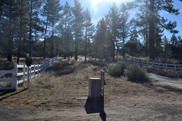
The trail follows paved road for a short way, then turns away from the Pathfinder Ranch entrance and onto a dirt road behind a locked Forest Service gate. The road is lined by fences until it starts to climb up into the hills. It is rocky and in poor repair as we go, but the passing walkers have kicked out a smooth trail among the rocks. A puddle along the otherwise dry expanse shows where a spring seeps. It is nice to see the water. This winter has just been so very dry. Things smooth out as they flatten out except for occasional deep ravines cut into one side of the road to make it impassible by a vehicle. Other roads wander off to the sides, but we keep ignoring them.

We stop by Gold Hill and a sign explaining some little part of the mining history in the area. It seems logical to conclude that these are mining roads we are following, or not following as the case may be. We see a few remnants of this history as we continue to climb. There are numerous curious concrete structures, metal pipes lined on the inside with concrete line the road, and there are even a couple shafts now closed to give bats a home.


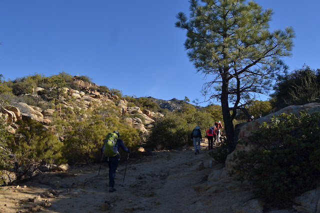
Past the mine, we turn off onto a bit of trail, but do not get very far down it before turning up a gully and getting onto use trails to climb Butterfly Peak. The use trail braids frequently and cairns are all over showing many possible routes toward the top. Boulders and fallen trees and shrubby vegetation provide the obstacles to simply choosing any path. There are a lot of all three to wind around.


We seem to join other trails often and what we are following becomes more obvious as we near the peak. As we hit a ridge, there is only a short way to go to the boulder outcrop that is the top of Butterfly Peak.

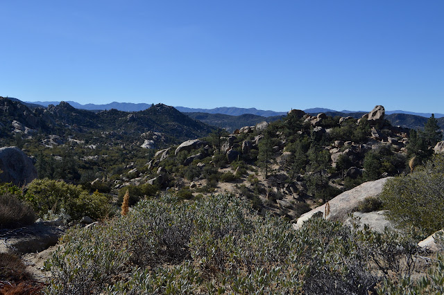
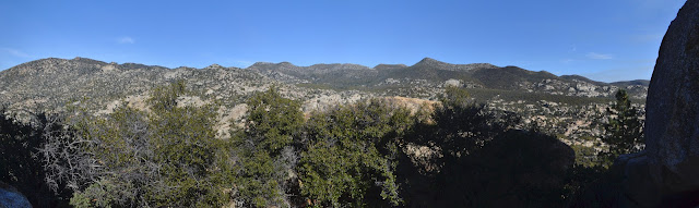
For those who climb the summit block, we find a couple of different routes up. I go up past a bit of wood set in the rocks to see what it might be marking. Nothing, as it turns out. We enjoy a bit of a snack trying to take in the view at the top. There is so much view.


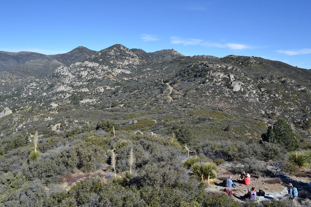
After snacks and signatures and a little smoke watching of the controlled burn, we are ready to head down again. The leader, Jerry, does a rather extraordinary job of following the same route down as we had taken up. I only note one deviation in spite of the proliferation of choices on the way.


We head back down the bit of trail and most the road we came up. We even pass by the sign for Gold Hill, which has a trail up the hill beside it and a number of our group wants to climb, before finally finding another abandoned road to follow out again. The road seems to dwindle into trail. We pass mysterious pipes, one line full of holes. We pass a creek with a short section of water in it. That is two water sightings in one day! The route seems generally downhill to me although we are supposed to be climbing a new peak.
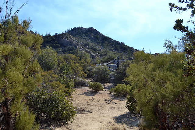
Our group uses a pile of wood that, presumably, was once a mining building as a sign post for where to turn and start climbing to Rock Point. A few feet after starting, we pass a little sign of old carved wood set on new PVC pipe pointing the way. This trail passes over some large rocks, but is mostly very easy to follow all the way up. It gets a bit of local use.
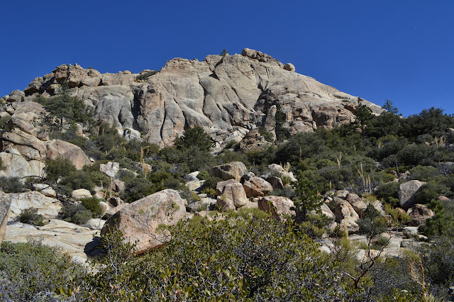
We reach the top with its huge boulders, one pointing at the other. We climb up the low rocks, but no one goes for the class 5 summit block. I suspect we would have to sign out before making the attempt because no one here is rated to lead a hike with a class 5 climb. Some people do mumble about what some famous climber or other would probably do if faced with this rock before us. It is nothing more than talk and pointing.


We head down again, the same way we came up. On the way back along the trail, we notice another little sign of old carved wood and new PVC pipes pointing back where we were for Rock Point and the way we are going for Butterfly Peak and mines. Trail leads down the hill from there, probably to Pathfinder Ranch near where we started.

As we get back to the junction, a few sign out to retrace a few steps back up the road toward Butterfly Peak and then up the trail to the top of little Gold Hill. It is on peakbagger now, so there is that little extra impetus for some. I was thinking to do it, but decide to head back with the group out of respect for what my legs will have to go through tomorrow. It was a lot of fun to hike with the group again and I got to reminisce about my previous trip to the area to hike up Ken Point, a trip that started just as the snow was finishing falling.
©2018 Valerie Norton
Posted 12 Feb 2018
Liked this? Interesting? Click the three bars at the top left for the menu to read more or subscribe!


Comments