Lookout and Table Mountains strolling the PCT
San Bernardino National Forest
30th of January, 2018
Click for map.
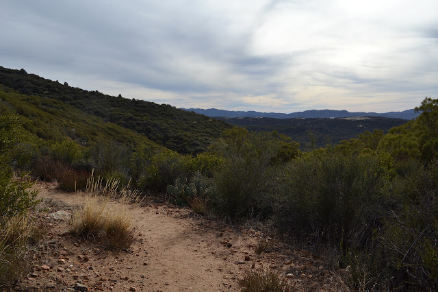
I headed for Riverside with a list of plans, stopping by the Trabuco Ranger Station for a map and a couple backpacking permits to help pull them off, then off to the junction of SR-74 and the Pacific Crest Trail in time for the nice afternoon hike which was number one on my list. Just south of here is a peak identified as "Lookout Mountain #1" on the Hundred Peaks Section list and a few miles south of that is a bump just slightly off the PCT marked as "Table Mountain high point" on peakbagger, which are my excuse to hike a few miles along the PCT. Parking is well signed and north of the highway. I have a track in the GPS to show a couple routes to the top of Lookout but cannot seem to find them once it loads up. (This is due to it coming up as a route instead of a track and that both saved routes and tracks only show up when the device is told to navigate along them.) I will just have to make it on my own. It did not look so hard. Just go up high and look for a bit of trail. I cross the highway, pop through the gate, and start up the edges of the mountain.

Past the first bush are milk jugs strung out on a rope that appear to be full of fresh water. Someone is maintaining a water cache a bit early in the season. Then again, it might be a really good time to section hike this area as the desert will be much more comfortable and the high mountains have very little snow. The trail climbs at a very easy slope. This was certainly graded for stock. It is quite short until there is new view at the top of the saddle.

I expect to see some sort of trail heading up the ridge from the saddle, but there is nothing more than a hint there. I am sure this is where the track I cannot see stored in my GPS leaves the trail. It comes back further down the trail, so I will see what comes up as I continue toward Table Mountain.

There are a couple more hints at routes up the side of the mountain as I go. One small cairn with a whisper of trail is especially tempting sitting on a small ridge. I expect I would go up it on the way back if I saw nothing else, except it will be dark then and not a good time for cross country and faint use trail travel. Then, when I have gone far past where I expect to see something, there is a dry creek bed that looks very strongly of trail. Looking up, there are two ribbons tied over it by the trail and maybe 20 feet further is a cairn. After the hints and whispers, this positively shouts trail. And to think I had basically given up on that. It clearly goes somewhere. At first, it follows directly in the creek bed that should not be able to look so much like trail in this season. Cairns mark it about every 30 feet. Eventually it climbs steeply out and wanders the steep slopes.


With a bit of chugging up the steep sides, the thick use trail eventually levels off onto the top of Lookout Mountain where I can find one reference and the station mark, but not a second reference that would be expected. North of them is an electrified fence marked "no trespassing". Other than the fence, it is a mountain top with views.


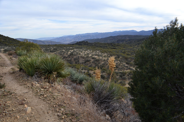
Shortly, it is time to head down again. I would like to get out to Table Mountain while there is still a little light to look around, after all. I am not certain how far away it is, but the straight line distance is 2.9 miles and the trail is very much not straight.

Back on the PCT, I head again in its southerly direction. The trail winds down off Lookout Mountain and out into a flat area between. The land drops off to the left turning into eroded gullies. Someone has set stones on the side of the trail into a 150. I must be 150 trail miles from the Mexican border. This should be part of the first 2 weeks of the average nobo. The trail drops through a shallow canyon in long, easy switchbacks, before climbing up Table Mountain with the same.


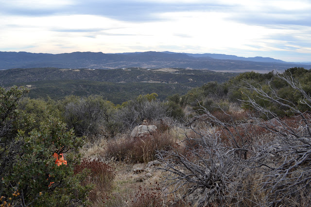
It looks like surveyors have been active out here. There is a line of white poles near the trail. Well, three or four, anyway. One the trail travels near has a few extra poles as if it might be more important. A little poking around will not hurt, surely? I make my way up to see if there is any monument. No luck. It is a section corner shown on the map, but apparently only marked by a fence post. I am so close to the top that I turn and wind and push through the bush to find it. There is a road at the top. To the east is a gate, more private property, and west is a nice tree and some benchmarks.


The sun is rather hidden by the wispy clouds, but they turn very colorful for the sunset. It is quite a show. I head down along the road under the fire in the sky. Feet and hooves have turned up a line across the road where the trail crosses it, so it is easy to find the PCT again.

As the light from dusk fades, the clouds seem to shrink and vanish to let the rising blue moon shine down. The trail is wide and easy enough to get away with traveling it just by that light, so I do, for five miles all the way back to the car. Why not? I can always see further and more when my eyes are adjusted to the natural light rather than the brighter spot of a lamp.
©2018 Valerie Norton
Posted 9 Feb 2018
Liked this? Interesting? Click the three bars at the top left for the menu to read more or subscribe!


Comments