Forbush Canyon trail work
Los Padres National Forest
Click for map.
This volunteer trail work trip was actually advertised as in Blue Canyon, around who's edges the Thomas Fire lapped its greedy tongues but ultimately left. That may come, but for now we are actually along (north) Cold Spring and Forbush. Workers could go in Friday night or Saturday morning and I chose the morning. We work Saturday, mostly, and come out Sunday. The roads along the edges of the burn are closed, so we gathered at the road block at the top of Gibraltar Road to drive in along Camino Cielo to Cold Spring Saddle, then gather up tools and take off into the green side of things.
Saturday
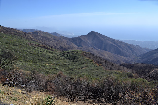
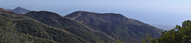
But first a look at the burn scar to the south. It was astonishing in its completeness over some areas as we drove in. Other areas were mysteriously left.
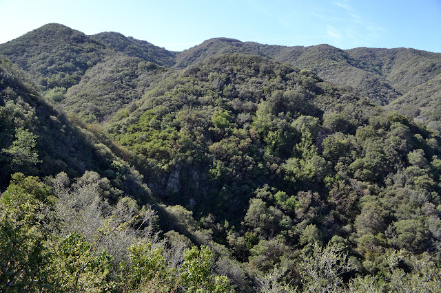
Loaded down with a few tools and our overnight gear, we turn to make our way down Cold Spring to the old homestead at Forbush Camp. The spring is flowing again, so we only need enough water to get there. Blue Canyon is also flowing, but we will stay higher than that. As we head down, we overlook a bit of the Rey Fire scar, which still makes the mountains look scraped. We stop to look out over Blue Canyon, too, to see that it is still with brush. Mostly, we just get down the hill, and set up our spots when we get there.

Once our pack have been lightened of camping gear, we are ready to head down Forbush for the work. This is brushing and a major slide area. There is a bit toward the top that I always think looks a little bit weak and ready to go. This is the slide area. Below it, the trail settles down closer to the creek and much of the brush is poison oak. I setting in working above on brush trying to push people out and off the trail.
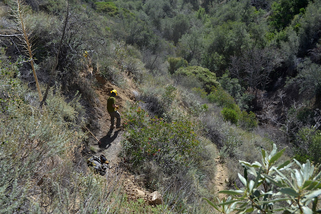


The slide among the many switchbacks was worked on from the morning on. After all those hours, it still looks a bit brittle. Late in the afternoon as those going further came back with tales of poison oak vines overhead getting cut before realizing what they were, we start back to camp for the evening.

It is a rather low key evening for a trail maintenance group. Even with a campfire, we barely make it to 8PM. The meadow is wet as I set up, but the air does not seem so much so. As it gets colder than expected (and after not finding it cold enough to test my other quilt here, I may have an incorrect perception of the temperatures it can be here) and finds some more water to wring out of the air onto me, I find myself just a little bit uncomfortable. I want dry and I want about 3 degrees warmer and I know I can get that under the trees. There is a big flat spot under one, so with an utterance of "Enough!" I head for it and drift into a sound and comfortable sleep.
Sunday
Sunday is really just set for the hike out, but we can work on the way up if we want. There are a couple thin spots and the trail has been needing a good hair cut for a while now, so there are a lot of folks opting to work on the way up. I am being lazy at the back, nearly, but still finding plenty to do and a few cuts in need of tossing.
It takes quite a bit longer to hike up while lopping anything too close, but we mostly make it by noon. Heading back, I do still want to stop and a couple look out points to see what has become of the front country.


©2018 Valerie Norton
Posted 1 Mar 2018
Liked this? Interesting? Click the three bars at the top left for the menu to read more or subscribe!


Comments