San Mateo Canyon: Sitton Peak
Cleveland National Forest

Click for map.
DAY 1 | DAY 2
Everything just looks a little hotter, so I think this 3 day, 30 mile plan will require more water than the one I just pulled off in Agua Tibia Wilderness. Although it looks more likely there could be water here, the map indicates all streams are seasonal. Since I could get no information on either water or the state of the Bluewater Trail, marked as unmaintained on the wilderness map, I have to plan as though there is no water and Bluewater could be difficult travel or navigation. The result of sitting down with the map and some mileage information that is helpfully supplied on the trailhead sign is to cut off 5 miles and the unmaintained part so that travel will be more certain and it is doable in 2 days. This leaves me confident enough to leave one bag of camping water, but none of the hiking water. Starting water weight is still 20 pounds and am considering this a rather minimal amount. Water planning can be quite the balancing act. I have also chucked out a pound or so of warm gear I decided was extra on the previous trip. Somehow the lighter pack still feels heavy.

I sign in as I pass since it makes it clear that my backpacking permit is an additional requirement for overnight travel. This time, I take the main path following the creek under the oak trees. They look a little haggard by the increasing drought. It is about a mile before I actually enter the wilderness, not that the arbitrary line matters all that much. Lion Spring above is keeping less than 100 feet of the creek moist, but there is one hint that there might still be water around in the form of a not too mucky puddle down in the rocks. That water does not last long either. There are a few possible nude sycamores in very random spots, too.

After a few dry crossings, the trail climbs up into the dry chaparral. With the junction, I swing to the right to begin the looping part of my hike. This crosses those rolling hills I was seeing yesterday as well as the service roads for the camp and ranches that sit surrounded by this wilderness.


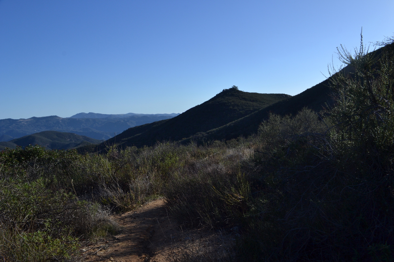
The Morgan Trail drops a bit just before ending at Bear Canyon Trail. White sticks marked with trail designation and mileage mark the junction. It is just a mile from here to what is officially the San Juan Loop/Bear Canyon Trailhead but everyone calls the Candy Store. This seems to be one of the most used trails in the area and today it is quite crowded. I have seen a couple groups before I even finish turning and there is a loud group somewhere above me. I join their line, climbing again in the trek to Sitton Peak. First it is a sometimes warm climb up to the namesake of the trail.

The trail crests into the upper reaches of Bear Canyon and drops a short way among oaks before coming to a junction, marked again with white posts, with the Bear Ridge Trail. Here, it becomes old road as it continues beneath the oaks. Usually it is wide enough to offer very little shade as it closes in on the middle of the day. As it begins to climb again, I notice a cinder block box to my left. It is locked, so I cannot tell if it is something relating to Pigeon Spring. Except there is a pipe leading into it from somewhere else. I follow it along, toward a group sitting and leaning on a twisted log while they snack, to a larger cinder block structure. Taking the little trail to that, it turns out to be a trough. There is about 6 inches of water in it, a little oily on top and with a collection of bees drowning themselves on one side. It does not seem to be filling. A cursory glance for more pipes leading to it comes up empty, but in a week I will learn that there is a cistern behind it somewhere. What I see is not all that attractive, but Pigeon Spring has water.


Shortly after I arrive at Four Corners, the end of Bear Canyon Trail, I spot a backpacker coming up from deeper in the wilderness. There is someone to ask about water, so I zip over to do so. His answer starts off with pulling out a bottle that looks a bit cloudy and stating that he has been worried about drinking it. He is one of a pair that went down Verdugo Trail and Bluewater Trail then up North Tenaja Trail. They found a rather unappetizing puddle for their water source, but it was water. I also learn that Bluewater Trail was no less passable than the others in spite of the designation as unmaintained. Surprisingly, I learn you can get a backpacking permit from the Candy Store and they are willing to hand out a water report. They also tell me about a nice, sandy camp site about a quarter mile the wrong way on San Mateo Trail and clearly think I am nuts to have no desire to go a little out of my way for it. Back to his water, I point out that after enough iodine has been dropped in and time has passed, anything that is left is nutrients. Mostly. Anyway, it is hard to get enough contaminant in a single liter to worry about as long as you do not keep coming back to it for more doses. Half of it seems to vanish. I wish I felt comfortable giving him more from my stash. He will be surrounded by day hikers who might be able to offer help for the rest of his travel.

I stash my extra water and gear a little way down the trail no one else is likely to pass on in preparation for taking the spur to Sitton Peak and they have continued on before I finish. The Sitton Peak Trail was a road once, too, and is called such once it passes out of the wilderness boundary. It does not look used as such recently. At the pass, there are trails going up the peaks north and south, but these are not the ones I am heading to. Down the other side, just past a saddle, is the use trail up Sitton Peak. People going up and down it, but if I was not sure, I could consult the white stake. Even the use trail is marked. It is very steep and has some braiding, but all roads lead to the top.


The steep trail reaches a top, but it is not yet the peak. A much easier trail continues south to the high point and then even further. I stop at the high point, then go just a little further to find the benchmarks and register. All the expected benchmarks are there. The ocean is now quite obvious and there are even a couple islands, Catalina and San Clemente, just visible in the hazy distance. Catalina on the north side is a bit clearer, but also a bit closer.


I head back down. As always, the trail is somehow steeper that way. I cannot help but evaluate the day hikers still coming up in the afternoon heat for their ability to help the thirsty backpacker. They seem worryingly devoid of any water at all. Back at Four Corners, I pick up my extra water and gear again and start out along North Tenaja Trail. This, too, was once a road, but the brush is closing in. I am a little worried about camping. Judging by the speed I have been going, I will still be out on the ridge when the sun goes down and when it gets dark. I think I am aiming at Fishermans Camp, but maybe that will mean travel in the dark and missing some sights, so I have my eye out for sites as well.


There are campsites along the way, although all are various levels of dubious from very to quite. The best seems to be marked by a triangle topped post of the sort that usually marks an end or junction on a fire break. There does not seem to be any reason for it to be in that particular spot as I take a look over the edge. It is too early to stop, but I give myself permission to find a spot after the sun has dropped behind the neighboring ridge. I have all my water, it is not like I have to go anywhere in particular to camp.


Just two minutes after the sun has vanished and two minutes until official sunset according to my GPS, there is a rather good spot. Still very dubious in placement, but I can be completely off the trail. It is flat and plenty of room and a bush protects from what little breeze is blowing up from Bluewater Canyon to the west. I debate it, but it really is one of the better spots I have seen and it is after the time I set and I have done about half the trip miles. I debate it until calculated sunset, then give in to the little details that really make it nice.

The ridge line is warm as the night darkens. When I started, the ridge up there was also warm. I felt like I dropped 20 degrees when I got a few feet below the top and another 10 degrees going into the forest. I do not test what it is like lower, that being accessed only by bushwhacking thick chaparral, but it sure is an easy temperature at the top. It is almost too hot for my quilt and no breeze is blowing. I eat and watch the stars come out. While I feel somewhat above it here, there is only one cleft where I can see some city lights. The rest of the horizon is dark masses of hills and mountains. A mask over my eyes against the moon, and I can snooze until morning.
Continue on to the next day ⇒
©2018 Valerie Norton
Posted 22 Feb 2018
Liked this? Interesting? Click the three bars at the top left for the menu to read more or subscribe!


Comments