San Mateo Peak
Cleveland National Forest
Click for map.
I arrived at Morgan Trailhead and started stomping up and down the first few hundred feet of trail and glaring at the gentle rolling hills covered in short chaparral. I was pacing, really, wondering if I really want to do this again. Do I want to load up my pack with three days of water, again, to hike another dry wilderness? One that looks a fair bit hotter than the last as I will be losing elevation along the way rather than climbing and the elevations here are lower overall. Maybe I should just drop it and go home. Still, I had the whole afternoon. When planning, I had noticed I could hike a nearby peak and thought I might if I had time after. It is only about 2 miles, so I have time today. I could at least get something out of being at the trailhead and gain a little more perspective on what is here. Surely there is a bit more than gentle rolling hills covered in low chaparral.

Heading down about twice as far as my pacing, things actually change quite drastically because I hit the bottom of the canyon. Oaks grow tall here rather than chaparral growing low. It did not take long at all to show there is more to it. I am looking for an unofficial trail, or at least it is not on my wilderness map. I get to the sign in station for the wilderness and follow one across the dry creek to find that is not the one I am looking for and start back again. Turning back, there is a more obvious trail splitting sharply off the one I came in on. Maybe 50 feet further is a sign topped with a large plastic lizard that startles me as I first notice it. The map shows Lion Spring in the area, so there should be a challenge to my impression that it is dry, too.


The spring is thick with green stuff, but also with water. It may not be located helpfully for backpacking, but there is water in the wilderness. Well, every so slightly outside of it actually. Details. A little bit further, there is another sign pointing the way out of the canyon and up San Mateo Peak. A dinosaur and a basketball nailed to the top of a stick also mark it. Of course they do. I make the turn and quickly leave the oaks for the low chaparral I was staring at before. It seems to mostly be made of chemise.
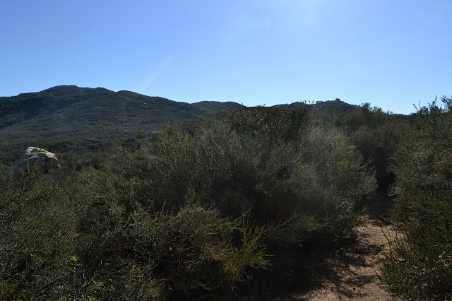
First stop is a little bump just off the trail that seems to be marked on peakbagger. Someone has stuck a bed sheet on a pole and staked it down nice and strong and apparently this makes it a meaningful bump. Provisionally. Some user added it, but it has not been accepted. There is a short spur trail to get up it easily, so I give it a short stop by.


There is still some climbing to do, so I continue on. The peak I am heading to is not even visible yet. I pass by another dinosaur because, well, dinosaurs roam this trail? There are a number of peaks with picturesque granite outcrops at the top along the way. Faint trails seem to head up to each and the chaparral is soft enough that pushing through it would not be too horrendous a prospect. I expect that if the climbing on the granite blocks were considered good, there would be more distinct trails to each.
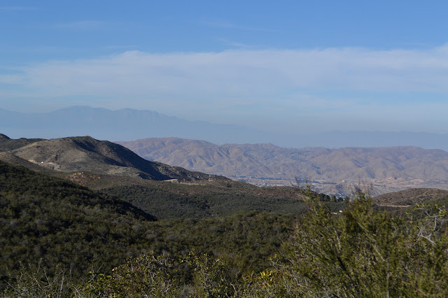


As I have more views into the wilderness stretched out below, I keep examining the canyons for hints of water. Mostly, I want to see sycamore trees with their nude limbs stretching upward. There seem to be none. Sandstone is good at supporting springs, but granite does not have the same porous nature. It obviously supports some and one is even flowing here, but what about others? From this vantage point, water does not seem to be available. I grump a bit before turning off to at least enjoy the peak climbing. The late day is warm but cooling.
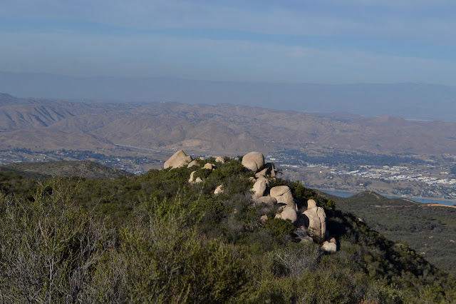
A sign in front of one more granite outcrop informs me I have got to my destination. Climbing up on the rocks, I have indeed found the top. It is a comfortable spot to spend some time.


The trail continues around the edge of the outcrop where there is a hitching post. This is not entirely surprising since there is evidence of horse use all along the trail. It keeps on going after that and with a little more attention paid to that first sign, I could follow it for a loop. It heads down to meet the streets of Rancho Capistrano where another trail continues back to the junction in the canyon. Since I did not, I take the somewhat shorter way back the way I came, stopping at one large rock for a nice, big, cooling hug. It is a little warm and feels like the weather could tip over into a range where the heat is too much for the water I can carry, especially if I lose some elevation.


Back at the trailhead, I am still not certain what I want to do about the three day backpack planned to start tomorrow. My water usage was a little high on this afternoon hike. I will carefully sort through the information I have at hand and see what looks best.
©2018 Valerie Norton
Posted 21 Feb 2018
Liked this? Interesting? Click the three bars at the top left for the menu to read more or subscribe!


Comments