Five and Ten Divide trail work
Klamath National Forest
(Map link.)
It has been a couple years since I actually did some trail work besides kicking the odd log and a lot of sticks off the path. There have been some excursions by the Siskiyou Mountain Club that got far enough south to tempt me, but none had worked out thus far. I noticed they would be working out of Clear Creek for five days and that sounded long enough to make it worth the drive. Is it odd that these California trails are getting a lot of maintenance by people from Oregon? Yep. I also notice that the folks driving out of Ashland are actually a couple miles closer to the trail than I am. I'm coming from another county too. Judging by the license plates on the way, it looks like more people from Oregon are using these areas too. In fact, you can find it covered in guide books for southern Oregon.
Thursday
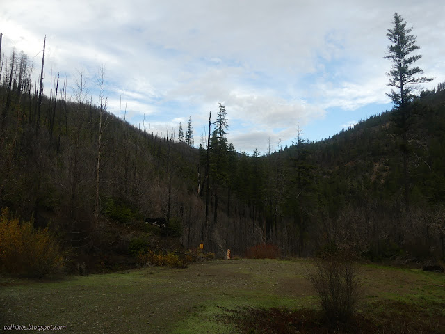
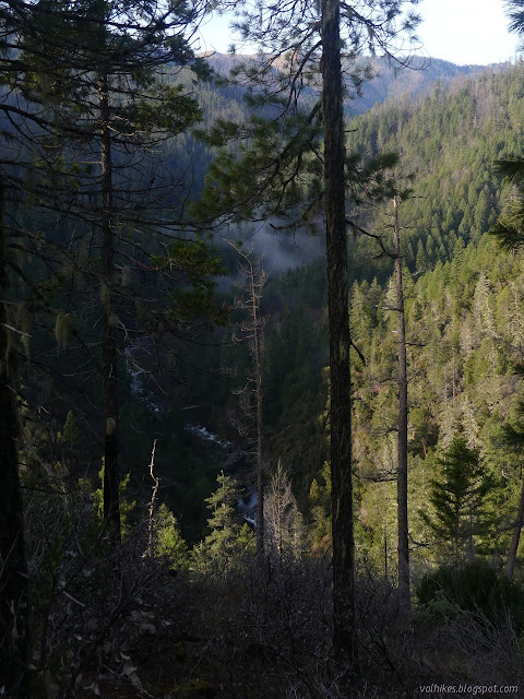
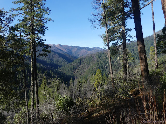
The work planed was not along Clear Creek, but up on the Five and Ten Divide which rises between Five Mile Creek and Ten Mile Creek. This hopefully-not-too-former trail used to connect Clear Creek to the fire lookout on Baldy Mountain. (Not to be confused with the former lookout site on Baldy Peak or the currently used lookout on Baldy Mountain in Del Norte County, just to the west.) More trail connected this lookout to Youngs Valley, the headwaters of Clear Creek, via Elk Lick Ridge. Together it makes a grand ~50 miles loop that follows ridges, dances through high valleys, drops past a lot of history, and follows a long stretch of Wild and Scenic River on National Recreation Trail. Oh, and unlike my Siskiyou loop, there is not the slightest bit of pavement to just get past.

So it surprised me when Luke, whose vision this all is and who was in charge of the volunteers for the long working weekend, took off down the trail with a wheelbarrow full of tools. I sort of expected to have to carry some in. The trail is all old road and camp a little short of the wilderness sign, so it all works out. It meant I had no hinderance in trying to take in the beautiful creek the trail follows.


The trail gets down near some really nice swimming holes. I expected to see camp sites clinging in here and there, but there is no need. The people who come here know it's almost to the bridge and camp just the other side of it.


We set up camp since we didn't want to carry all that working and were expecting a bit of rain in the afternoon and maybe even before. Then to the safety talk and job hazard analysis and grabbing some tools and getting to see what it was we were getting into.


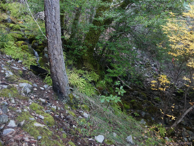
We turned at the flagged junction just before Clear Creek Trail plunges into crossing Tenmile Creek. (That's currently wide and cold, but could be crossed for now.) There's still one sign for Youngs Valley there. We followed up along Tenmile Creek and turned again to start climbing where use trail continues near the water. Then we had work to do. We cut out small logs and cut back the vegetation and made it all a much more pleasant trail to a flat right above the camp.


We had lunch at the flat, then had to face that we'd just worked the most obvious portion of the trail. Above the flat, no one was sure where it went. Then some remnants were picked up again for the final climb to a ridge that it seems to follow. Along there, we could see trimming work, almost all of it not that old. There's none of the blazes one expects. The tour along it turned around at a tree with a notch in it. Deems says this is what you get along this trail. It clearly was cut. Sliced into the bark, but not very deep. It was, in a word, unsatisfying.

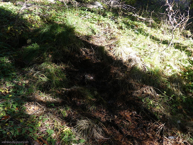
On the way down, I decided to explore the line on the Forest Service map. The trail follows near climbing ridge line on the Bear Peak quad, but drops off the map for the Preston Peak quad. I found one of the stronger animal trails crossing upward from the good trail we worked to the climbing ridge. It would be a nice one to walk up in that area. Luke and Beth were already coming up with nothing searching it for trail. There's another good animal trail that goes back to the flat. The trail shown was still west, so Beth and I headed that way to have a generally green extravaganza that was definitely not in a place with a trail. She kept pushing downward and I think I must have a bit of a green claustrophobia, because I sure didn't want to go down into that. For one, climbing back out of the steep, overgrown hill would be solid work. So we didn't climb back out. We contoured around, eventually coming to something that was very like trail. We arrived back down at known trail right where it starts climbing. The day was thinking about darkness, so we headed back to camp to dwell upon the mix of trail quality. We also dwelled on the difficulty in starting a camp fire before finally getting it done and generally reducing the fuel quantity in the general area.
Friday
Most the rain came in the night and by morning, it was rather misty, but nothing was coming down. We got a 7AM start and got moving. Some work along the way, but mostly trail and climb and trail and climb and trail and check out the used can cache and climb. We actually passed a single hacked in blaze on a tree. It indicated the trail was traveling across the steep hill. Above it, we ate and set to work.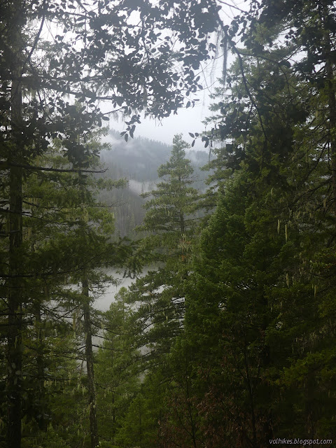
There's three trees in a row, all notched, at the upper end of the flat where we ate. It's not clear where the trail went. Probably along the eroded bit. Then somewhere past the very large fallen tree. I went around the back of a small stand of pines where I had the good luck to find something that looked like tread and the funny thing was it looked just as good as it ran under a tree and some other crud as it did out in the open. I got Greg over to show and he clambered over the tree and branches to find, in about 50 feet, a lovely switchback. That lead us back along a nice slope to a tree and a little further to run into the blaze. Unfortunately, there seemed to be clues that trail actually was going back the other way before that. I pointed this out and Greg took off again to find a second really nice switchback. Not only that, but the tree it wrapped around had a notch cut in it. We followed the last bit down and then lost it again. We were at a very shallow bowl with a couple of gas cans in the bottom. We worked on those for a while. Even after a little work, they were a lot easier to see from the top than the bottom.


We had a deadline to look over the rest of the flagged trail, so we spent the rest of the afternoon climbing to the "key view", which sort of had trail. We hit severe burn area for the last few switchbacks and they've definitely vanished into the soil from which they arose.

From there, we headed up more switchbacks that haven't vanished. The top is a flat area and the trail has gone there. I must admit, I didn't much care for where the ribbons went although they were set according to Deems' memory. He went along the low part of the draw and I stayed high on the west. There is one more hill with no trail still visible and the flag go directly. I found a nice line going off to the left and followed it. Then I turned back along a second line and followed it to the top. At the top, I continued to ignore the flags and took an animal trail to the final destination for the day, a spring. It meant I missed the camp that had been carefully flagged.

By then, it was getting late, so we headed back down. These switchbacks proved to be harder to see from above than below. We kept accidentally cutting them. There's a lot of trails one might use and some of them just aren't at a very good grade.

There actually are a couple more hacked in blazes along the trail by the saddle next to the "key view", but finding trail that skipped one of those and touched a notch had rather soured the blazes. Greg insisted on stopping at one spot for 5 minutes of listening. It was a good moment. I stretched to hear a bird among the buzz of insect and tumble of creek, but failed to. Birds were getting rather disappointing in their absence. We ultimately got down a little after dark, but all good.
Saturday
A couple people left and a bunch had arrived. This was the big day for work. There was report of eight vehicles in the No Mans parking area. Eight! Up a little often 1 lane road that is technically only for 4WD for the last mile! Luke was out to work on the certain bits leaving all the directly up the hill bits to people with paychecks to figure out. He's just a volunteer too. I wanted to check out a bit of maybe trail I should have done the day before. Near the gas cans there was something going down the side away from where our attention had been.


I passed the can dump and got to the hacked in blaze (much deeper on a much smaller tree than the one above) and knew I'd gone too far. I grabbed the ribbons to reroute them to the now known trail, finally realizing that the can dump and the gas cans are at the same elevation, just about 200 feet apart, maybe less. The trail, on the other hand, had gotten more defined in my memory overnight and wasn't much to look at once I was standing over it. It could go wandering down the hill with some much needed switchbacks, perhaps first going under a rather large tree, but it seems unlikely. I searched a bit down that hill for any sign of something but came up empty.

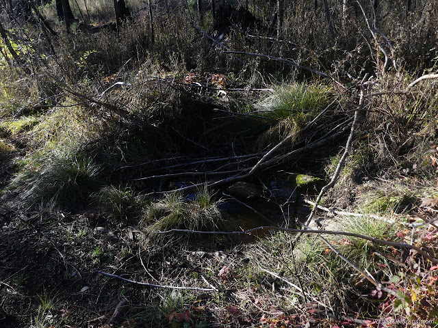
So I headed down. There's one odd bit of trail that seems to travel rather level for a while before climbing. Below it, things looked almost like water and I went exploring. There was more good tread below the now marked trail which goes around and under a tree. The bit getting to diving under the tree looked especially good. I got down further to where I though might be water (there wasn't) and continued on to where leaves looked suspicious. There was water there. I found another spring! Not so good as the one at the top in volume or placement, but something.
Then I climbed back up to the trail and people working only to find myself on the other side of that same tree. The trail goes in a line to it, but then turns up and away on a short but too steep bit to go high a short way and drop back down, but never quite return to the original tread. So there's a little more tread found. It's just debatable if it matters because the tree in question would be dangerous to cut through. It's hanging about 4 feet off the ground because it broke up high.
I spent some time cutting trees, but was entirely too worried about snapping things under stress on a little one and entirely too weak armed to do much on a big one. My just wanting to do something will never quite compare with really liking to cut through downed trees or really liking to cut away brush. When those were done, we went down a much nicer trail than we'd gone up. Just above that first lunch flat, we found some of the folks who are fabled in finding faint wisps of old trails. They were expressing deep unhappiness at having been up and down this little bit of hill six times without finding anything. I had gone out along the bench and upward earlier in the day and maybe found one of these notches on a ponderosa in the middle of it. Or maybe not. It had odd marks around it that were insect related and didn't quite look cut. Anyway, who notches trees? Even if they do seem more authoritative on this trail than the few blazes. They also had teased out the thread of a trail that was a visible shelf along the side, then faint, then visible, and found it goes at least a half a mile with old flags. It was getting dark and we all headed down for the evening.
Sunday
The plan for the day was to follow the mysterious trail off to the side although it didn't seem to be in any hurry to climb over the half mile known. An early start was wanted again, but without a wake up, we weren't really certain it was time and so some of us were late. Me, I was definitely late. They said just follow the flags and I knew where the start was anyway. Others started working on it, but I was suspicious a hypothesis put forward the night before for it might be right: it's the old Clear Creek Trail. Only a hypothesis.
Of course, I really just wanted to travel it too. The others say that at least the bears will like the work whatever becomes of it. The bears seem to make it happen when they need it.
I got to the flat the others had gotten to the day before and got to pondering it a little more than the flags. It looks like an excellent place for a camp, with water not too far back along the trail. I wandered it a little bit, finding nothing constructed of a camp.

I circled back to the western side of the flat and pondered the trails that climbed from there. One of them looked quite good. I wandered back the other way looking for flags again, but was blind to them dropping off the side because I was feeling a strong feeling that this is where one should turn back if one were, say, to be aiming at the faint "i" cut into that one tree. There is a wide ramp (undoubtedly an old debris flow) with not too steep a slope on the east side that the fire opened up into a nice walk up that I decided to take. (Look, the trail is a bit of a fight to walk and there's a great log near the start I wouldn't be able to reverse my path over.) I looked around as I went for signs, but the first bit seemed too similar to that hillside near the "key view" that certainly doesn't hold much trail now.
I found more flats (and more illusionary trail where the rocks seemed to align along an edge and the bushes left a space) along the way with some pretty easy travel for the most part. Then I ran into a gash rather like the one that is rerouting Boundary Trail south of Harrington Mountain. The Forest Service map showed me near the bottom of an unvegetated area, so I went down. I should have gone down a little further and just stayed along the flat for easier travel. I did eventually. When I stopped, I heard all those birds I'd been hoping to hear when we had the 5 minute listen with Greg. Then I ran into the flag line and hiked back down it seeing no one at all. When I picked up my tools, I thought I saw madrone across the potential trail, but that was just another misreading of the situation. I was still not quite to where trail had been settled on. I continued down and got to enjoy the creek from the bridge during the few hours when it is not in shade. Others arrived back a little later in the afternoon. (Also, I probably shouldn't be so ready to just strike out on my own. Perhaps.)

The others reported that they had followed the trail, neither rising particularly nor dropping, to the edge of the main ridge, then turned up to follow the ridge to the top. That way the trail trackers got to see what was up along the worked route as well as this mystery trail. (The ridge was known to be passable, so it gets the job done.) They got a grand view of Marble Mountain topped with snow. Luke got a look at the trail he wished he'd been able to release all those Saturday hands onto there following the ridge. They then dropped not too long to the spring and on down, showing off the nicks and blazes and bits of trail that are there to comments of "interesting" and suchlike.
It really is interesting. That trail is particularly mysterious. It appears to be properly built, although a long time ago. Surely if it was the old Clear Creek Trail before some bridges, it would have dropped down because it has to cross Five Mile Creek soon after the ridge. If it was the old trail along the ridge, it would climb more. Looking to the maps offered by USGS, the 30' series from 1922 show no trails between what was then the North Fork and Boulder Creek, nor any trails downstream along Clear Creek. Besides renaming North Fork to Tenmile Creek, there is no change in the more recent editions. The 15' series from 1955 and 1956 show a route that follows Tenmile Creek and stays down on the west side of the divide, finally cresting the top as the ridge turns northeast and actually passing on the west side of Boulder Peak. Also, Boulder Creek has become Fivemile Creek. There is road up Clear Creek that stops at the bridge over Clear Creek just past Fivemile Creek. The road is much further down the canyon than the found trail. The 7.5' Forest Service maps from 2013 (that can be accessed via Caltopo) have some head scratching details. The road up Clear Creek is missing, the trailhead is there, the trail is missing although it is labeled. It shows trail very roughly following our worked trail, although it diverges at the top to gain the ridge a little further north. (Still much further south than shown on the 15' maps.)
One could imagine (and imagining worked out for that eastern switchback, maybe not so much here) that if a guard were tasked with placing a trail between the lookout on Baldy Mountain and whatever the building shown just the other side of Tenmile Creek on the 15' series, they might not utilize the ridge line. They might drop down Baldy Mountain Ridge toward Fivemile Creek somewhere, then cross it up high and proceed to contour right around the edge. One could also imagine that if this is the case, the trail has been built three times over the last 100 years. Or maybe it's something not so old or well built as it is being taken for and is just the travel of a survey team for the wilderness boundary, which is suspiciously close to that contour.
Monday
Faced with a head scratching confusion on the trail and basically done with all the work we were feeling certain about, we didn't really need to stay until Monday. But it's a fine camp and we decided to enjoy it one more night and easy morning. Then on to the hike out, which was much colder along the south side of the creek where the shade was nearly continuous.
It didn't quite turn out as planned on this outing, but the big loop will happen. Switchbacks will get picked out for the steep bits along this section and much of it is already done. (It is still an adventure hike for now.) There's already another planned. It'll go better.
*photo album*
©2021 Valerie Norton
Written 30 Nov 2021
Liked this? Interesting? Click the three bars at the top left for the menu to read more or subscribe!


Comments