Posts

Showing posts from July, 2021

Elk Head and College Cove

Image
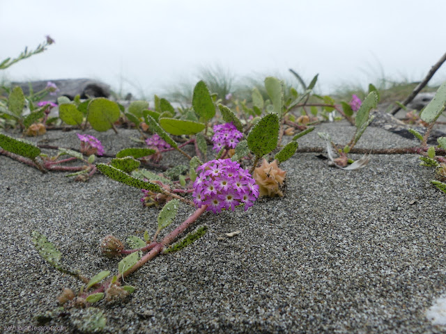
Trinidad State Beach (Map link.) I have been neglecting Trinidad State Beach and I decided to rectify that for the moment. There are three main parking areas. One is down by the harbor and the other two are along narrow Stagecoach Road. I stopped at the main parking and picnic area with its paved, pull in parking, and cut across the lawn past one of the tables to an unsigned trail just east of the bathroom. It cuts down to a neighborhood access trail that roughly follows the road to the east. I turned west, which gets into the small trail system instead. One official route down from the parking lot. It is unsigned, but has wooden step improvements. The trail stays fairly high on its way to a junction with an obscured beach view. I looked at the narrow, weed encroached trail heading downward and wondered if that was what I was really looking for. I followed the recently worked to a wide footpath trail upward to find that it probably was. It got to looking more official on...

Ma-le'l Dunes South

Image
Friends of the Dunes Bureau of Land Management (Map link.) The mix of plants was different at the north end of the dunes compared to the south end of the dunes, so I simply had to actually stop by the south end ready to record what I saw. While I was at it, I thought I might do the Redwood Edventure Quest that Friends of the Dunes offers . It's been a while since I did one of them. It says start at the Humboldt Coastal Nature Center, and that's what I did. The Humboldt Coastal Nature Center at Friends of the Dunes. There is a little parking at the top, but I don't need to do that extra driving. The nature center was open, but I wasn't feeling the need to go in yet. I walked around the edge to find the Wildberries Trail and the first of the markers. This Quest was the most like a traditional interpretive trail because all but the last are marked with physical posts. These are marked with animals instead of numbers, but I missed the little bit of extra engage...

Hookton Slough

Image
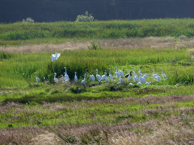
Humboldt Bay National Wildlife Refuge (Pink. Map link.) I headed over to Hookton Slough. It has a more generous gate timing of closing at sunset. The trail follows an old levee along the edge of the slough almost to the beach below Table Bluff. The wildlife refuge ends there. Since beaches are public, you can probably continue on at low tide, but I've not done this. I just strolled along the levee. Since they don't allow dogs, horses, bicycles, or even running, that's all one can do without a boat. They do allow you to put in with an unpowered boat and start in on the water trails through the bay. The rock armored edge of the levee beside Hookton Slough. I spotted movement in the water and found striped shore crabs in abundance among the rocks put down to armor the levee edge. They seemed to see me, too, and tended to be scrambling away. Not all of them, though. Some stayed out to be photographed, albeit underwater. A couple of the striped shore crabs on the...

Shorebird Loop

Image
Humboldt Bay National Wildlife Refuge (Map link.) It can be sunny on the coast if you time it just right. I went for a sunny round on the Shorebird Loop in the Salmon Creek Unit of the Humboldt Bay National Wildlife Refuge. The parking lot is open, but when going for that brief window of sun in the afternoon, it is important to realize that they close at 5PM. It is tempting to think sunset or up to an hour after like practically everything else with gates, but that is not the case. In summer, it's also important to notice the actual time because the sun is still very high at 5PM. The trail starts on the boardwalk at the visitor center where signs helpfully note that the gate closes at 5PM and this is a tsunami hazard area. The have an otter on display until September . The visitor center is still closed, but it's by a window so everyone can admire one side of the art. I headed out pondering the wet areas and the birds. The migrating ones that spend so much time s...

Bug Creek and Chaparral Mountain

Image
Six Rivers National Forest (Map link.) I got an email from Ken Burton asking if I might want to come along as he checks out Bug Creek Trail 4E26 for the upcoming edition of Hiking Humboldt vol. 1 . On the one hand, I'd just gone . On the other, it's a special place. I rather suspect that it isn't quite so obviously a special place in the middle of July when there's no mats of fawn lilies here and there, but it still deserves a look. Besides, I'd barely done the part of the trail out to Chaparral Mountain, which was the object of this exploration. So I said yes. (Look at me, I'm actually meeting people!) We picked the coolest upcoming day (predicted high of 66°F) and got up there the evening before for the easier early start. Camp was about a quarter mile short of the trailhead on Board Camp because the Subaru didn't make it the last 200 feet. Except for the shout of a mountain lion uncomfortably close to camp, it was a quiet night. She wasn't hun...

Centerville Beach to the mouth of the Eel River

Image
Centerville County Park and Beach (Map link.) I keep hoping for a sunny, or sunnier, day to hike out to the mouth of the Eel River once more. It's July, it isn't going to do sunny. Even when it is sunny a mile or two inland, the beach is shrouded in fog. I also keep hoping I'll contact the Wildlands Conservancy to find out a little more about their properties to make it a more interesting hike, but that doesn't seem to be happening either. There are two properties in the area. The southern property is Sounding Seas Dunes Reserve , which is open to the public and "may be reached by hiking north from Centerville Beach County Park". (Pretty much everyone except the county calls it Centerville Beach County Park.) That is the complete information offered for location. The northern property is Eel River Estuary Preserve , which may be visited by reservation only. There were some grants many years ago to try to make it more accessible to the public, but those ...

Ma-le'l Dunes north

Image
Humboldt Bay National Wildlife Refuge (Map link.) I was out to Friends of the Dunes on Saturday for the "Dune Ecosystem Restoration Team" event yanking invasive beach grass from the foredunes, and it made it quite clear the seasons have changed since I was last on the dunes. The shore buckwheat is looking rather stunning and there's lots of other flowers out now too. They're all really enjoying having the room that was once a near monoculture of invasive. (See the calendar here for similar volunteer opportunities.) I decided to visit the north part of the Ma-le'l Dunes once more . They're not too keen on any fast movement in the conservation area, so no dogs, horses, bicycles, or even running. I followed Tsoutsgish Trail along the old railroad grade. Trees on one side are slowly falling into the slough and trees on the other slowly getting suffocated by sand. We try to remember that this is alright. This is a land of change. It sits on sands and s...

Prairie Creek, Foothill, and West Ridge loop

Image
Prairie Creek Redwoods State Park (Map link.) After hiking Hope Creek , I still had a few hours before dark to wander trails. Where to find a gnome plant? Since my GPS is rather primitive, I had elected to name the points in it according to how accurate they were. Knowing the accuracy helps me not get wrapped up in looking around an area only defined to ±1km, but wasn't as helpful for finding a specific plant. There were quite a few points near the visitor center and a couple up on West Ridge, so I decided it was time to finish off walking West Ridge. (As I walked it, it's parts total: this south bit, the middle , and north .) Parking near the visitor center was a little crazy. People were waiting for the 15 minute spaces next to it. I found one space near the campground and there's approximately half a mile of parallel parking along the meadow, so they weren't actually about to run out of room. I wound my way likely the long way around to get to the visitor cent...

Ten Taypo and Hope Creek Loop

Image
Prairie Creek Redwoods State Park (Map link.) After returning to the Rhododendron Trail the previous week to see how the budding parasitic plants were getting on, but missing most of them , I prepared a little more to find them and returned. I noted the actual locations I found the plants, then for good measure checked out where everyone else had been finding monotropes (that is, subfamily Monotropoideae, which includes snowplant) around the park. I'm less interested in the wintergreens (genus Pyrola) or the other wintergreens (genus Chimaphila), but there were plenty of more interesting points left. They seemed to cluster around the Hope Creek Trail. That was a nice find. I'd rather not do the same trail three times in a month. I need variety! And since I've done Hope Creek in the past year , I elected to change the direction and loop counter-clockwise. It may delay the gratification, but will be a little different experience. Of course, there's a whole lot o...

Little Creek

Image
Prairie Creek Redwoods State Park (Map link.) I was out to Prairie Creek once more searching for those funky parasitic flowers that I had missed the week before, but didn't have a full day planned. I decided to stop by the couple of little trails I've not done along the way. These are much smaller than the others and only marked by a trash can and a small sign. They don't even get warnings that a trailhead is ahead along the road. I missed the first, but stopped at the second. All that marks the trail is a trash can and a barely visible sign. The sign says "Little Creek 1.0 mi", which is a promise it can't keep. I started up it, past the sign saying it is a mile. It swings away from the creek, climbing, then stays high and fairly flat. It seems a little less used, but well established. There are a couple trees down across it, but nothing one can't go under or over. A bit of that trail with one of three trees being a nuisance. A little more...