Bug Creek and Chaparral Mountain
Six Rivers National Forest
(Map link.)
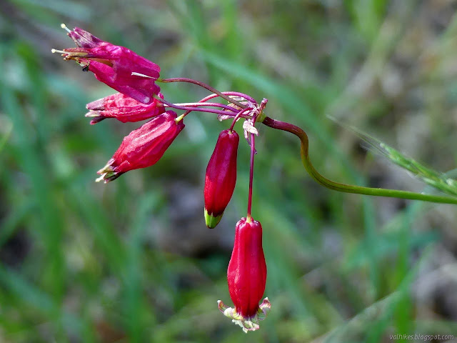
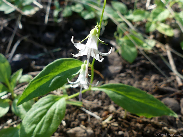
I got an email from Ken Burton asking if I might want to come along as he checks out Bug Creek Trail 4E26 for the upcoming edition of Hiking Humboldt vol. 1. On the one hand, I'd just gone. On the other, it's a special place. I rather suspect that it isn't quite so obviously a special place in the middle of July when there's no mats of fawn lilies here and there, but it still deserves a look. Besides, I'd barely done the part of the trail out to Chaparral Mountain, which was the object of this exploration. So I said yes. (Look at me, I'm actually meeting people!) We picked the coolest upcoming day (predicted high of 66°F) and got up there the evening before for the easier early start. Camp was about a quarter mile short of the trailhead on Board Camp because the Subaru didn't make it the last 200 feet. Except for the shout of a mountain lion uncomfortably close to camp, it was a quiet night. She wasn't hunting, anyway. Not exactly.


It sure it a lot faster to that western junction with Wallace Camp-Forks Camp Trail when not having to tread through an extra two miles from the pavement to Board Camp Mountain. It's a much greater percentage of ridge top as opposed to under the trees, too. I checked the lilies I had seen starting (looks like they dried up without flowering) and the fritillary (no sign at all) on the way past.
Now for the harder bit. Our plan was to take the southern trails first, so I pointed at the shot off trail marker and we shuffled through the little oaks to the trees. There I pointed at the grey diamonds nailed to the trees and we tried to ignore the general lack of tread. I think I pointed out the shuffle over to the badlands too early, but we popped over the little hill to something like a trail through it. There's a little tread after the badlands, but the markers get harder to find.
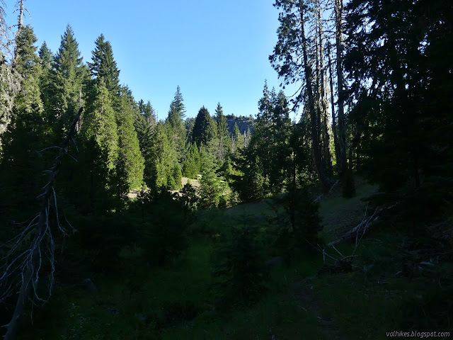
Not one hint of the carpet of fawn lilies remained as we reached the rock outcrop above the waterfall. Probably not much waterfall, either, but there were puddles high in the creek and flow further down. From the rock, opinions are divided about what is trail. There are markers to be found if you go low or high. Ken had no division of opinion and went up, which is exactly how I looked at it a month before. Low is very reasonable, as I found out then on the way back. We followed paths, not always the same, generally on the south side of Bug Creek. Where I knew there was good marked trail low on the north side of the creek, I followed it. Ken took good trail high on the south side and seemed happy with it too. We managed to skip the extra stuff going around the bend and suddenly were at the meadow with a small campsite. I've got to remember to stay lower on the south side in that portion.
It wasn't much of a confluence as there were only puddles in the tributary. It's uphill from there, very gently at first. We passed a much better used campsite and then faced off on the non-existent junction.

The map says up the hill. The hill is steep and covered in broken rock. We backtracked slightly to the drainage and joined with another trail that came over the hill from the other side. Options. Then our travel was halted to let a mama bear do her thing, which included some bluff charges. We backed off further. Neither of us had actually encountered bluff charges before.

After the bears had gone, we waited a bit longer to let them really vanish then continued up. We lost all vestiges of trail. I thought I saw things that looked familiar and ended up taking a route more to the left of what I expect is approaching proper. It gets brushier down the hill making travel more difficult. I never found the bit of old tread I'd thought I'd followed the other direction until the very obvious junction on the far end. I've seen junctions that vanish as people cut them to varying degrees, but the trails stay strong. This is the only time I've seen it the other way around. From that junction, there's often tread and almost enough markers to keep one on trail right to the end.
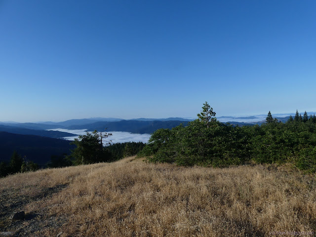
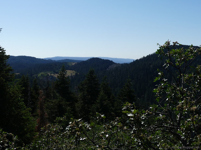
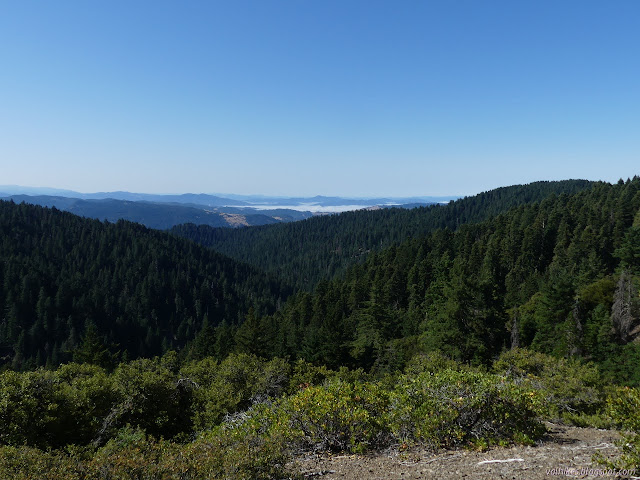
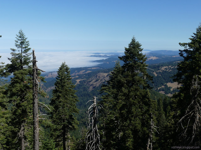
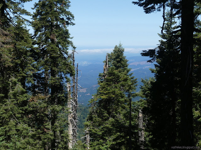
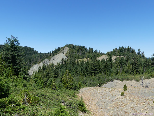
We hit the chaparral ridge and its grand views. I'd somewhat forgotten that there was this more universally appreciable part of the trail on the way to the peak that is, well, rather sheltered with trees.
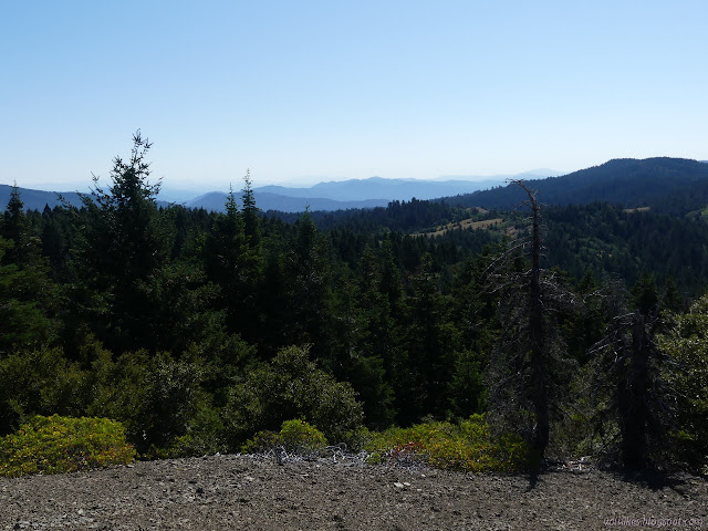
It becomes forest again and the trail actually seems to get better. That and where it goes were mysteries I really wanted to solve. The thing is, it is over 200 feet of unnecessary drop and then who knows to find out and I was the only one who wanted to solve this mystery. I pushed because it's just been this nagging thing and we went.
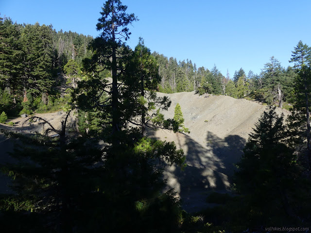
It was rather anticlimactic. The trail was good as we lost all that elevation. The markers run out at the forest boundary and the trail runs out at a junction of mysterious roads. One comes in high from the north and leaves high to the south. Another leaves low to the south. Maybe one of them follows what the trail used to do, but there is no way of telling now. I can't seem to find it on any maps past that point. At least it was short. But it is very nice to no longer have that nagging.

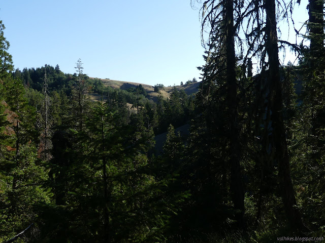
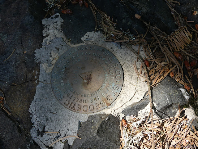
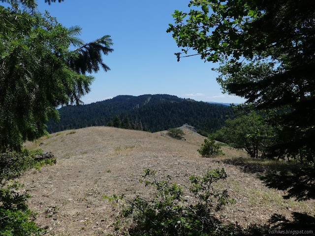
So we turned back and soon left the trail to head for the peak. It was clear enough under the trees to travel easily, but the ridge line itself was choked with little scrubby oaks. Gamble oaks (Quercus gambelii) or Brewer's oaks (Quercus garryana var. breweri, another subspecies of the nearby taller Oregon white oaks), I expect. We seemed to pass some surveyor markers, then we arrived at the mapped surveyor marker at the peak.

The peak has a small clearing that makes the forest feel comparably claustrophobic. The trees stand tall all around it totally blocking off any view. They are narrow, so perhaps it was clear when the benchmark was placed nearly 100 years ago, or they just grow very slowly. The original reference mark is up on a boulder that would be a fun scramble for a 5 year old, but maybe not much to the 5 year old that could make the hike to it. I had to dig a little to find reference 2 again.
We started down the other side, cutting over to the trail fairly quickly, then continued on to the northern parts of the trail. For the first little loop, this is as mapped on the Forest Service quads and includes markers and some tread. They don't entirely agree with each other, but they are there. We followed the tread down while the markers took a higher, more gentle approach to the slope. I think. Once we left them, they are hard to see. This way may be longer, but the little valley is more picturesque.
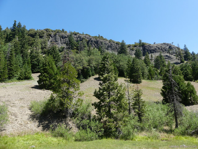

Back at the invisible junction, we struck out again across the meadow and each found our own way upward through forest and scrub and more meadow. I practiced an "any trail will do" strategy, picking the ones that seemed to mostly point my way. I finally hit the scrub oak at the top and found the bit of trail through it that I'd found when going the other way. We intersected what has become of the trail and rolled along it through the hills. I stopped just inside the shade of the last oak and pine trees at the top of a hill. I was really feeling the heat, especially as I had forgotten my hat. Ken wanted to retrace some trail for extra solid tracking, so I got a little longer in the shade.
We took off through the dry meadow, down under the sun and up again with patches of shade. It wasn't too bad after drinking plenty of water under the trees.


Then there's the ridge. The first part has a lot of shade, but the last climb is rather sunny. Once I really wanted it to have shade, I found that it frequently does. There are places to rest and cool on the way up.

We were back at camp by 3PM with the temperature gauge on the car claiming 70°F. That may be warmer than predicted, but certainly doesn't justify how hot I was feeling under the sun.
*photo album*
©2021 Valerie Norton
Written 2 Aug 2021
Liked this? Interesting? Click the three bars at the top left for the menu to read more or subscribe!


Comments