Centerville Beach to the mouth of the Eel River
Centerville County Park and Beach
(Map link.)
I keep hoping for a sunny, or sunnier, day to hike out to the mouth of the Eel River once more. It's July, it isn't going to do sunny. Even when it is sunny a mile or two inland, the beach is shrouded in fog. I also keep hoping I'll contact the Wildlands Conservancy to find out a little more about their properties to make it a more interesting hike, but that doesn't seem to be happening either. There are two properties in the area. The southern property is Sounding Seas Dunes Reserve, which is open to the public and "may be reached by hiking north from Centerville Beach County Park". (Pretty much everyone except the county calls it Centerville Beach County Park.) That is the complete information offered for location. The northern property is Eel River Estuary Preserve, which may be visited by reservation only. There were some grants many years ago to try to make it more accessible to the public, but those don't seem to have gone anywhere. This second property is where there is greater opportunity for a more varied walk.
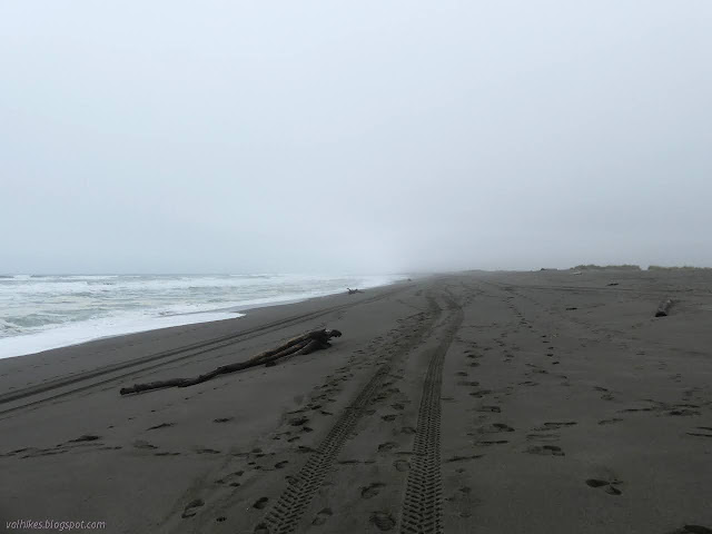

I soon came upon a rather odd feature on the beach. Waves were washing over a harder piece of land that seemed like a bit of mudstone. What could it be? Well, off road vehicles are allowed to drive on the waveslope north to the river mouth and south to the California Coastal National Monument, plus a corridor to get from the road to the waveslope. The "waveslope" is legally defined as "the area of the beach that shows evidence of having been washed by waves during the last tidal cycle." Those tracks in the pictures above are legal. The trouble is, far too many of them don't stay there. They don't even stay on the beach where there is absolutely no vegetation growing. They go up into the grass covered foredunes, into heavily signed private property perceived as public property (the Sounding Seas Dunes Preserve) and right into explicitly signed private property of the Russ family. (Like the ones that gave Ferndale a park over 100 years ago.) The off-roaders would probably be going more deeply onto that private property except there's vast ponds that would probably mire the vehicles. The foredunes have vanished from this area once the vegetation is gone. The preserve has lost 20% of its area since acquisition. As I examined the apparent mudstone, I found the broken off stems of grasses along the top surface. It is one more piece of ranch washing out into the ocean, all thanks to the people who believe the rules don't apply to them. And then they wonder why the rest of us want to stop them from "just having fun" in such a destructive manner.

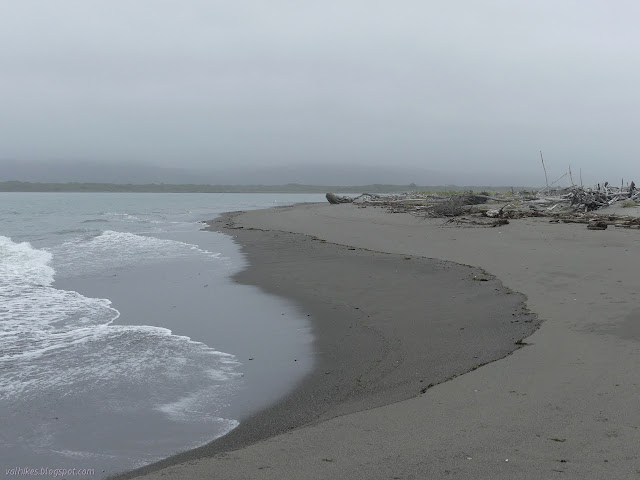
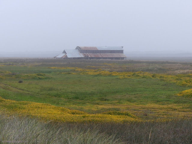
I continued on, passed by the only other walker of the day and four ATVs leaving tracks that wouldn't wash away with the next high tide. At least they were mostly down the beach when I saw them. Beaches without such traffic have a scattering of plants coming down toward the waves, but not this one. I was approaching something that is a bit of a landmark for those who walk this beach and another consequence of the off roader need to crush ever more vegetation. The hulk of a barn, somehow still standing although the ground had washed away beneath it, lurked in the mists ahead. I strolled across the flat beach still missing foredunes to see it closer.
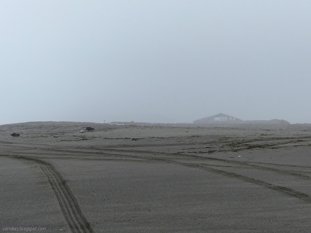
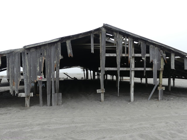
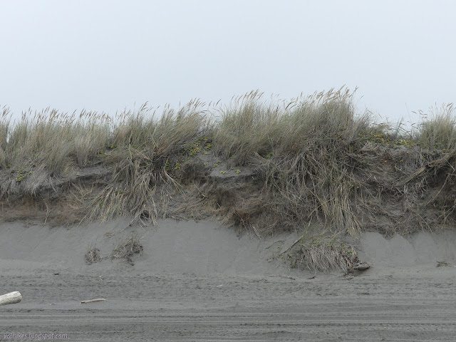
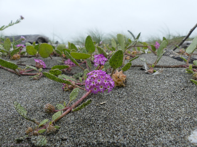
There's frequent "private property/no motor vehicles" signs around the barn and "conservation easement boundary" behind it. (That's my boundary as a pedestrian.) The motor vehicles have been doing donuts around them to make it clear they see the signs, they just don't care. There's actually a few remnants of dunes north of the barn. Something to save if quick action is taken.

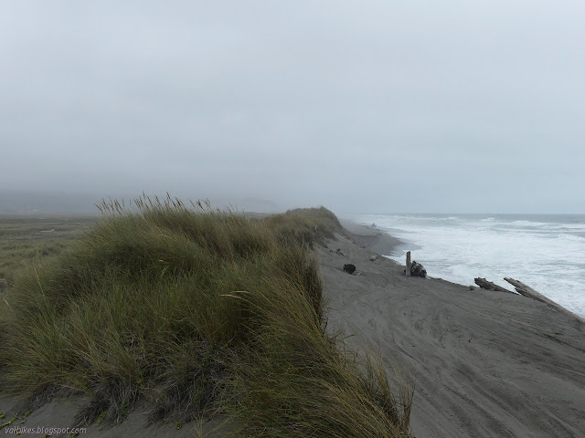
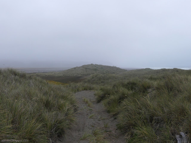
I wandered back down to the beach to continue north and remnants of hills became actual hills. The taller, stronger hills of the invasive marram grass, but at least there's hills. In one spot, the beach was very narrow with a sand cliff below the grass. The rising tide required a little timing to get past below the cliff.

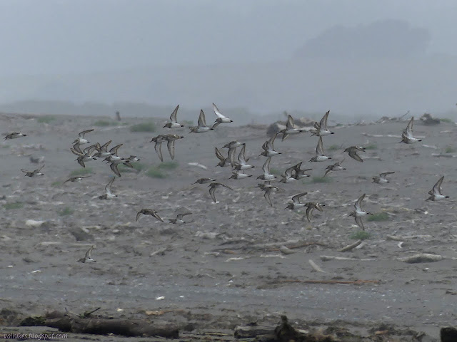
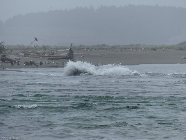
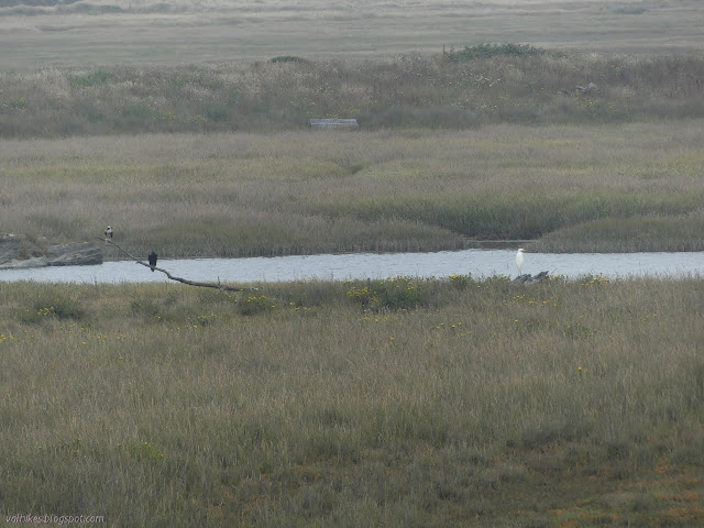
There got to be more pebbles and rocks and I got close to the river mouth. The Eel River has the highest sediment load of any river its size or bigger in the 48 contiguous states, and there it is. I saw more and more heads poking out of the water whenever I looked out over the waves. I also saw a lot of birds as the dunes flatted out into a changeable spit. They would erupt into great churning balls of flight for no reason and were something to watch as they flew nowhere in particular together.


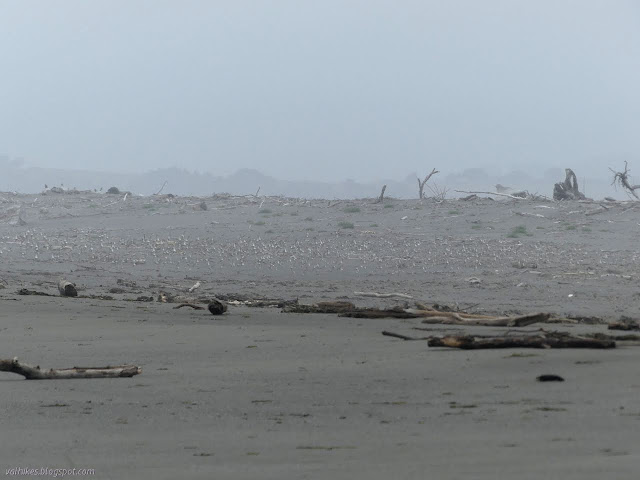
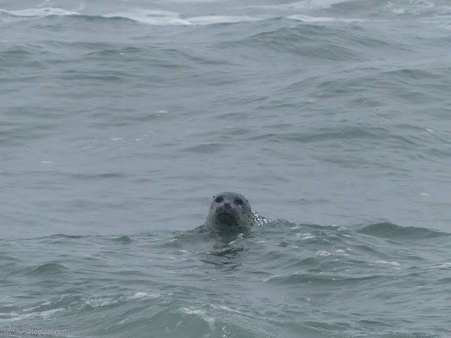

I made it to the end of the spit. There were no fishermen at the Eel River mouth like on my last visit. Just choppy water and those seals watching. There's at least the impression of a lot of water moving. The river didn't seem like so much under the bridge on the way and the tide was just about perfectly at the high point. Still, there it was, powerful, moving water.


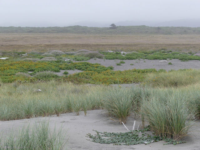
I continued around the river edge of the sand spit where the water got very calm. The estuary is vast. I do wonder why this one doesn't form a lagoon the way the others north along the coast do. Even Humboldt Bay is really a very large lagoon, averaging 11 feet deep, getting to 40 feet deep only because it is dredged, that used to close up and fill and breach just like the smaller lagoons still do. Maybe it's all that sediment filling it in.

I headed back along the dunes. This should have been easier, with lots of grass holding the sand together, but filled with more stabby annoyances, than it was. I stayed between the "private property, no motor vehicles" and "conservation easement boundary" signs, which generally left me the space all the way to where the backs of the dunes wasn't so steep.


As I came to the shortened barn, I was left with just flattened beach to walk, even far from the waves. I watched wisps of mist shuffle across it all as the fog thickened again, then made my way among the scattered plants desperately trying.

I picked a particularly bad day once giving up on sunshine. The day had only cleared enough that when I got to the mouth, I could only see faint shadows of the cliffs to the south and the trees on Table Bluff to the north. By the time I finished, it was practically raining.
*photo album*
©2021 Valerie Norton
Written 27 Jul 2021
Liked this? Interesting? Click the three bars at the top left for the menu to read more or subscribe!


Comments