Ma-le'l Dunes South
Friends of the Dunes
Bureau of Land Management
(Map link.)
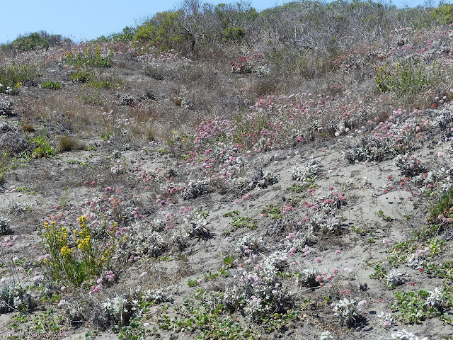
The mix of plants was different at the north end of the dunes compared to the south end of the dunes, so I simply had to actually stop by the south end ready to record what I saw. While I was at it, I thought I might do the Redwood Edventure Quest that Friends of the Dunes offers. It's been a while since I did one of them. It says start at the Humboldt Coastal Nature Center, and that's what I did.

The nature center was open, but I wasn't feeling the need to go in yet. I walked around the edge to find the Wildberries Trail and the first of the markers. This Quest was the most like a traditional interpretive trail because all but the last are marked with physical posts. These are marked with animals instead of numbers, but I missed the little bit of extra engagement the usual directions require to follow along.


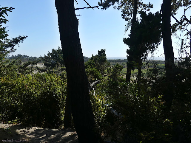
The vegetation changes quickly on the short walk toward the beach. The trail drops low and the vegetation gets tall with the greater water availability.


Then up the trail goes again, following between trees in the low spaces and buckwheat and its neighbors in the high spaces.


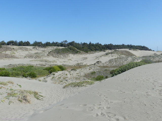
I came to the end of the trail and just about the end of the quest. It finishes out on the beach, looking back at the dunes and observing the difference between where it is crowded with invasive marram grass (with thin blades) and where the native beach grass is now returning. I couldn't quite admire the most recent work I'd helped with because we were actually just on the inland side. If it gets too complete, they'll have to rewrite the quest. (If you'd like to lend a hand, volunteer opportunities are on the Friends of the Dunes events calendar. Currently, there are two a month: 10AM-1PM on the 2nd Saturday at Friends of the Dunes and the 3rd Sunday at Ma-le'l Dunes South.)

I found the clue for the finish of the quest, which was basically a crossword clue, and failed to immediately figure out what the proper answer should be. I hit the beach and headed north. I was determined to take the trail up through the tree stabilized dunes in Ma-le'l Dunes South which hits the beach about half a mile north of the Wildberries Trail.


The trail was marked at the beach by a couple vertical sticks someone had placed. Behind them was a more official sign. Then there was the long sand ramp up to the nice walk in the woods at the top. That is the drawback to this trail hiked from the beach.


I got over the last lip of sand and onto the apparent soil within the forest. There's partly obscured views of the ocean on one side and more trees on more hills on the other. It's really quite impressive how steeply the sides of the hill drop.


Coming to the end of the trees, I dropped down and wound my way on the lower trails back to Friends of the Dunes. Mostly, I followed the waterline back. I got back after the nature center had closed, but I still hadn't sorted out the correct answer to the quest, just redundant answers.

*photo album*
©2021 Valerie Norton
Written 16 Aug 2021
Liked this? Interesting? Click the three bars at the top left for the menu to read more or subscribe!


Comments