Posts

sketches

Image
Sketches for both July and August. I seem to have neglected these last month. I was thinking, "Well, there is only one," but there was actually three. Resting by Twin Lakes and watching the waterfalls . The peaks that attracted my attention the most while planning. Just wandering the local trails, this being the view from along McMenemey Trail. Watching the water flow : Evolution Creek. Enjoying the forests underwater and overhill from Trout Farm Campground in Malheur National Forest. View of the mountains as we bed down, ready to get to the best spot for watching a total eclipse.


Lloyd Lake

Image
Golden Gate Park Click for map. We stopped by the park on the way through. There is actually plenty of free parking along the streets near and through it. Count me surprised about that. There are also plenty of people walking around it and, on a Sunday, plenty of parties going on. But I guess sometimes you just have to sit by the pond and watch the ducks. Turtles too. They were not easy to scare. The ducks mostly come in pairs. They are a bit easier to scare.

Bolinas Lagoon

Image
Point Reyes area Click for location. Driving past Bolinas Lagoon, we stopped to try to take it all in. Taking in the lagoon from a tiny point of land beside the road.

White House Pool Park

Image
Point Reyes area Click for map. We stopped at the park at the edge of the Tomales Bay Ecological Reserve not certain what we would get. It is a popular little spot by the cars in the lot, but the one picnic table sits unused. And here we are, at the start. We pop over the bridge and start wandering the trail. It edges past the nearly static waters of Lagunitas Creek. They sit like a long, thin lagoon below a steep bank. A few ducks can be found upon them. Tall grasses edge the water in some places.

Mill Creek mill

Image
Del Norte Coast Redwoods State Park Click for map. The map says "former mill site" and I was curious. The sign at the bottom of the road said only open on weekends, so checking on it the previous evening did not work. The gate is open now and up we came to the end of public travel on the road to where there is a large parking lot surrounded by blackberries. There is something large across the creek from the parking area, but the blackberries on the steep banks do a rather good job of blocking any direct access. Roads are supposed to curve around to there, so we start up the road past the gate. The forest beside the road. A mighty stump a short way up the hill from the road, but there are none further up. Mills generally kept a small grove of old growth trees nearby and we are walking at the edge of the one that was kept here. There are big stumps off to our right a short way off the road, but none further than about 50 feet. Some big trees can be seen high ...

Lady Bird Johnson Grove

Image
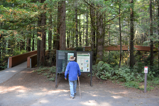
Redwood National Park Click for map. The coastal redwoods do not get too close to the coast, they like a buffer between themselves and the salt air, so after the coastal wander we still needed our daily dose of tall trees, preferably old growth. Going from the obscure to the well advertised, we stopped by the Lady Bird Johnson Grove just in time to watch a logging truck full of redwood zip under the bridge and down the road marked "not recommended for trailers". This may be the national park and the road may look small enough to be going nowhere much, but it goes all the way through, which is not that far, and out into private lands owned by logging companies. A little information and a road crossing bridge to start the trail. Across the bridge and into areas logging companies salivate over, but as yet cannot touch, we get into the serious business of looking up. This is an interpretive trail and there are plenty of brochures, mostly well used, tucked away in the ...

fake farm houses

Image
Redwood National Park Click for location. We headed out from High Bluff Overlook going north on the one way section of Coastal Drive. The continuation of the California Coastal Trail as it heads over Flint Ridge is obviously marked, but warns that a bridge is out some miles away where the trail is closed. A little further is a seemingly random roadside sign. We stopped to find some World War II history. A building that was disguised as part of a working farm. Below the road are two buildings that were built to appear as part of a working farm perched out here on the edge of the land. The disguise is meant for passing ships, overhead airplanes, and even travelers on the road. We take a short trail down to see what they really are. Big, boring cinder blocks with an elaborate wooden facade.

Coastal Trail Tey-wo-lew section

Image
Redwood National Park Click for map. The California Coastal Trail is a long trail in the making. Unlike the "Pacific Crest", it goes through areas where people crowd in, so it might forever be in the making. It also has an awful lot of road hiking, but maybe less so in the north. This part is a mostly abandoned piece of the Coastal Drive that is about 3 miles from gate to gate. It seems likely to be a lovely bluff top excursion through the trees above the roaring surf. Also quite easy. The start of the restricted section of road. Hikers and bicycles only, no dogs or horses. It is foggy and it is paved, although the paving is inconsistent. It does look like someone gets to use this road. Coming to a turnout, it is clear that this road was built for public use. On the left edge, there is an interpretive sign. The surface has nearly become a uniform yellow from age, but it can still be read. I stop for a moment to learn about the beach below and how gold has been ...