Piru Creek from Hardluck
Los Padres National Forest
Hungry Valley State Vehicular Recreation Area
Map link.
I headed again to Hungry Valley, this time with multiple plans. The road is marked as open 1 May to 1 Nov, but was open for hunting season, but now that the deer are safe again, the road can't be expected to be open. At the entrance station to Hungry Valley, I found out that the forest doesn't keep the state informed about the local area or even supply them with the free OHV maps, so all I found out was that there was a bit of a rough spot at the start of the Piru Creek ford going up Alamo. I set off to try to get to the upper end of Snowy Creek trail, listed as closed but doesn't say if that's just to bikes or all or if that's the whole trail or just part. I found that the ford was easy enough to cross, but the road is looking a bit more like when I first drove it. I came to a ditch that I couldn't cross without plowing a lot of dirt with my front bumper and had to turn around. It looks like I have to wait until they grade the road again before going up. I drove up to Kings Camp, noticing that fire crews were out picking up garbage at Gold Hill as I forded Piru again. King's Camp is the other end of Snowy Creek, which was really my plan C, but proximity to plan A made it the next to try. I must have been more uninterested in going on that end of the trail than I knew, because I could not find the trail head when I drove up into the campground loop, then over to another large dirt area. I should have found an open gate and a truck parked near it, but somehow missed that. I left as some youngsters settled in just past the "no target shooting" sign for their own purposes and proceeded to Hardluck.
Back in summer 1995 when I was a counselor at Camp Tecuya and would get 24 hours off between the strings of 6 22 hour days in charge of campers, I sometimes wanted to be far away from people. One weekend, the little tent that said "Hardluck" on the map looked like the place to do so. It had no water, so was free. It had very solid pits that had been shot at a bit much, but there were still a few good ones. Too many people hadn't found the good ones, and decided a better choice was to squat by a bush. It had toilet paper tucked under every bush. Except for being disgusting with waste paper, it was a very nice spot. I had the place to myself when I went to bed, but had gained a neighbor two spots down by morning. My neighbor commuted from LA to Bakersfield every day and sometimes decided it was a long drive and set himself down in Hardluck. In the morning, I packed up and headed off with a few hours yet before noon and duties, so I took a left at a road into Hungry Valley, headed to Gold Hill and up and around Alamo Mountain, which was spectacular. I returned a few times to Alamo Mountain that summer and in the years since, but have never been back to Hardluck. Now I've decided that maybe Hardluck has a little more to offer.
Unfortunately, that offering doesn't include an open road into it in spite of the Forest Service website saying it is. I joined another car parked off the road at the gate just 100 feet from a sign saying it was still 3.1 miles to Hardluck. With a lot of daylight wasted and no good idea for another hike, I pocketed the bit of map for the trail extending downstream from Hardluck, shouldered my pack, and decided it was fitting. I could easily return on the road in the dark, so could still get a few miles of trail in. Perhaps this was my first bit of foolishness for the day. I'm not sure why hiking a dark but smooth road should be much more dangerous than camping, but that does presuppose that I actually return by the road.
 |
|---|
| Looking north to Hungry Valley State Vehicular Recreation Area where there are some impressive bluffs, while nearby there are fenced off flats. |
The road travels shortly along with the state park to the right, then enters it. Travel is easy on the smooth and very slightly upward going road. A sandy spot full of footprints and bicycle tire prints hints that this road has been closed for a long time. A few bushes grow out of the blacktop and haven't been mowed by the passage of vehicles for another hint. A dirt road, now gated at both ends so that only hikers may use it, goes off to the right. I spotted a road cut climbing up and over the bluffs to the southwest and soon found myself walking along it. Just over the top, I entered into the forest again.
 |
|---|
| Entering Los Padres National Forest, land of many uses (as it says on the back). The land looks a little rougher on this side. |
The road drops down along a wash to Piru Creek where a thin stream of water crosses the ford. Just short of the ford, there is a gate on an old road on the upstream side. The fellow in the state park kiosk had asked if I was going upstream when I said that I'd go to Hardluck, which I had thought was odd since I've only seen trail on maps going downstream. The sand showed a mass of footsteps all heading along the old road. I looked at the more open canyon downstream and the narrower, more attractive one upstream. At this point, I added to my foolishness by turning upstream just short of the area that was mapped by the paper in my pocket.
 |
|---|
| Lots of footsteps and bike tracks headed for a locked gate on an old road. The box holds angler survey forms. |
The road goes a short way and ends at a few wood posts marking out the spot of a large building that is long gone. The footprints continue on all over the place. They were headed generally downward and with the loop of the creek coming up, it seemed to make sense to cross it, then climb up a bit on the rocks. Doing so, I found a very good use trail and joined it.
 |
|---|
| Climbing up the far side of the creek shows a very good use trail that cuts a large bend in the creek. |
 |
|---|
| Looking upstream, tight bends are visible ahead. |
The trail drops down to the creek and crosses again to cut another big bend. The footsteps seem to spread out as they approach the creek, making the trail less easy to follow. Climbing up on the other side finds another trail. I joined this trail and followed it. There was a spot where it seemed to split, some heading down to cross and other staying high. I tended to want to stay high, and thus found the trail fading out and had to make my way down and across the creek to climb up to another section of good looking use trail. This repeated many times interspersed with a few times when I was able to meet up with good trail again without crossing. Sometimes the footprints thinned out and I though maybe their makers had given up and turned around only to find another section full of them.
 |
|---|
| A spot where I follow a few others along a grassy bank before pushing through the willows to a larger path behind. Ahead, a cleft in the canyon wall shows where a tributary comes down. |
 |
|---|
| A trickle of water flows down over rocks that mark the mouth of Snowy Creek. |
 |
|---|
| Trying to take in the view after climbing particularly high up on the canyon wall. |
 |
|---|
| And a look from lower down among the cattails and willows. |
I stopped for a bit to eat by some blue striped granite and one of a few bits of iron scraps I'd seen in the canyon. Toward the end, I heard the noise of a bike go by, which I hadn't expected. Going around the next corner, I spotted what looked like another tributary coming in, but while I worked my way up the canyon the sound of water flowing got further and further away. I came upon an old cabin site with the twisted metal of a single bed and other scraps that weren't so easily recognized. A little of the wood remains. Beyond it, the plant life hints at the presence of a spring.
 |
|---|
| Looking up the wide expanse of Smith Fork, which is dry but has a spot of willows that may mark a spring. |
 |
|---|
| A bit of metal at the cabin site. |
I followed along the edge of the likely spring fed vegetation, intending to go back to the creek and probably turn around when I spotted another motor bike, this one much quieter as it was being pushed. A few steps more and I found the trail he was on, the Smith Fork trail that I wasn't expecting at all because it has been removed from the 1995 version of the map I had been looking at. I chatted with the poor fellow who had probably lost his clutch on Snowy Creek. He was surprised that it was supposed to be closed since the gate was wide open and the firefighters hadn't said a thing when they unpacked their bikes, although they hadn't seen any other tire marks the whole day. The motor I had heard was his friend checking out the trail ahead to make sure it was reasonable to go out that way.
Unfortunately for me, finding a trail leads to thoughts of all sorts of possibilities of taking it back around and returning by the same road I'd driven down many years ago, a road that I'd though at the time I would never find again if coming from the other side. The route I had taken already circles back on itself a bit. It would be shorter, I though, or at least it certainly wouldn't be longer. New adventures could lie ahead. And so it was that I compounded my foolishness and started up Smith Fork with a little over an hour to sunset. I was still following all kinds of footprints up the dry creek. At some point, the trail headed up to the left while I stayed in the creek with a multitude of footprints and one tread. Eventually the footprints and tread climbed out to the right to join another trail. One spot looked like it had had aggressive brush work done this year. The brush isn't really so bad, it is the tread that needs work and I was surprised to see the bike tires go over a few sections that looked dangerous enough to hikers. A steep section proved difficult to climb, then a short climb more brought me to a hole in a fence and the ridge. The tires went down between the fence along the ridge and another protecting an area closed for restoration. The multitude of feet went both ways.
 |
|---|
| Looking across the Smith Fork to the trail on the other side. Shortly after, I spotted the bikes using that route for their tow as they stopped in a puff of smoke. |
 |
|---|
| A little used trail between two fences in Hungry Valley. |
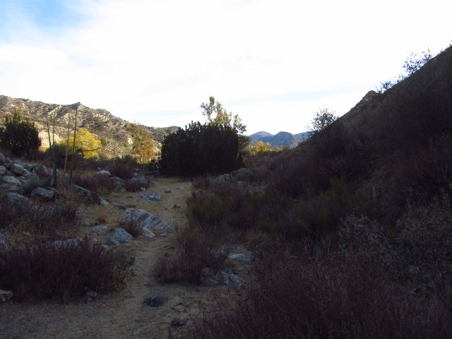
Hungry Valley is flat and would be easy to hike, but as I looked out over it, I recognized that I was at the far side of it, nearly to Gold Hill Road. The trail down was entirely the wrong diagonal from what I would like to see, so I turned and followed it up along the ridge line. I was still following numerous footprints which slowly coalesced into a single, beaten path. At a few spots with little vegetation, the path stops by the edge for a look out toward Piru. The immediate slope is quite steep, but below it flattens out again for quite a long walk to the creek.
 |
|---|
| The route up the ridge between two fences. Although the trail isn't well defined, this is easy vegetation for cross country travel. |
 |
|---|
| A long stretch of flat and lumps on the way to Piru, visible by the bit of yellow from Poplars at its edge. |
The route along the ridge was actually quite fun, even if a little worrying as the sun got low. I came to someone's dump spot. I guess someone thought no one would notice, but the many foot prints say someone probably has. As I went, trails would drop down again and I would lose the use trail for a bit. Continuing on along the ridge sometimes required crossing a fence, especially when there was a path down. I found a large spool of barbed wire left out on the dirt. I would climb over the next lump and find a bit more use trail along the ridge, still full of foot prints.
 |
|---|
| A study of the south edge of the ridge. |
As it grew dark, I seem to have been skirting around the tallest of the peaks. I decided to follow the trail down from the roll of barbed wire as I had lost the track again, but got a short way before it got hard to follow even though part of it had been clear enough to see from a long way off. As I got lower, travel got easy and the pull of going the direction of the car got greater, so I ended up trudging over the grasses again, trying to keep level but actually climbing a little. I came again to well traveled use trail along the ridge and followed it for a bit more with one more thought to dropping down as the trail vanished again. Once past the pointiest peaks, the trail actually became very good and easy to follow. A bunch of bushes popped up at the very top of the ridge and the obvious trail passed to the steep side, which wasn't pleasant. A second bunch of bushes and I decided to ignore the obvious trail and found there was more trail on the easy side which didn't offer any danger in following. Shortly after that, I nearly stumbled over the survey marker.
 |
|---|
| A survey marker set by the USGS in 1929 labeled, simply, "random". |
Just a few feet later, I found a tall sign to greet me into LA County and below it was another survey marker, set to mark the exact line between Ventura and Los Angeles.
 |
|---|
| A county boundary marker between Los Angeles and Ventura. |
By this time, the use trail was quite easy to follow, but it also started to drop down in a way that looked, from my little light, quite steep. I wasn't sure about the slope, but I was sure about the direction. Ahead, I had spotted quite some time ago the blazing lights around the fire station not far from where i parked. A few other lights had become easy fixed points for navigation to help provide confidence. I carefully followed the multitude of footsteps down the hillside. Eventually the fire station lights disappeared behind a hill as the footing flattened out again. My GPS track was showing not far to go before I would be back on paved road. I came to a fence, happily not barbed, and climbed through it to a dirt road, and turned right to get to the gate a short way down it. On the other side of the gate was the black top of the road to Hardluck, where I turned left to roll down the last bit of hill to the car.
I was quite happy with the hike by the end, although it would have been better done knowing it was what I was going to do at the start and with a few hours more light remaining.
*photo album*
©2012 Valerie Norton
Posted 15 Nov 2012
Liked this? Interesting? Click the three bars at the top left for the menu to read more or subscribe!


Comments