Bald Mountain
Humboldt-Toiyabe National Forest
Click for map.
I found a nice camp spot where the USGS map shows three buildings but now there is only a picnic table, campfire ring, and plenty of room tucked in beside the Bald Mountain Wilderness. It is possible that the prime little car accessible starting point is a little up the road from here, but there is not sufficient advantage to bother scraping off the frost to drive up there. Still cold, but not snowing. With my pack stuffed and appropriate maps tucked in, I just start up the low ridge north of the site. There are some bumps along the way it might be easiest to avoid, but otherwise navigation is just to follow it up. Just to be sure I head in the right direction, I estimate the peak position off my map and drop that into the GPS. It is only 2.6 miles away.

The ridge is tree covered and there is not a lot of view except at a few more open spots. Winding through the trees and avoiding low branches pushes me down one side of the ridge or the other. The south side is steep, so I tend to the north. There are thin pony trails along the top and pony trails are definitely the best. Most the game actually using these trails are not horses and will walk under rather low branches quite happily, but there seems to always be a little extra walk around trail from the taller horses.


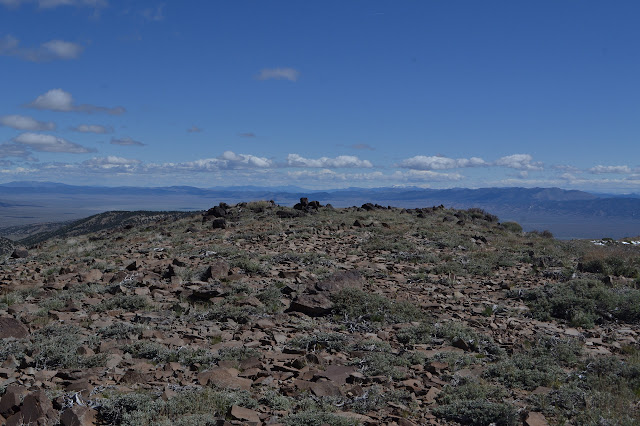
My attempt to go around the bumps along the ridge is thwarted with the first along the way. It is really not so far up, these often have so little drop on the uphill side that it is of little consequence, and the top affords a much better viewpoint than most the spots along the way. The draw of the peak is just too much, even a little tiny peak. At least the point of the hike today is peak bagging. I go for it and it is a nice and open place to pull out the map and decide which bump I am standing on. Then consult the GPS and find it is actually another bump anyway.
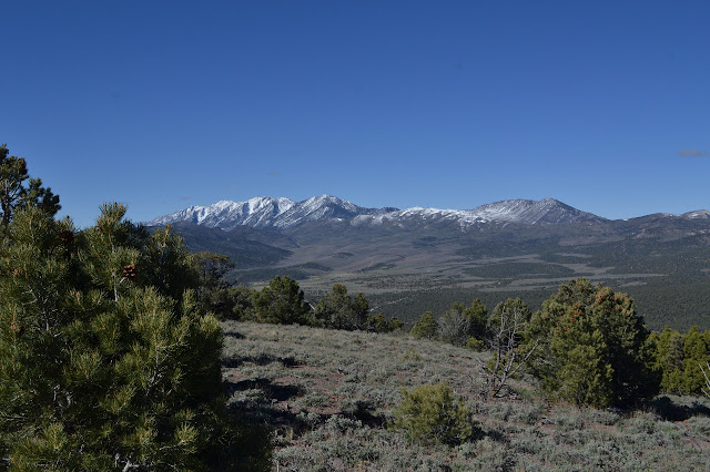

The slope up the next bump is very steep, so I go around it. There is some really good game trail along the way and I follow that up for a while until it turns away. It seems to cross over into the drainage on the north side and I wonder if maybe it knows something I should be paying attention to, but decide to just follow this ridge instead. Climbing upward a little way, there is another good trail to simplify the footing.

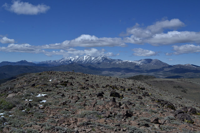
The next bump along is again too close at hand to bother going around. It is a nice, rocky one and again offers view all around. From here, I can really take in the route to the peak. I have been thinking it might be one to the north, but that has gotten close and it is still a mile off to the northeast. Taking in the actual peak finally, I am hit with a wave of recognition. It is quite false of course, but it sure feels like being up in the Flat Tops again.


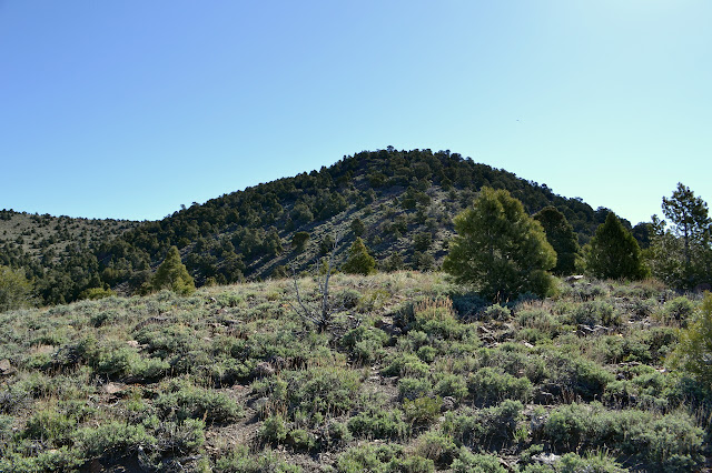
The peak is still a long way off, but there really is not a lot of climbing to do to get there. There are plenty of game trails again and many of them are going my way. I pick and choose among them, taking the best or none at all as I go. There is some brush to thread through, so they help. The trees have changed. Most up here seem to be a mountain mahogany. Juniper makes up the rest.


At the top, it is pleasant, maybe a little bit cool. Today, I can take plenty of time to enjoy being there. There are a half dozen deer just down the other side. They hang out a while, although wary, before heading down. The benchmark is a little way over the top, too. It is easy to find marked by rocks but I cannot find the reference marks that are supposed to be here.


Heading down again starts off the same as I came up. For going up, just following a ridge really simplifies navigation. They all lead to the top. Going down, a drainage does the same thing, but the right one must be selected at the top. From the minor peak I missed on the way up, there is a saddle and everything flows right down to my campsite. So I head out to there to check out a route.


Somehow, it is steep going down just like it looked it would be to go up. I retreat to find a less steep area and follow more animal trails down. It is steep down into the wash, too. I move along toward camp as I go down, but it seems like the bottom is dropping at least as fast as I am. I just have to get all the way down for what could be easy walking at the bottom.

As I get close to the wash, it does not look like easy walking. There is a narrow and rocky section. Past that, there is plenty of flat. More game trails travel the bottom and when the bottom of the wash is not easy walking, they show the easiest way along one side or the other.


The last bit of travel to my campsite is easy. Actually, most of the route was easy since more than half was on some pretty good game trails.
©2017 Valerie Norton
Posted 9 Jun 2017
Liked this? Interesting? Click the three bars at the top left for the menu to read more or subscribe!


Comments