Hickison Petroglyphs Interpretive Trail
Hickison Petroglyphs Recreation Area (BLM)
Click for map.The historic marker at the top of Hickison Summit on US-50 told me about the petroglyphs nearby, but the giant sign with "Petroglyphs" in very oversized letters would have probably been enough to get me to turn. My planning, such as it was, had focused on wilderness areas in the National Forest rather than spots the Bureau of Land Management thought were worth emphasizing. It is a nice surprise. There are no brochures in the box for the self guided tour and I cannot find an online copy, so I could not learn as much as I might like, but the numbers for the brochure will help call out where to look for the petroglyphs. There is a rough map showing the short loop. Even with the spur to see the view, it is less than a mile. All the trails seem to be marked as accessible, but they are not paved.
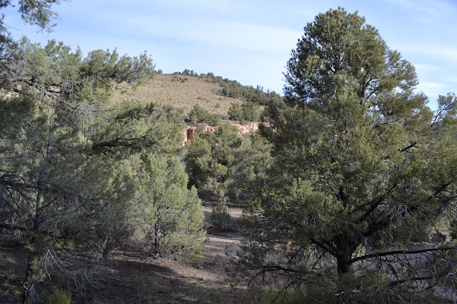
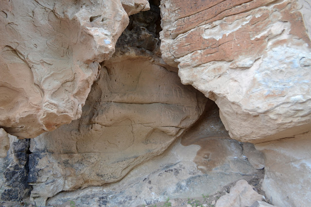
The trail is wide and fairly flat, but the packed surface has a bit of gravel over the top. The upward slope is fairly easy. It may be handicapped accessible to some as it reaches the rocks with the first grouping of petroglyphs. It is a series of panels along somewhat sheltered rocks. Each is distinctively different.


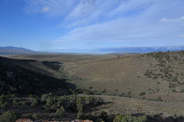
The trail climbs further upward, continuing at a gentle slope, to the spur with a view. I take it, of course.


There is a lumpy little peak beside where the trail ends. Many people have been up it for the few feet advantage it offers over the flat and I seem to follow them. It is only a slight thing, but it does improve the view.


Returning and continuing around the loop, there is another trail that heads off. This one was not indicated on the sign at the start, but there was clearly a trail up the peak on the north side of the saddle, so it might be that. Past this, the trail becomes narrow and rocky as it gets in close to the next grouping of petroglyphs. Here is is definitely not accessible.

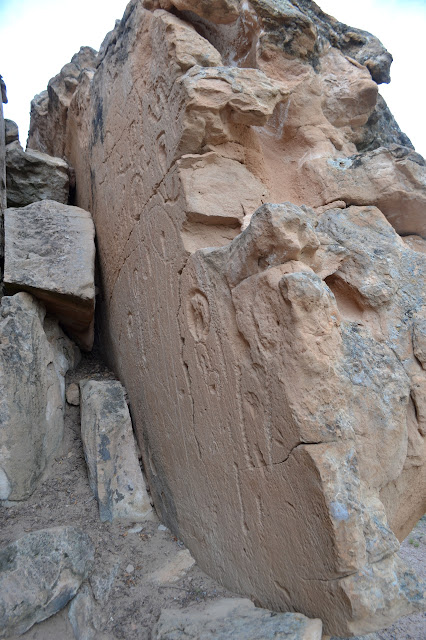
The rocky trail does not stay near the cliff for very long. It winds down to the third grouping of petroglyphs. This is a rock that stands out on its own and is carved on all sides.


The trail back to the parking lot from the stand alone rock is similar to the first part of the trail and may be handicapped accessible again. There is another trail traveling north past the rock that is not described on the crude map at the start. There is no sign for it, but it looks well used.

©2017 Valerie Norton
Posted 27 May 2017
Liked this? Interesting? Click the three bars at the top left for the menu to read more or subscribe!


Comments