Little Cherry Creek
Humboldt-Toiyabe National Forest
Click for map.
My last day of experimentally determining that Nevada really is not flat is also my last pre-planned hike. I had spotted a labeled trailhead, which is pretty rare on the Ely Ranger District West Half map. There are plenty of spots where trails hit roads, but this was the first I saw actually marked as a trailhead. It is conveniently located next to one of the total of three forest service campgrounds on the map. I had expected a little more to it than the unofficial site I had the last two nights, but it only has tables, fire rings, and a bit of space. They do claim online that there is a pit and four sites. I only found three of the sites, maybe the pit is by the fourth. (The map indicates no restroom.) The site next to the trailhead was already taken when I got in in the evening, so I grabbed the next a bit down the road and around a canyon corner. They left early and, as I found in my walk to the trailhead, had an enthusiastic campfire they could not be bothered to put out before driving out. That is the sort of thing that can make a southern Californian think very unflattering thoughts about another human's worth as a person even when home is not currently experiencing another human caused massive wildfire.

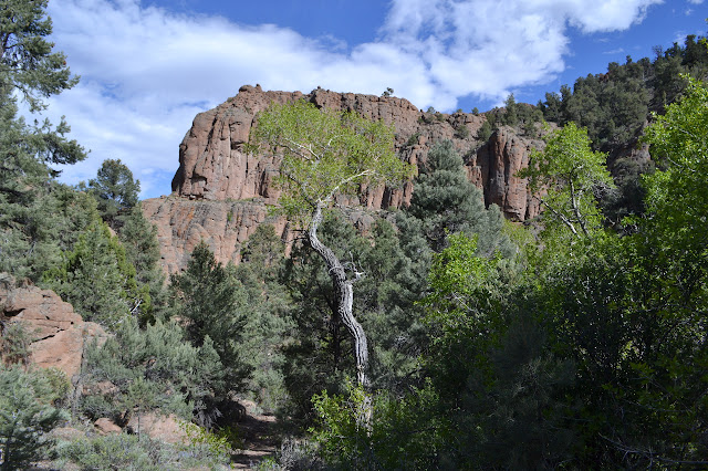
The trailhead has an information sign with some generic information about national forests and an admonition to be a good neighbor and clean up the campsite next to a mildly broken trail register with generic information about traveling and camping within the wilderness, but no pages to actually register. Behind it is a distinctive trail that could use a little work. It is a little worse than hoped and a little better than expected. The creek is just a little too big to cross without wet feet or aids and there are rocks or sticks to aid when needed. It does look like this trail gets some use.


There is one hiccup in the trail as I go. One spot looks like a crossing, but after the hop, it thins to nothing and requires quite a bit of work to get through the undergrowth and connect up with the trail again. Other options are a short rock climb to about 12 feet up with a similar climb down the other side or to splash through the creek. The short, but not exactly brief, push through the vegetation does help me appreciate the rest of the trail, with brush squeezing from all directions, quite a lot. Then the canyon opens up.

There is another sign for the wilderness boundary and this one even has surveyor markers. There is a stake with no cap next to the sign, but a little off of it is a reference marker for an angle point. It is a little unusual. It even has a distance with the arrow. Of course I have to go looking for it with that much information, but it is very decidedly in the creek or just the other side and the short drop to the creek is far too choked with vegetation. I leave it and continue as the canyon briefly shrinks again before opening up even more. The increased room does seem to mean bigger trees to jump over along the way.


The trail comes to a meadow and vanishes. It is par for the course when encountering meadows. You just have to find it at the other end. Hopefully. There is a nice, distinct trail there for me to follow. Trouble is, it is not unique. The cow paths are strong here. I can hear bovine braying up the canyon as I follow the trail around to a different one. I spot a few too. It is a little lower here than the places I have been hiking. Guess I did not beat them here like I did there. They act strangely for cows. They do not seem particularly worried by me, but they also make themselves scarce rather like deer in a park.

The canyon is very pretty, but between the certainty that I am going north rather than northwest and the fact that I am leaving the water behind, I suspect this is not the way I meant to be going. Checking the instruments confirms that while this may be a wonderful excursion, it is "wrong" as far as following trail is concerned. It just means picking a different well established cow trail and following it back and up the other canyon. The cows are quiet and vanished once I get back.

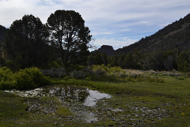
I am getting pretty confident that I should be following water when there is a major tributary coming in from the south. It looks to have at least half of the water that was flowing in the creek below. Okay, maybe not that water. Just past it, a flat spot among the trees gives me an intense feeling of being a camp. Stopping and looking around, I can spot at least three flattened and rusting tin cans on the ground. Even more certain, I continue gently upward.


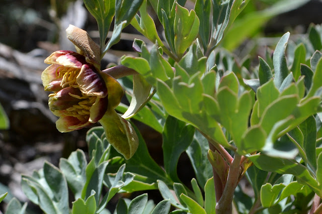
The water in the creek thins out quickly and then starts playing hiding games in the rocky ground. So much for following the water. As I wander into a small field of mules ear and lupin, there is a suspicion of going up the wrong canyon again. A bit of looking around shows it to be a false alarm and it is eventually followed by a second. Without an obvious trail, travel cannot be done mindlessly, at least not for the most part. That is not always a bad thing.

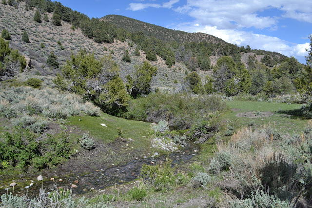
As the canyon comes to a constriction, there is a thin ribbon of water down in the creek, and then further up, a decent creek again. Posts stand in a row on one side of the trail and on up the rocky slope on the other side of the creek is the smashed wood of an old spring box. Broken plastic pipe comes out of it and there are pieces in the creek. It probably supplied a trough that was held in place by the posts. Above the spring, the creek is dry again.

I expect the constriction to be enough direction that there might actually be an obvious people trail again, but nothing of the kind shows up. It is still cow paths all the way up to the ridge. First, there is one more split in the canyon and as the trail I am on wanders over to the wrong side, I have to back track one more time to get back to what is ostensibly the trail.


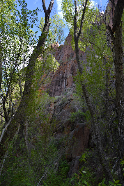
I try to dutifully follow the line on the map to its spot high on the left side of the ridge, but all the paths seem to head off to the right side of the long low spot. Just as I reach it, there is a cut from a saw. It is the first possible indication of trail I have seen in a long time. Trail seems to go over the top and down the other side. On that far side, Hooper Canyon has plenty of interesting details, but the brush hides some of my view. The small peak further on my right looks like a great spot for a better view. It is showing some, uh, peak pattern baldness.


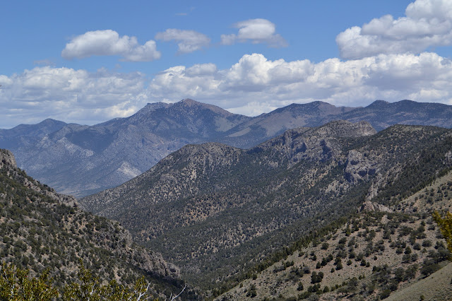
Sitting up on top of the little hill surrounded by much taller peaks, I am feeling fairly satisfied that Nevada does have some topography. Looking out over the row of cliffs of volcanic rock in Hooper Canyon and the spindle of the high point and, well, most everything else, it seems like topography worth visiting, too. There is plenty of time to wander down again, so I just take it in the fine sun at the top. When I am good and ready, I finally meander downward.


I pause along the way at one of the rock outcrops. It has little caves tucked away all over and a pine tree next to it just seems well composed. The cows do not make themselves known as I continue, but there are deer around now. They watch me without particular concern, then scatter when I look away. My only worry is finding the trail again when I need it, but it is not a very great worry. The canyon narrows and it will make the trail hard to miss.

The trail is easy to find at the end of the meadow: it is right where I left it. The trees are still there to hop, as well. This time, as the trail comes to a climb or slosh or breaking through a bunch of branches, I pick the climb. It is not simple, but still easier and a lot shorter than the trashing I used to get through before.
Finishing, there is nothing to do but relax and reflect. Any looking around will have to be limited to where I can walk. There is a lot of dirt before I hit pavement and a lot of pavement before a gas station and after the extravaganza of driving yesterday, I have just enough. I do not expect a gas station before Tonopah. Relaxing and reflecting are not such bad things.
*photo album*
©2017 Valerie Norton
Posted 14 Jun 2017
Liked this? Interesting? Click the three bars at the top left for the menu to read more or subscribe!


Comments